
Sign up to receive email notices of recent acquisitions.
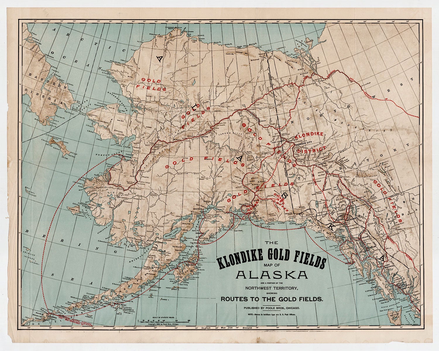
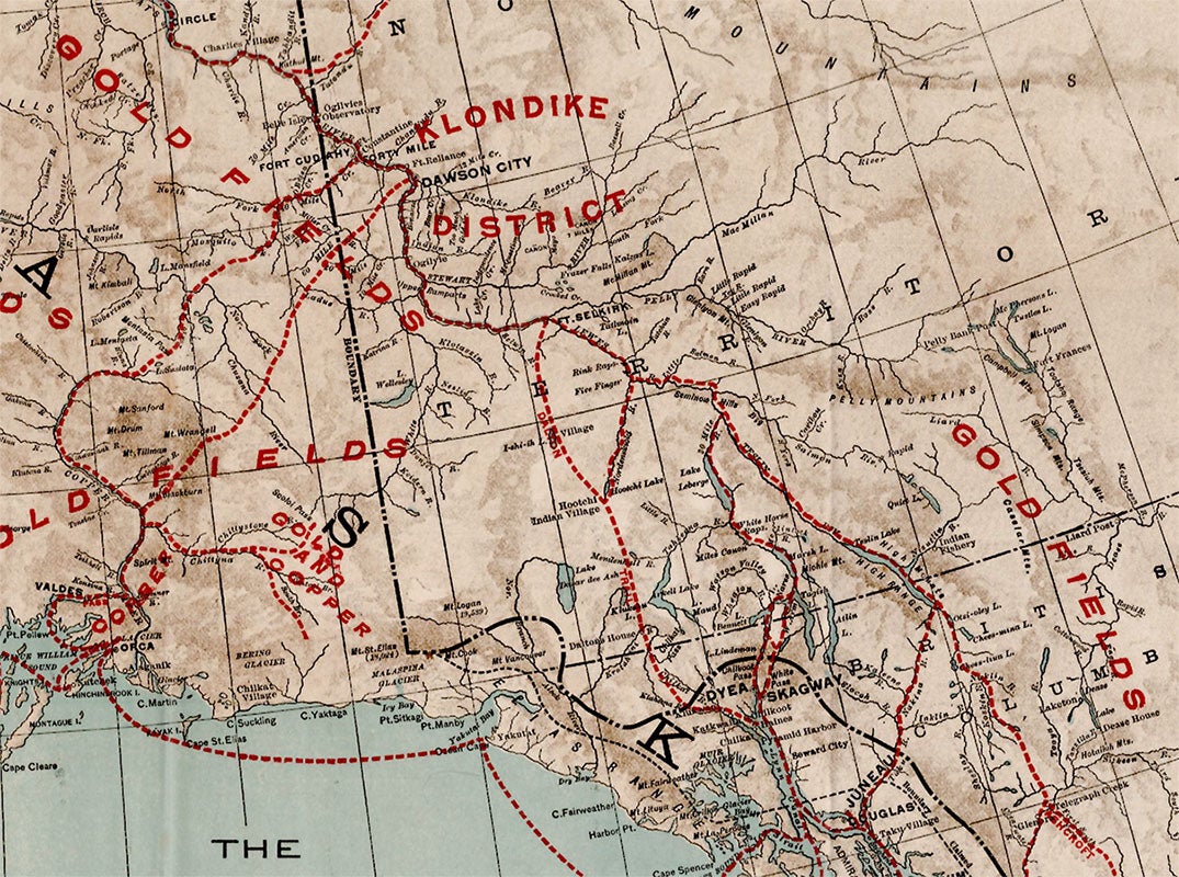
The Klondike Gold Fields Map of Alaska and a Portion of the Northwest Territory, Showing Routes to the Gold Fields
Chicago: Poole Bros., 1898. folding map printed in red, blue, black and brown. An alluring Klondike Gold Rush promotional map, with gold fields vividly identified throughout Alaska and the Northwest Territory, suggesting the great riches to be found in the far north. Depicting Alaska, the Klondike District, and the westernmost portion of the Northwest Territory, this map presents a variety of possible destinations for miners venturing to the region, highlighting in red not only the immediate vicinity of the Klondike but also seven gold fields to the south and west. Also identified are regions with copper deposits. Dotted red lines trace the numerous water and land routes to the Klondike and elsewhere. Steamboat routes threading through islands and touching at various harbors extend across the lower coast of Alaska, while the direct route from San Francisco, Portland, or Seattle to St. Michael’s passes through the Alaskan Peninsula and arcs to the northeast. A network of land routes crisscrosses the landscape, including the Dalton Trail and the Ashcroft Route. A scale of statute miles appears at the bottom-left, and a note below the title indicates that names in boldface type are U.S. Post Offices. Relief is conveyed by shading. The Poole Brothers were leading printers and publishers of maps, guidebooks, brochures, and other promotional publications. Founded in 1870 by George Amos and William H. Poole, the firm operated until 1968. Servicing nearly every railroad in America, the Poole Bros. became the largest printing house in the country specializing in transportation and travel publications, later expanding to periodicals, such as Advertising Age and the New England Journal of Medicine. Among the numerous titles to their credit are: Map of the Atchison, Topeka and Santa Fe R.R. Leased Lines and Connections (1884), Northern Pacific Railway and Connections (1887), Gold Fields of Alaska and How to Reach Them, (1898) and Map of Burlington Route (1907). A compelling map of the Klondike Gold Fields and the surrounding region, published at the height of the momentous Klondike Gold Rush (1896–1899), which witnessed the migration of an estimated 100,000 prospectors to the region. CONDITION: Very good, old folds, a few small stains in margins.
Item #2889
Sold