
Sign up to receive email notices of recent acquisitions.
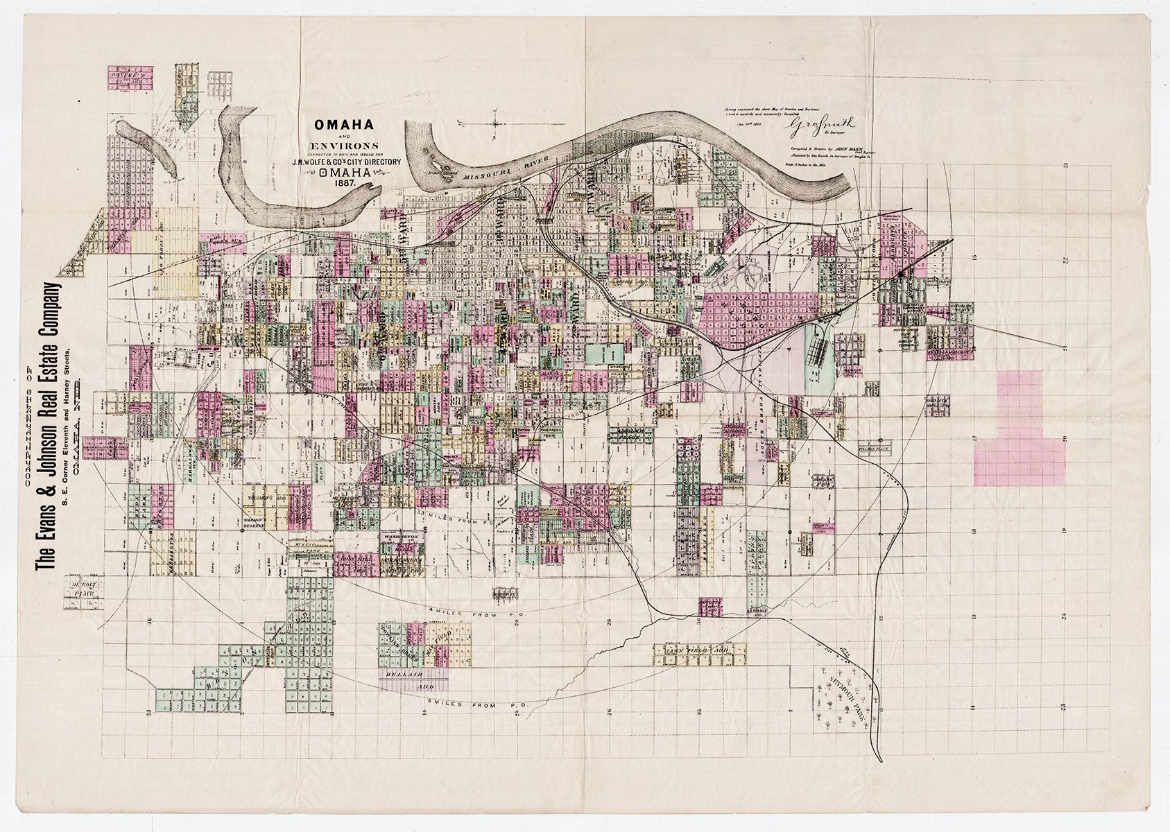
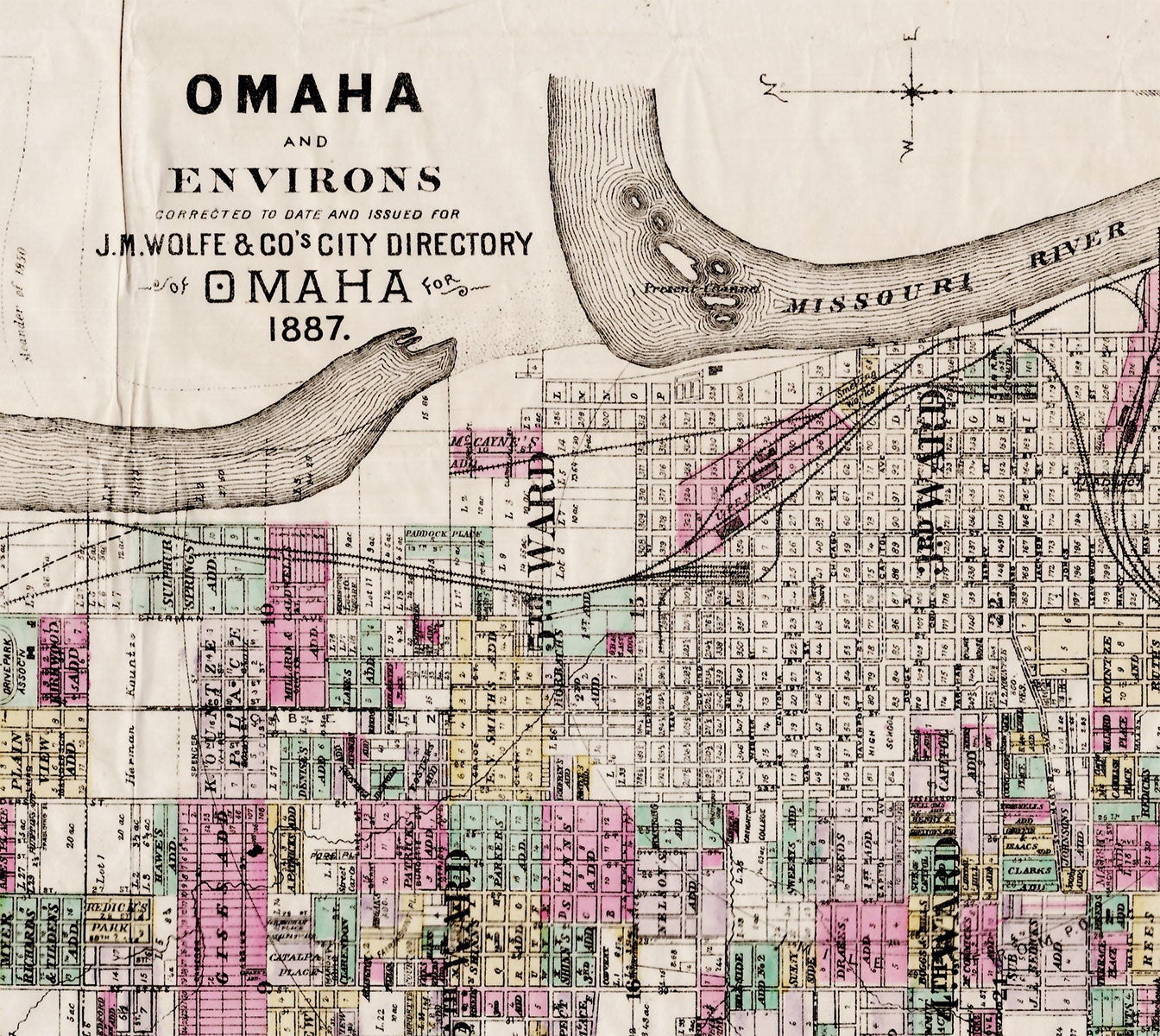
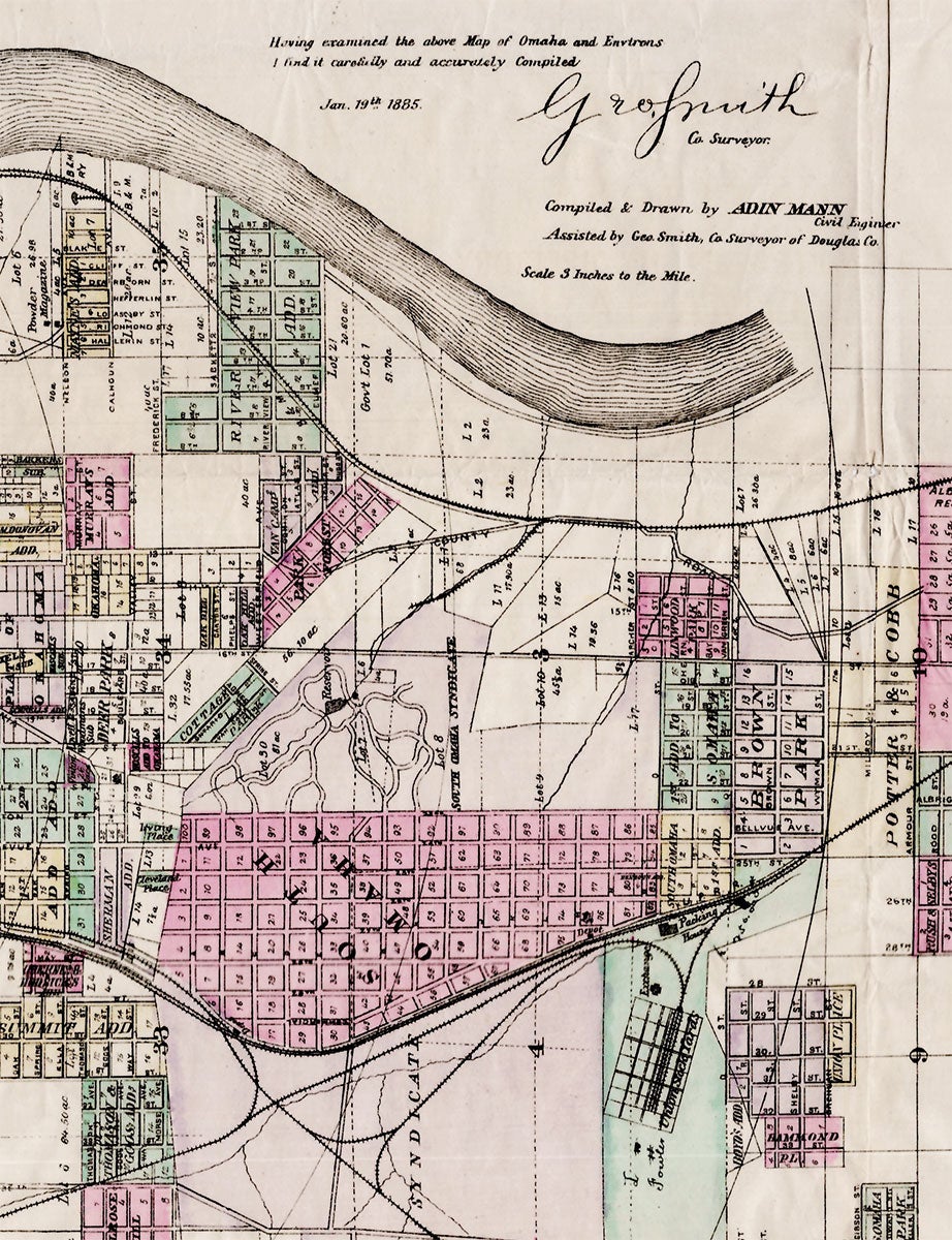
Omaha and Environs, Corrected to Date and Issued for J. M.Wolfe & Co.’s City Directory. Compiled and drawn by Adin Mann, Civil Engineer.
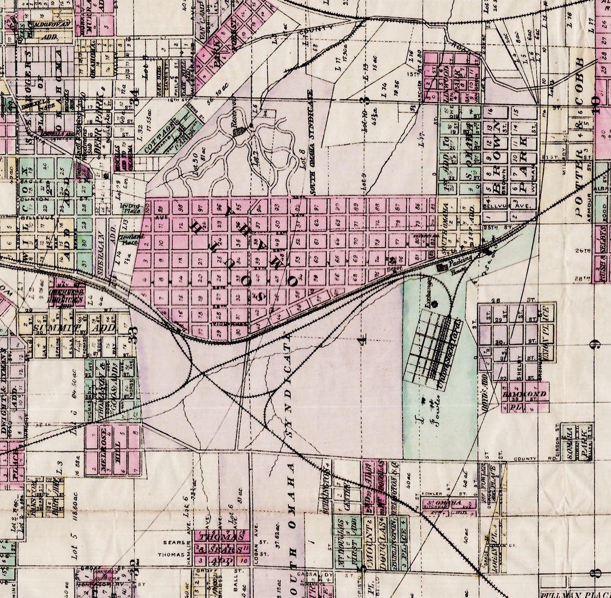
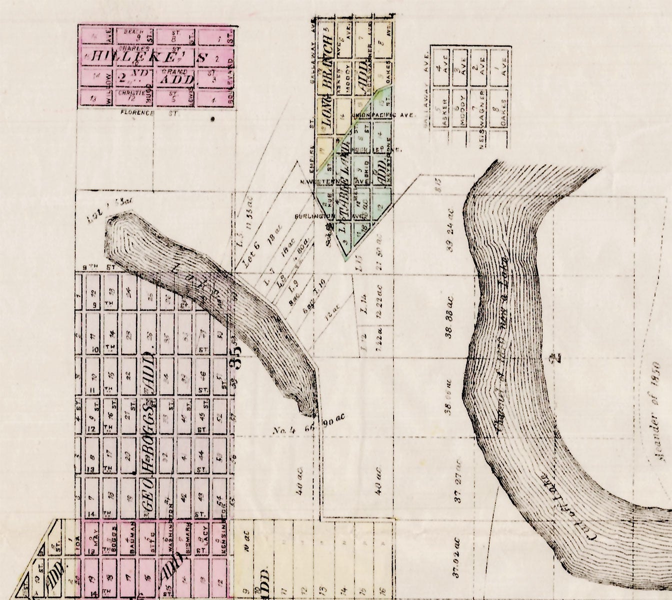
Omaha, 1887. Hand-colored map, 22” x 32” plus margins. A separately issued version of this map which also appeared in Wolfe’s directory and the Official State Atlas of Nebraska (1885). An advertisement reading “Compliments of the Evans & Johnson Real Estate Company S. E. Corner Eleventh and Harney Streets, Omaha, Neb.” appears in the left margin. By 1887, Omaha was a bustling town, the fastest growing in the west in fact, and firmly established as the gateway to the west, its growth spurred by the construction of the Trans-Continental Railroad and Union Stockyards. This promotional map shows a city of numerous subdivisons and additions, variously colored, criss-crossed by the lines of the Union Pacific Railroad, the Burlington & Missouri Railroad, the Omaha Belt Railway, and the Chicago, St. Paul, Minneapolis & Omaha Railroad. Near the southern edge of the city the Union Stockyards and Packing House are shown, located hard by the Union Pacific Railroad. Fort Omaha appears in the north, which served as an important supply depot for other western forts during the Indian Wars period. A portion of the Missouri River appears along the eastern edge of the city, along with a section of former riverbed which became a lake when the course of the river shifted. OCLC records three separate issues of this map, dated 1886, 1887, and 1888, for a total of five copies. Three of the five bear advertisements for real estate firms, and one an advertisement for a bank. REFERENCES: There is a copy of the atlas version of the map in the Rumsey collection. Not in Phillips. CONDITION: Very good. old folds and a few creases, a few miniscule holes at folds.
Item #3054
Sold