

Sign up to receive email notices of recent acquisitions.
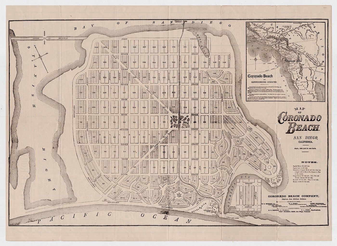
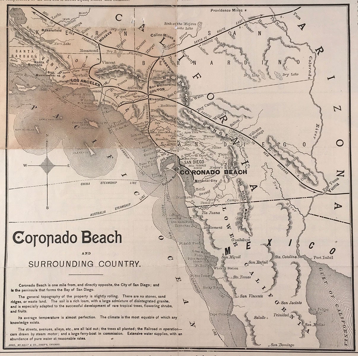
Map of Coronado Beach, San Diego, California.
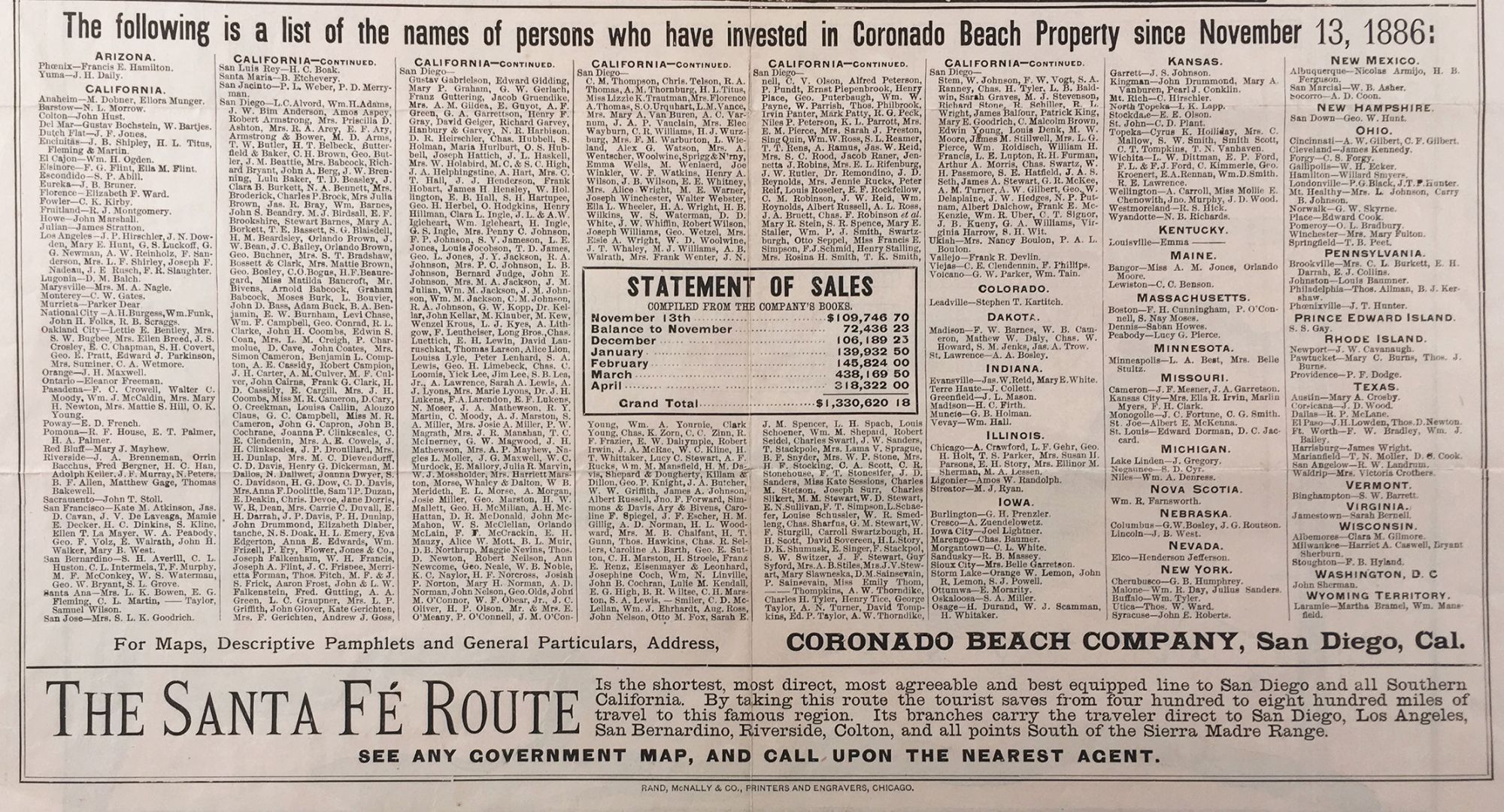
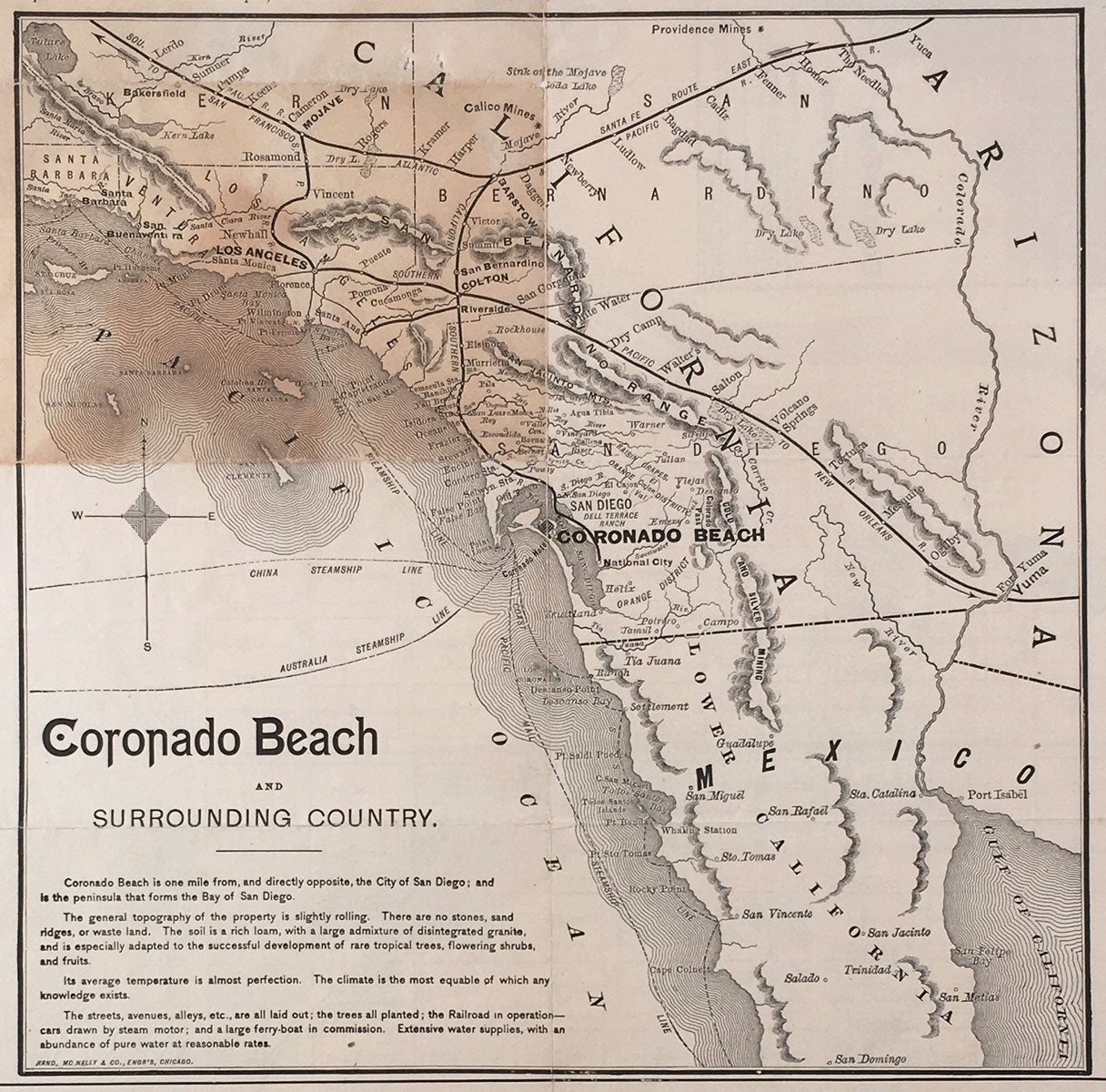
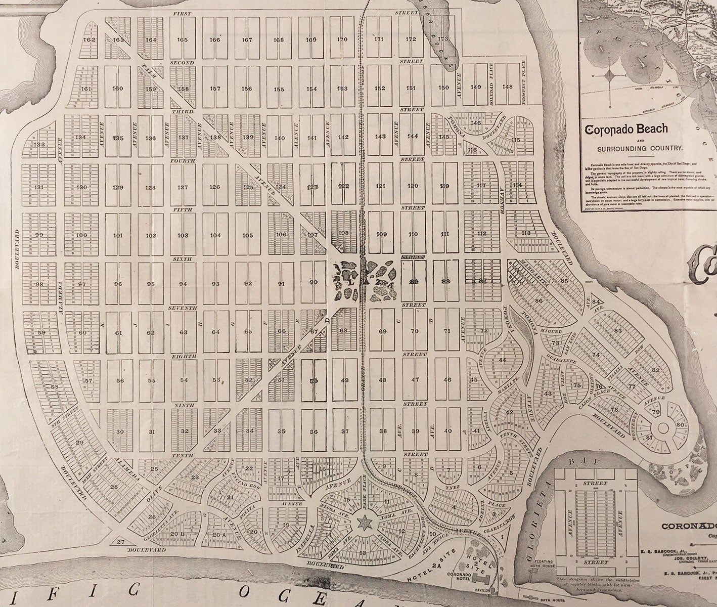
San Diego: Coronado Beach Company, ca. 1887. Rand McNally & Co. engravers. Broadsheet with maps, recto map, 34 x 52.5 cm, plus margins; verso map, 25.5 x 25.5, plus text and margins. A scarce subdivision map with promotional text, issued during the first year of development at Coronado Beach. Located one mile from, and directly opposite, San Diego, Coronado Beach is a peninsula that forms the Bay of San Diego, as well as a major resort city established within a year of this map’s publication. The peninsula was purchased by Elisha S. Babcock, Jr., Hampton L. Story, and Jacob Gruendike, for $110,000.00 in 1885, and they were soon joined by Heber Ingle and Josephus Collett as investors, to form the Coronado Beach Company in April of 1886. Development began immediately. The land shown here encompasses some 173 plots, and is circumscribed by the Bay of San Diego, the Spanish Bight, Glorieta Bay and the Pacific Ocean. The Coronado Beach Railroad runs through the development and a large plaza lies in its center. Notes below the title give the dimensions of regular blocks (300 x 500 ft.) and lots (25 x 140 ft.). The site where The Hotel del Coronado would be built and completed in 1888 is shown at the middle-bottom of the plot; specifications for the hotel appear in the promotional text on the verso. The Company sought to create nothing less than the world’s leading seaside resort, and reports that pretty homes have been springing up and the demand for building sites has resulted in $1.25 million in revenue—with demand steadily increasing. An inset map in the upper right corner, entitled Coronado Beach and Surrounding Country, appears enlarged on the verso. It extends from Santa Barbara in the north to San Domingo in Mexico. Promotional text on the verso includes a “Statement of Sales” as well as a list of names of individuals from many different states who have invested in Coronado Beach Property since 13 November 1886. The Santa Fé Route is advertisement as the shortest, most direct, most agreeable and best equipped rail line to San Diego and all of Southern California. Situated 30 ft. above sea-level, the topography of the property is described as slightly rolling and the temperature “almost perfection.” A large steam ferry (owned by the Company) makes the trip between San Diego and Coronado Beach in a mere four minutes, and the crescent-shaped beach is said to provide a natural boulevard unsurpassed for driving. What’s more, “the streets, avenues and boulevards are laid out with exquisite taste, and are fringed on either side by orange, olive, palm, and other fruit and ornamental trees, which have made prodigious growth. The view of the ocean, bay and mountain scenery is magnificent, and in charming variety is equaled nowhere.” CONDITION: Good, old folds, darkening to one folded section; a few small breaks and holes, mostly along the folds. REFERENCES: Coronado’s Unique History at www.coronadohistory.org
Item #3212
Sold