
Sign up to receive email notices of recent acquisitions.
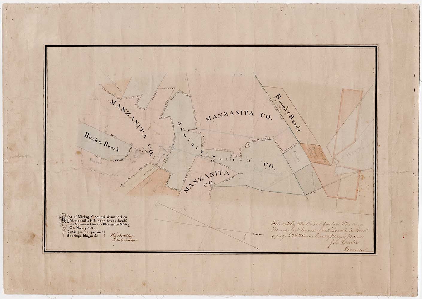
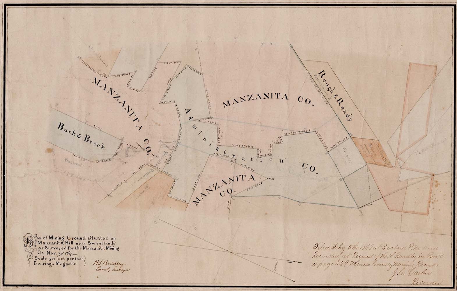
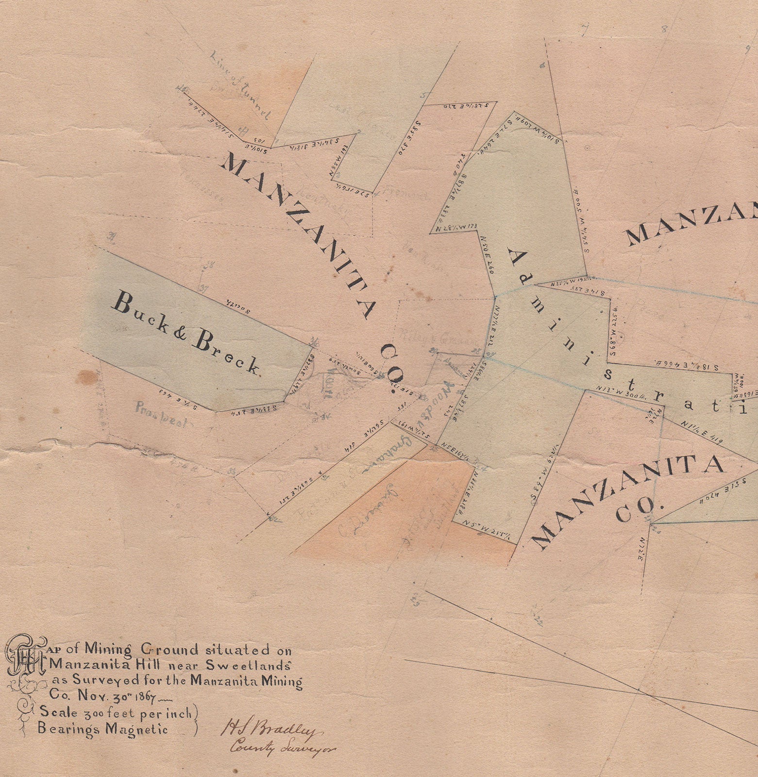
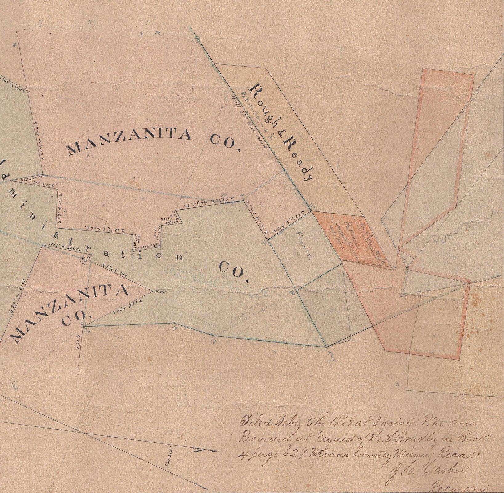
Map of Mining Ground situated on Manzanita Hill near Sweetland’s as surveyed for the Manzanita Mining Co. Nov. 30th 1867.
Sweetland, Ca.[?], 1867. Hand-colored manuscript map, 11” x 17.375” plus margins, mounted on linen. An appealing manuscript map of the Manzanita mine in the Sweetland mining district, Nevada County, California. The settlement of Sweetland was established by the Sweetland brothers in 1850. They are also known to have operated a trading post there in 1852. Henry Pettit Sweetland was a California State Assemblyman. The Manzanita mine was one of the largest in the district. The claims of the Manzanita Company, the Administration Company, Buck & Breck, and Rough & Ready are identified in bold, black ink. Claims that were apparently established subsequent to the creation of the map are identified in both pencil and light blue ink. These are labeled Tennessee, Kentucky, Fremont, Prospect, Riley & Graham, and so on. A dotted line and note in the upper left quarter identify the “Line of tunnel,” and a pencil note on the far right locates the “Yuba Tunnel.” A note in the lower right corner reads: “Filed Feby 5th 1868 at 3 o’clock P.M. and Recorded at Request of H.S. Bradley in Book 4 page 329 Nevada County Mining Records. J.C. Garber Recorder.” The map is drawn on a scale of 300 feet per inch. CONDITION: Good, a few short creases and tears.
Item #3346
Sold