
Sign up to receive email notices of recent acquisitions.
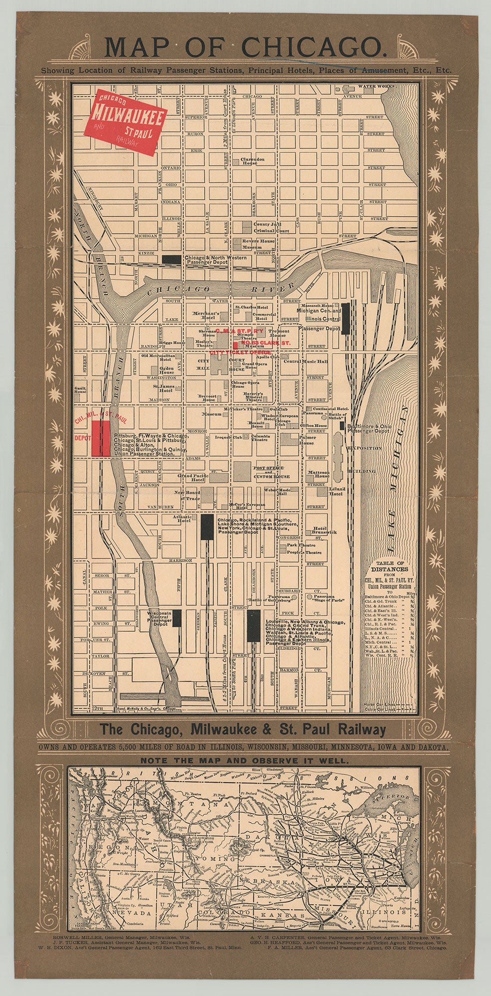
Map of Chicago. Showing Location of Railway Passenger Stations, Principal Hotels, Places of Amusement, Etc., Etc.
Chicago: Chicago, Milwaukee and St. Paul Railway, [ca. 1885]. Rand, McNally & Co., Engrs. Lithograph, 20.25” x 8.875” plus margins, printed in black, red and olive. A rare railroad advertising map, depicting Chicago from 12th Street to Chicago Avenue, and from Canal Street to the waterfront. The depot of the Chicago, Milwaukee & St. Paul is printed in red, as is their ticket office. Other railway depots appear on the map, as well as hotels, theaters, a music hall, the post office, the custom house, etc. Of particular note are three circular buildings or “cycloramas” for exhibiting panoramic paintings of The Battle of Gettysburg, the Siege of Paris, and the Battle of Shiloh. A inset map at the bottom showing the railways from Lake Michigan to the west coast appears below text reading “The Chicago, Milwaukee & St. Paul Railway Owns and Operates 5,500 Miles of Road In Illinois, Wisconsin, Missouri, Minnesota, Iowa, And Dakota. Note The Map And Observe It Well.” Unrecorded. Not in OCLC, Rumsey, Phillips, Rare Book Hub (formerly Americana Exchange), or Antique Map Price Record. CONDITION: Good, old folds, streak of blue ink in title area, some reinstated losses to corners and edges, not affecting image or text.
Item #3383
Sold