
Sign up to receive email notices of recent acquisitions.
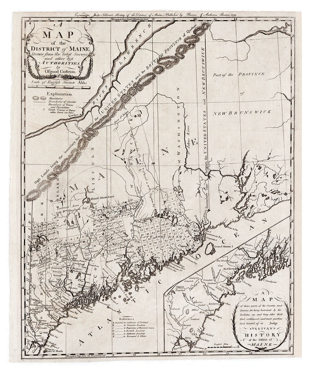
A Map of the District of Maine, Drawn from the latest Surveys and other best Authorities...
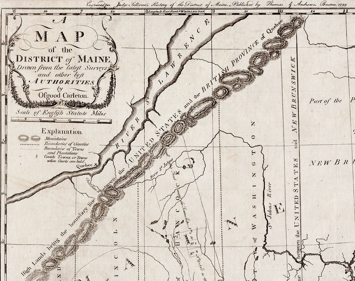
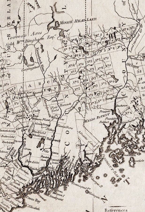
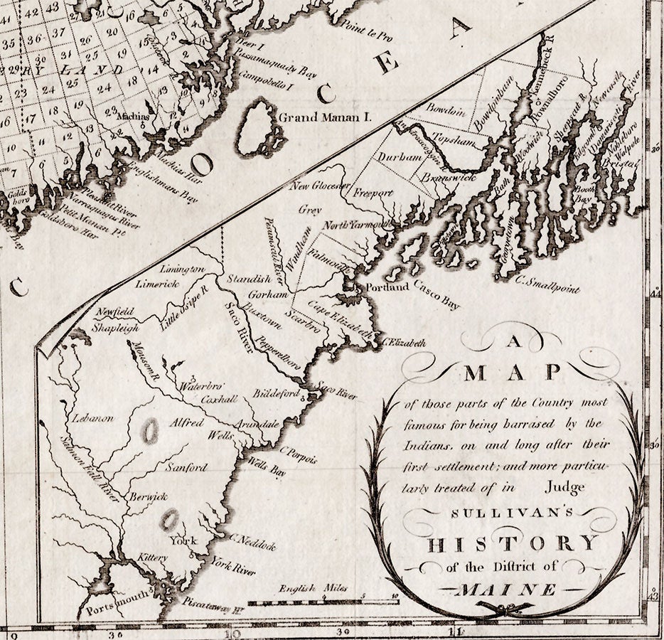
Boston: Published by Thomas & Andrews, 1795. Engraving, 20.5” x 16.25 plus margins. An important, early map of Maine by one of the leading American mapmakers of the Federal period. This is just the second map to focus on Maine in its entirety and the most accurate up to that time, surpassing the first map of the District, also by Carleton, which appeared in Jedediah Morse’s The American Universal Geography (Boston, 1793). Designed and engraved for Judge James Sullivan’s History of the District of Maine, as noted across the top, this map is particularly interesting for its treatment of the northeastern and northwestern boundaries. While Carleton improved here on numerous inaccuracies found in his first map of Maine, his placement of the St. Croix River is still much too far to the east, along with the corresponding “Boundary line between the United States and New Brunswick” running due north from the source of the St. Croix (per the Treaty of Paris). Moreover, his northwestern boundary line “between the United States and the British Province of Quebec” appears as a boldly printed straight line of mountains, running parallel and far too close to the St. Lawrence River, whereas the earlier map depicted this boundary more accurately. Nevertheless, the present map adds a wealth of detail to all previous representations. Additions include the five counties that existed at the time (York, Cumberland, Lincoln, Hancock and Washington); numerous towns and unorganized townships; land grants to various academies, the “sufferers of Portland,” and others; land reserved for the Indians; lands purchased by Philadelphia merchant and statesmen William Bingham; and the Waldo Patent. Also included are lottery lands in southern Hancock and Washington counties. Appearing in the lower right corner is an inset map depicting the coast from the Piscataqua River to the Damariscotta River, meant to show “those parts of the Country most famous for being harassed by the Indians, on and long after their first settlement…” Osgood Carleton (1742–1816) was born in Nottingham, New Hampshire, the son of Jeremiah and Eunice Carleton. Little is known of his early life, but in 1758, at the age of sixteen, he enlisted in the regiment of Colonel Ebenezer Nichols, serving under chief British engineer John Henry Bastide during the siege of Louisbourg. Carleton appears to have had a close relationship with Bastide, possibly serving as his clerk and living with him, which some have cited as the means by which Carleton acquired his knowledge of mathematics, surveying techniques, etc., since he lacked a formal education. By 1768, Carleton had settled in Lyndeborough, New Hampshire, where he worked as a housewright. He surveyed a road in town in 1770, and undertook additional surveys in the region between 1771 and 1773, laying out lots for landowner Benjamin Lynde and becoming a landowner himself. During the Revolutionary War, Carleton served as quartermaster in the 16th Continental Regiment. Following the War, he established himself as a teacher of mathematics and opened a school in Boston in 1787, where he taught, algebra, navigation, astronomy, surveying, the use of maps and globes, etc. Between 1788 and 1789 Carleton met Boston engraver and publisher John Norman, who kept a shop near his school, and thus began his career as a commercial mapmaker. The two published A New General Chart of the West Indies in 1789, following which Carleton served as the “cartographic authority” for the charts that Norman engraved for Matthew Clark’s Complete Set of Charts of the Coast of America (1789–90), the first nautical atlas published in the United States. In 1791, Carleton and Norman published their second map, The United States of America Laid Down From the Best Authorities, Agreeable to the Peace of 1783, which carries an extended note by Carleton regarding the projection he used. In addition to their collaboration on such navigational works as The American Pilot (1791 and later eds.) and A Pilot for the West Indies (1795), Carleton and Norman brought out An Accurate Plan of the Town of Boston, and its Vicinity (1797), with Carleton as publisher and Norman as the engraver. Carleton’s most ambitious works, and those for which he is best remembered, are An Accurate Map of the District of Maine (1798) and An Accurate Map of the Commonwealth of Massachusetts (1798), proposed and undertaken to provide official maps for the state of Massachusetts and its then possession, the District of Maine, as approved by an act of the Massachusetts General Court. Carleton had established himself as an authority on the geography of Maine when he compiled and drew his map of the District for the American Universal Geography. This and his early efforts toward an official map, which involved the copying of surveys of townships and grants for the Committee for the Sale of Eastern (i.e., Maine) Lands, enabled him to produce the fine map offered here, characterised by Thompson as “Undoubtedly the best map of Maine at the time.” A very appealing copy of this handsome and important map of Maine. REFERENCES: Evans 29589; Williamson, Bibliography of the State of Maine, 9608; Wheat & Brun 171; Thompson, Edward. Printed Maps of the District and State of Maine, p.3 and map #2; Bosse, David. “Osgood Carleton, Mathematical Practitioner of Boston,” Proceedings of the Massachusetts Historical Society
Third Series, Vol. 107 (1995), pp. 141-164. CONDITION: Very good, excellent impression, expert partial remargining at right, a few pinholes.
Item #3517
Sold