
Sign up to receive email notices of recent acquisitions.
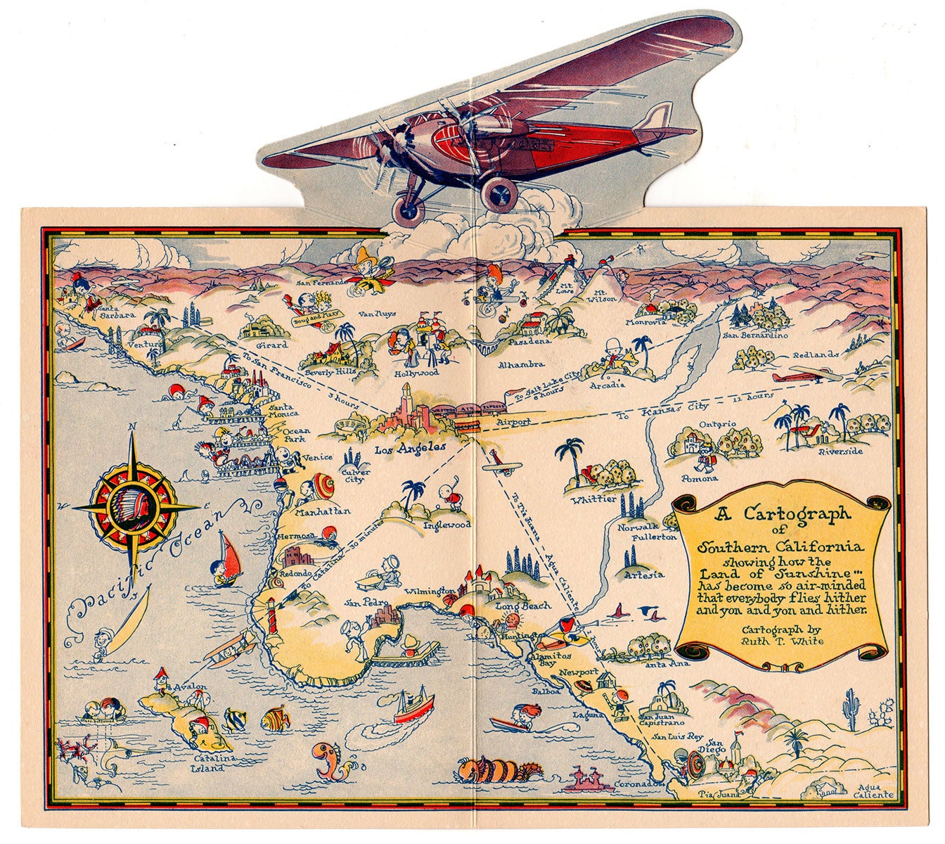
A Cartograph of Southern California showing how the Land of Sunshine has become so air-minded that everybody flies hither and yon and yon and hither.
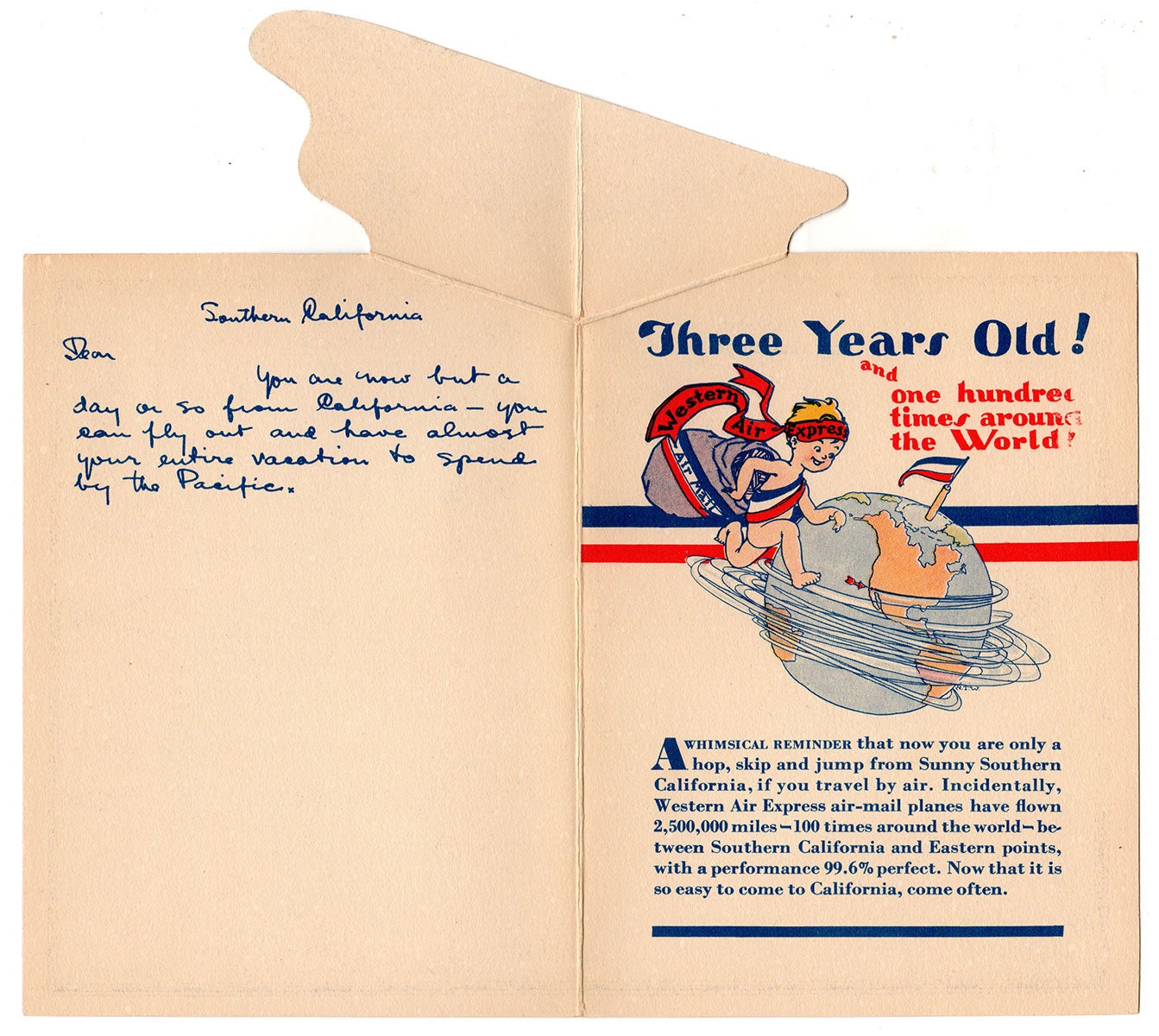
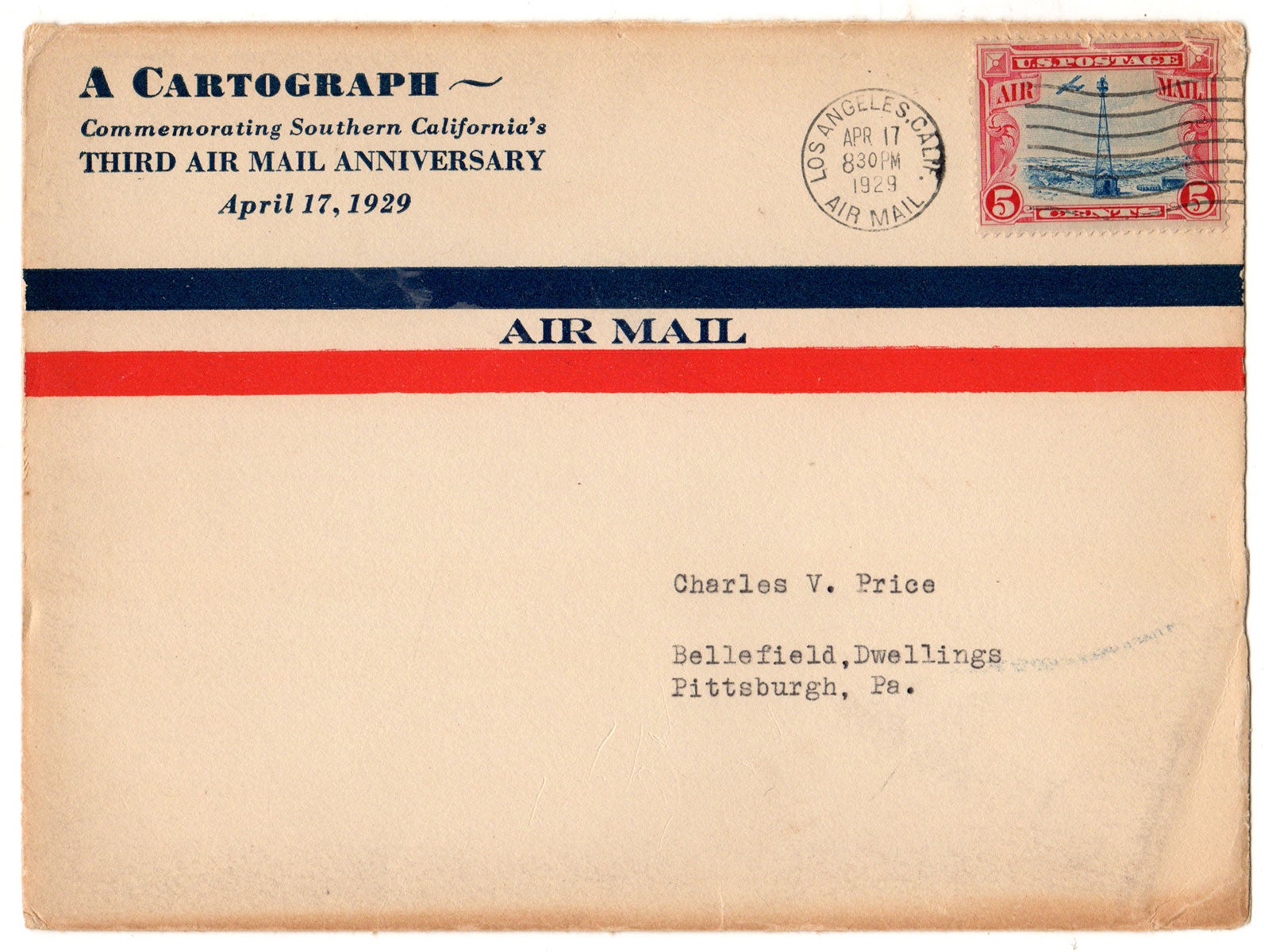
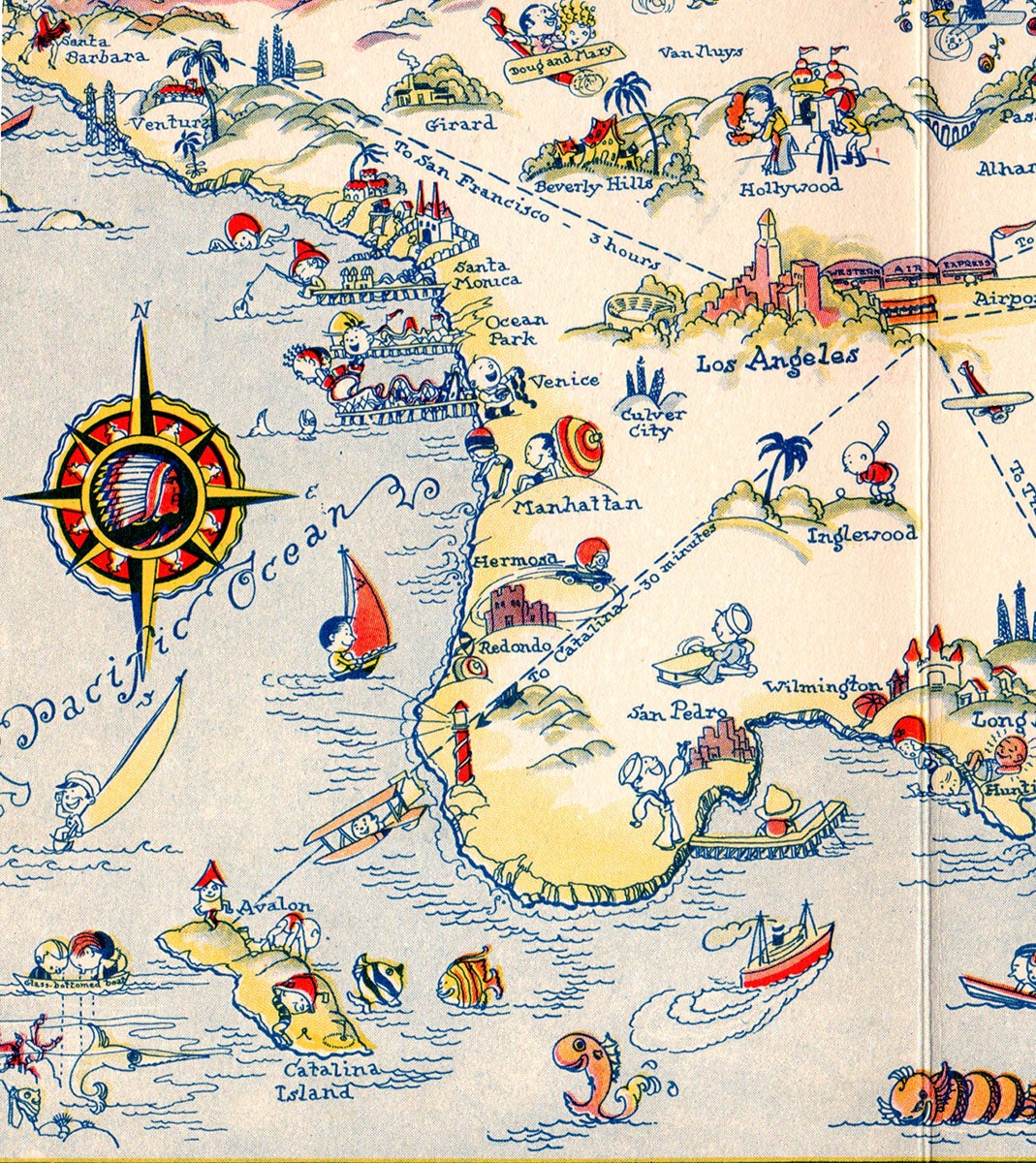
Los Angeles, California: [Western Air Express], 1929. Color pictorial map, 24 x 25 cm plus margins. 1 original envelope (14 x 18.5 cm) addressed to Charles V. Price. A scarce pictorial map of Southern California issued by the Western Air Express with a pop-up illustration of a propeller plane and numerous playful illustrations. This charming map of Southern California centers on Los Angeles and shows five routes of the Western Air Express stemming from LA to Kansas City, San Francisco and elsewhere, with distances to each destination given in hours and minutes. Tia Juana is the southernmost city depicted, and the map spans as far north as San Fernando and as far east as Riverside; the Pacific Ocean occupies the left portion of the map. Many cities, towns and tourist attractions are featured, most of which are paired with playful illustrations of natural scenery, landmarks, and cartoon figures swimming and sailing along the coast, while sea creatures frolic on the surface of the water. Cruising above Beverly Hills, “Doug and Mary”—the famous actors Douglas Fairbanks Jr. and Mary Pickford—appear in an airplane. The original envelope is entitled, “A Cartograph—Commemorating Southern California’s Third Air Mail Anniversary. April 17, 1929.” The verso of the map features a toddler running around the world with a sack of Western Air Mail and the following commemorative text: “Three Years Old! and one hundred times around the World! Western Air Express Air Mail.” A predecessor to Western Airlines, Western Air Express began carrying mail for the U.S. Postal Service in 1925 along a 650-mile long Contract Air Mail Route from Salt Lake City to Los Angeles. Western’s inaugural flight took place on 17 April 1926 and the air company began offering passenger flights the following month. In 1928—a year prior to this publication—the company reincorporated as Western Air Express Corp. A manuscript message appears on the verso addressed to one “Dean”: “You are now but a day or so from California—you can fly out and have almost your entire vacation to spend by the Pacific.” Ruth Taylor White (1899–?) was a noted American pictorial mapmaker who published numerous maps from the 1920s to the 1940s; this work is among her rarest. Some of White’s other works include Our Gay Geography, as well as other maps of California and Hawaii. “White’s ‘cartographs’ (as she called them) were characterized by her signature bobble-headed cartoon characters who romped through colourful, attractive landscapes. These visually rich and highly narrative maps simultaneously strove for accuracy and engaged in profound stereotyping with regard to culture, race, gender and class.”—Dori Griffin OCLC records just two copies. CONDITION: Very good, old folds. REFERENCES: Griffin, Dori. Beautiful Geography : The Pictorial Maps of Ruth Taylor White at tandfonline.com
Item #4980
Sold