

Sign up to receive email notices of recent acquisitions.
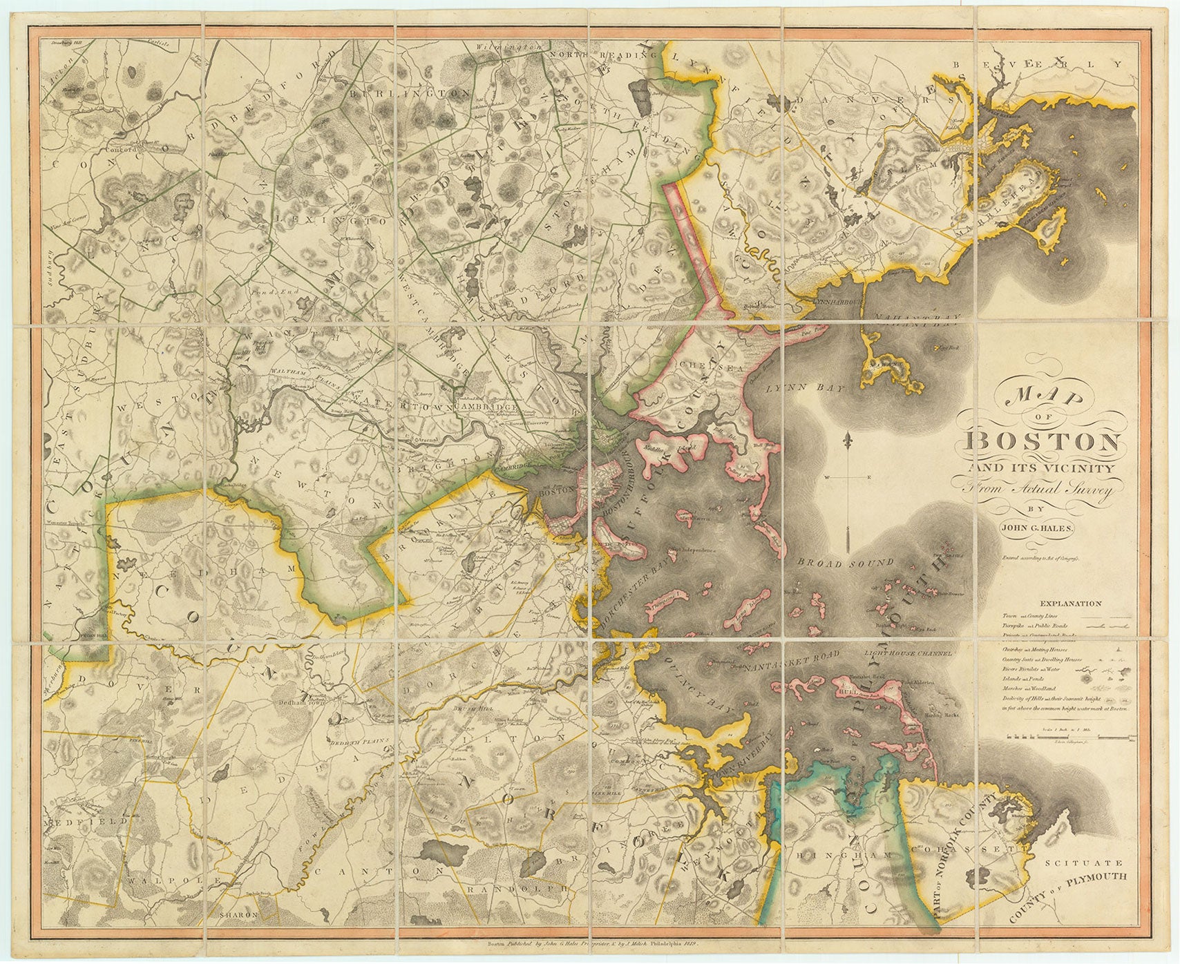
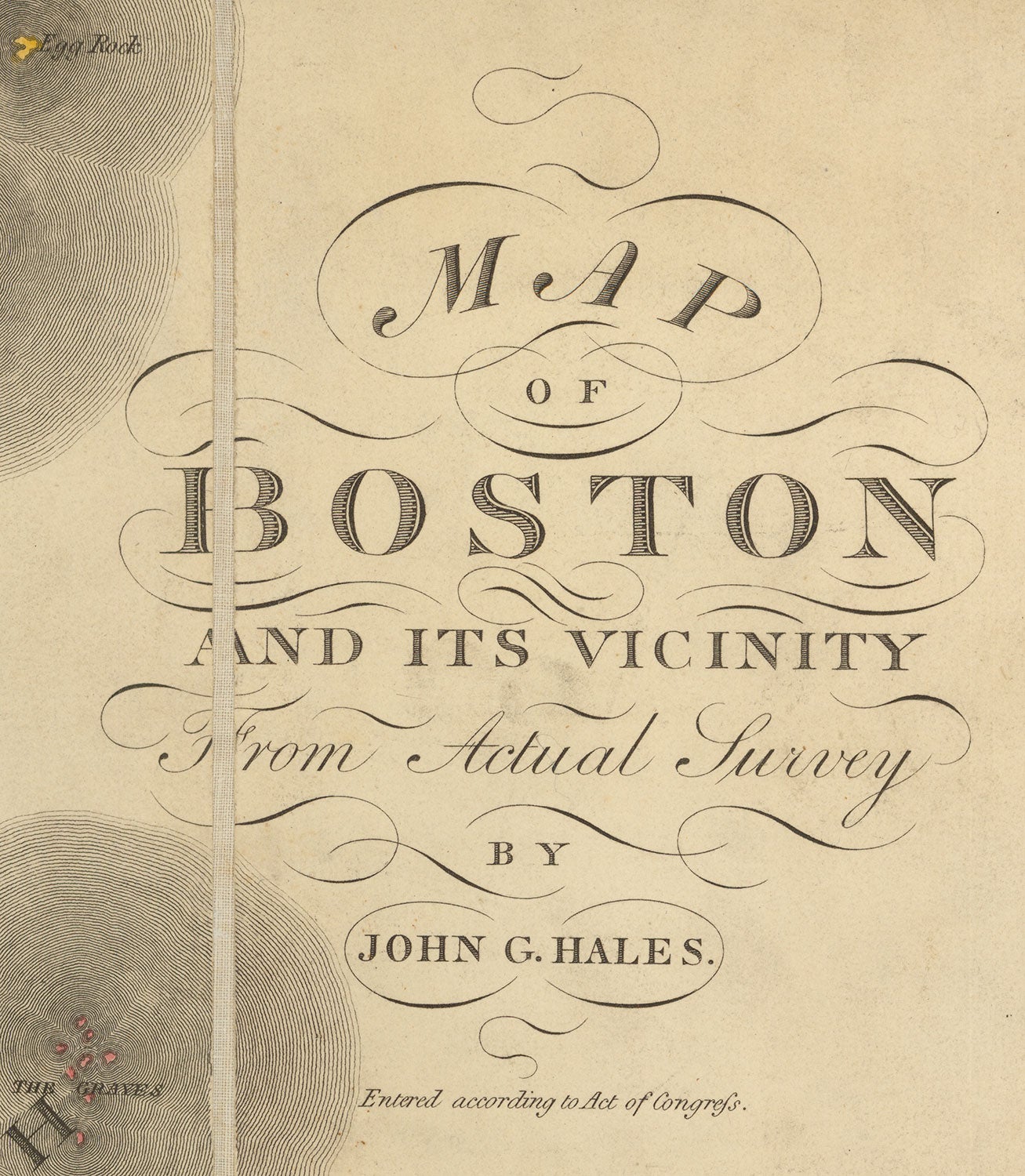
Map of Boston and Vicinity From Actual Survey.
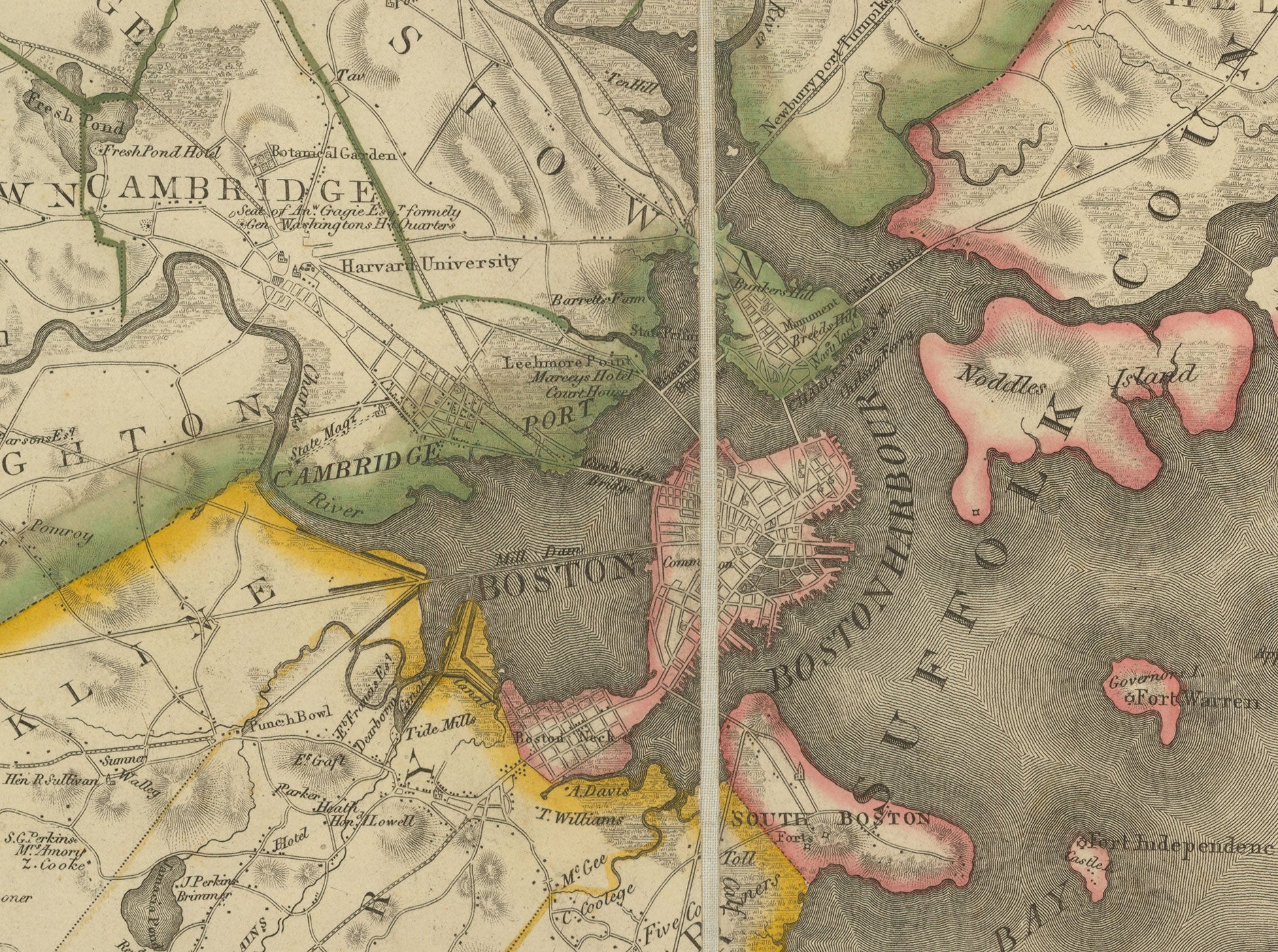
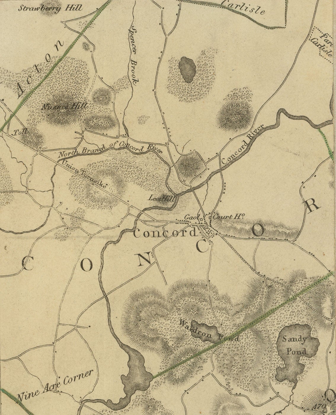
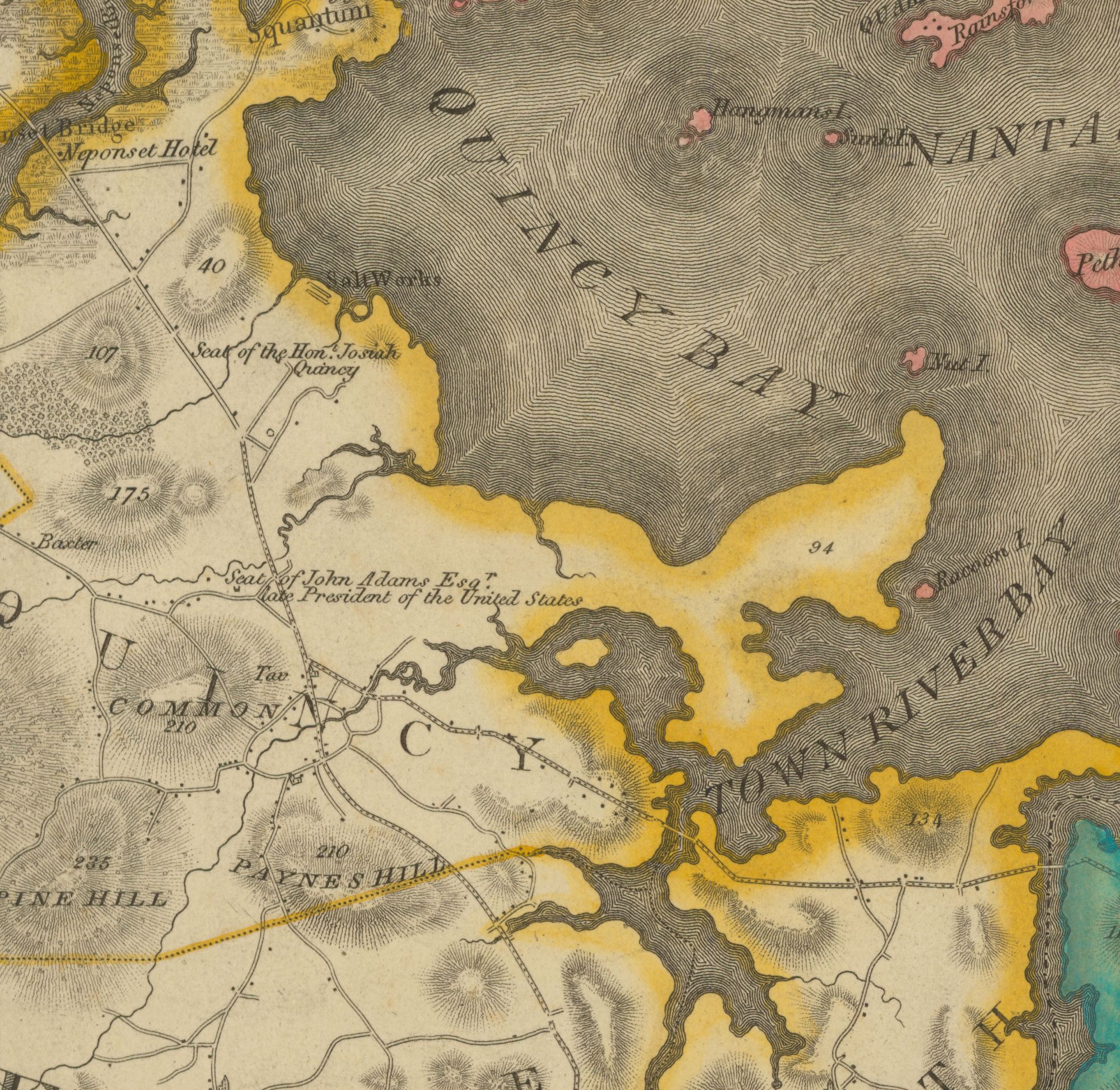
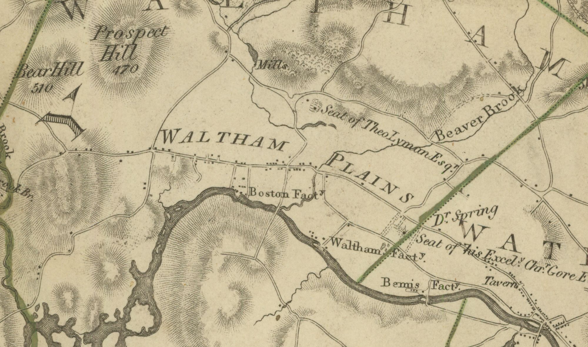
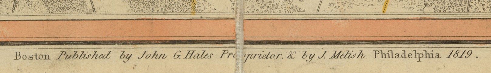
Boston: Published by John G. Hales Proprietor, & by J. Melish, Philadelphia, 1819. Hand-colored engraving, 25.75” x 37.625” plus margins. An important and beautiful map of Boston and its surroundings, reflecting Hales’ pioneering application of advanced surveying techniques to the mapping of New England. The region represented in this map extends from Boston as far north as Danvers and Beverly, to Concord, East Sudbury, Dover and Medfield in the west, and Walpole, Canton, Randolph, Weymouth, Hingham, etc. in the south. Drawn on a scale of one inch to the mile, the map is filled with interesting details, including roads, churches, meeting houses, dwellings (with many property owners named), forts, schools, mills, factories, hotels, taverns, toll gates, canals, ponds, rivers, marshes, hills (many with their height indicated “above the common height watermark in Boston”), etc. Also identified are such notable places as the home of John Adams in Quincy, a U.S. arsenal, and Harvard University. As noted by Michael Buehler in his Surveyor, Mapmaker, Forger: The Career of John Groves Hales (ca. 1785–1832), this was an unusually sophisticated map for its time and place:
To produce it Hales conducted a trigonometric survey (also known as a “triangulation”), using careful measurements and calculations to establish a network of precisely-placed locations, which served as control points for placing the details of the natural and human landscape […] Though these advanced methods had been in use in Europe for many years, and had been applied in the surveys of the American coast published in the Atlantic Neptune, this seems to have been the first time they were applied to a terrestrial map of New England.
By far the best map of the region published up to that time, it proved quite popular. Editions dated 1819, 1820 (two issues), 1829, and 1833 are known. The copy offered here is a first edition.
One of New England’s greatest mapmakers, John Groves Hales (ca. 1785–1832) was born in England, where he became a civil engineer and surveyor, prior to emigrating to Portsmouth, New Hampshire around 1810. His first published maps appeared in 1813. These were Map of the Compact Part of Portsmouth and A Map of Upper and Lower Canada, both carrying a Portsmouth imprint, although engraved by Boston engraver Thomas Wightman. Perhaps seeking a larger market for his next map, Hales turned his attention to the south, publishing Map of Boston in the State of Massachusetts in 1814, the most detailed map of the city published up to that time. His most important map followed in 1819—Map of Boston and Vicinity.
In addition to the aforementioned maps, Hales attempted an improved map of the state of Massachusetts, a project which failed due to a lack of official support, and possibly as a result of Hales’ conviction on charges of forgery in 1823. He also published The County of Essex From Actual Survey (1825) and undertook numerous surveys for corporations and towns. Hales’ manuscript town surveys are held by the Massachusetts State Archives. A number of these were printed and published by Pendleton’s Lithography of Boston in the early 1830s, including maps of Lexington, Concord, Holliston, Pembroke, and Northampton.
A very attractive copy of this landmark map.
REFERENCES: Buehler, Michael. “Surveyor, Mapmaker, Forger: The Career of John Groves Hales (ca. 1785–1832),”Newsletter of the Boston Map Society, 2009; Peveril Meigs, “John G. Hales, Boston, Geographer and Surveyor, 1785–1832,” The New England Historical and Genealogical Register, 129 (1975), pp. 23-29.
CONDITION: Very good.
Item #5083
Sold