
Sign up to receive email notices of recent acquisitions.
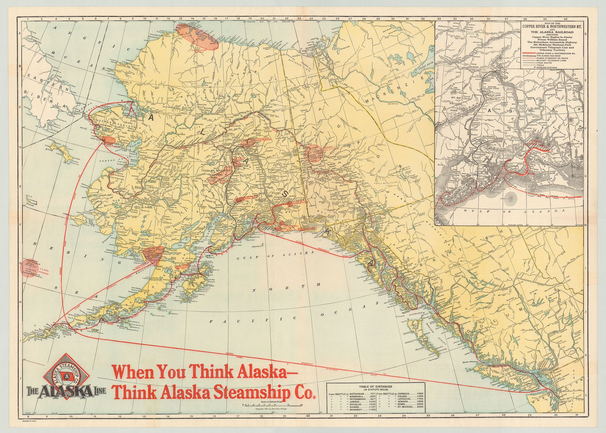
The Alaska Line. When You Think Alaska—Think Alaska Steamship Co.
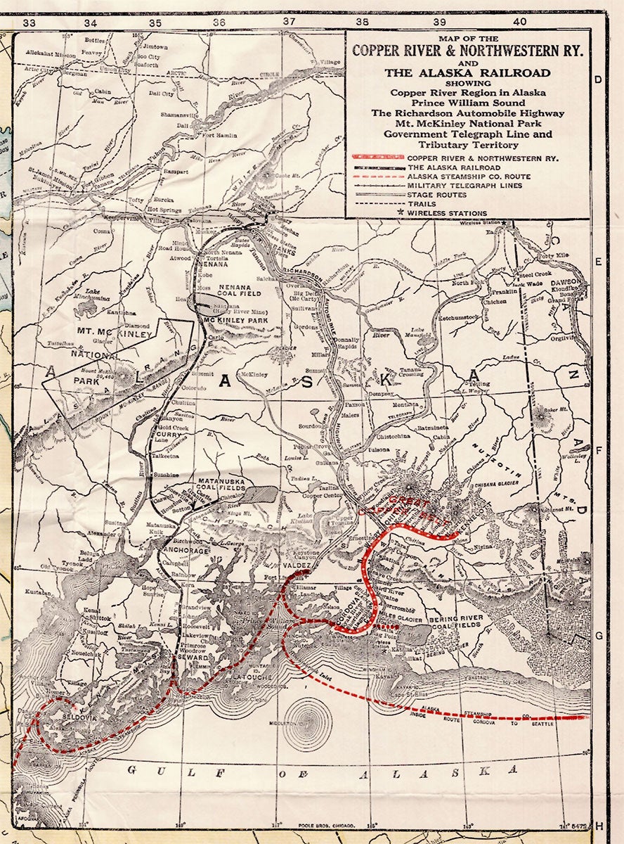
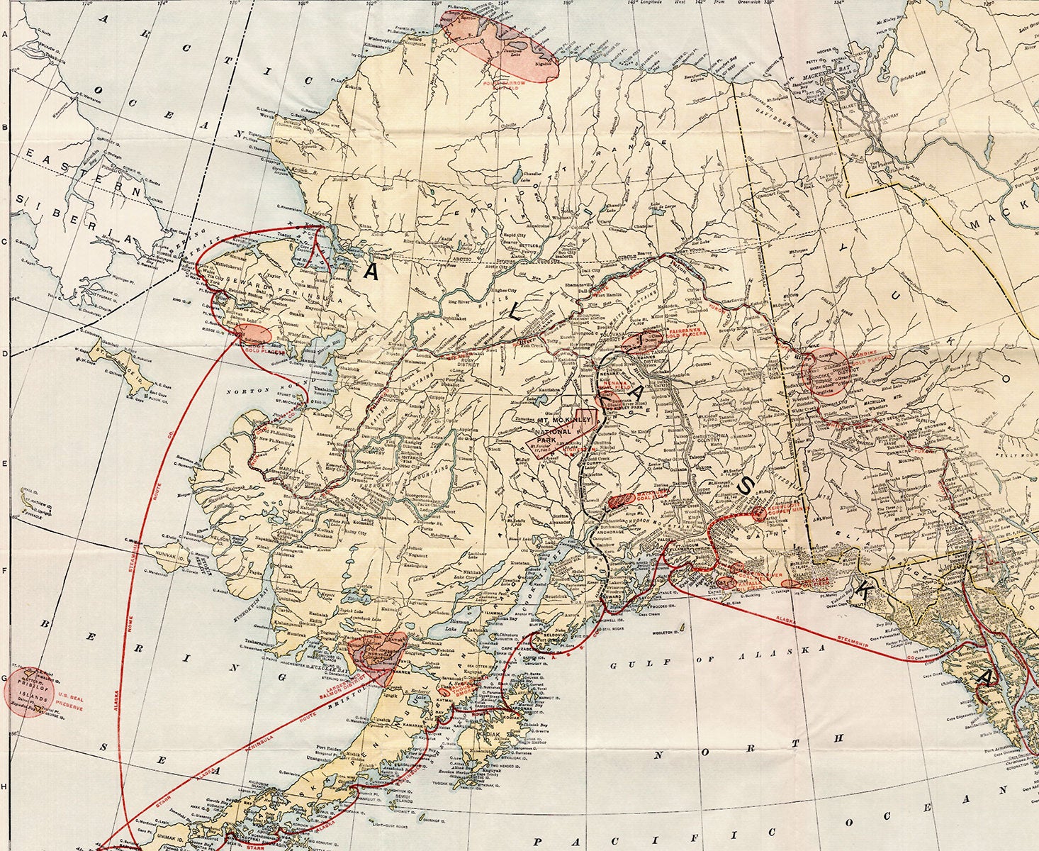
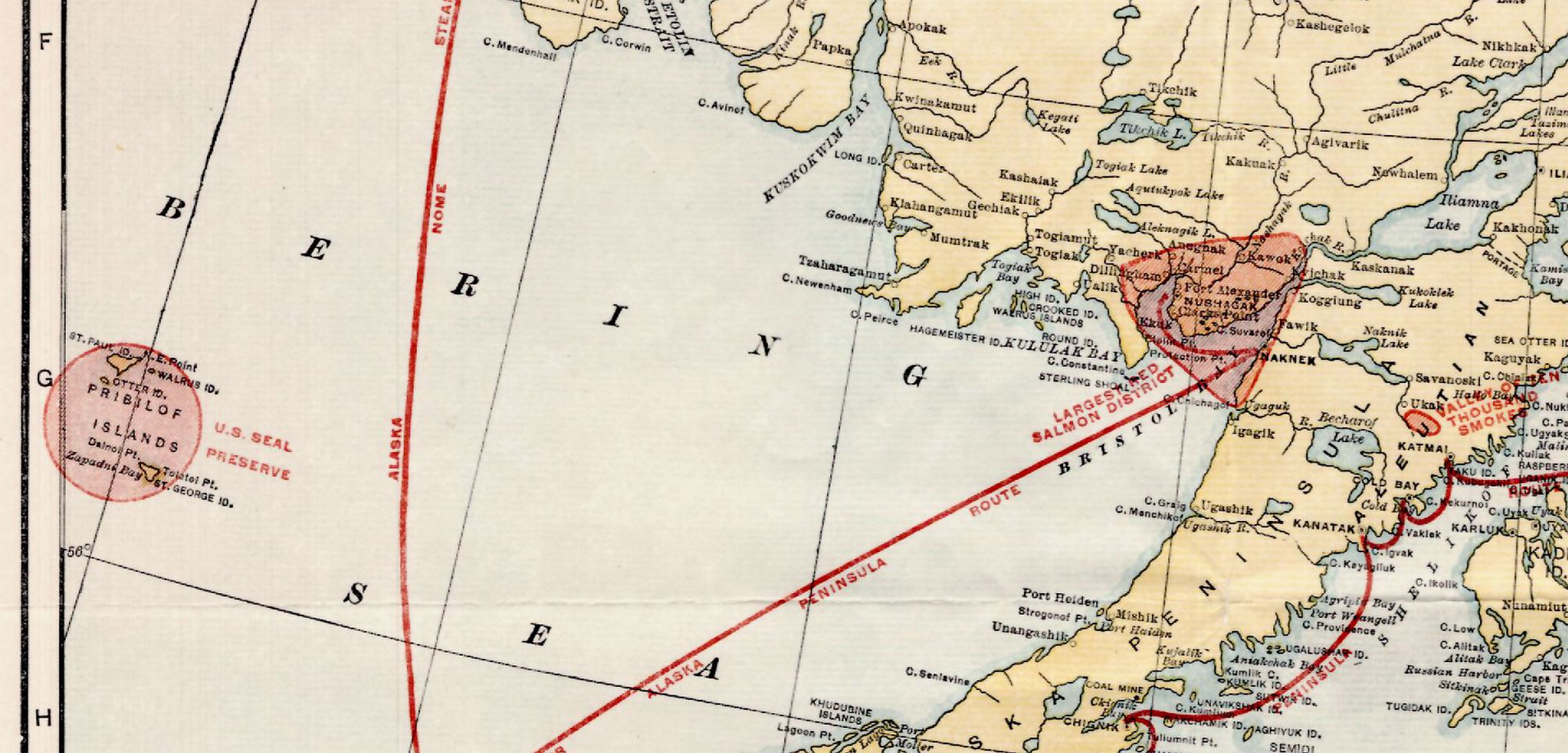
Chicago: Alaska Steamship Company; Poole Bros., printers, 1917. Folding map, 53 x 77 cm, plus margins. CONDITION: One 8.5 cm tear at bottom-left corner, several small separations along old folds, but no losses to the map. A promotional map for a cruise from Seattle, Washington to Alaska, published roughly a decade after the height of the Klondike Gold Rush (1896–1899) and reflecting development in the state in the first two decades of the twentieth century. This map depicts Alaska, the Klondike District, and the westernmost portion of the Northwest Territory. Highlighted in red are over a dozen salient features in the Klondike and elsewhere: coal and gold fields, copper mines, salmon districts, oil fields, gold placers, a U.S. Seal Preserve, and so on. The inset map at the upper-right—entitled Map of the Copper River & Northwestern Railway and the Alaska Railroad—depicts the Copper River Region (labeled the “Great Copper Belt”), and shows automobile highways, military telegraph lines, stage routes and rails, and “wireless stations.” Red lines trace intersecting water and land routes to the Klondike and other locales; black lines indicate railroad lines, and steamship routes thread through islands and touch at various harbors. A scale of miles appears at the bottom-middle, and a table of distances records various distances from Seattle to thirteen Alaskan locales. Established in 1894 primarily for passenger service and fishing products, the Alaska Steamship Co. began to ship mining equipment, dog sleds, cattle, etc. to Alaska with the onset of the Klondike Gold Rush in 1897. In 1909, the company was purchased by the Alaska Syndicate and merged with the Northwestern Steamship Company but retained its name; at that time its fleet was expanded to eighteen ships. During the Second World War the U.S. government took control of the Steamship Co.’s ships. The Poole Brothers were leading printers and publishers of maps, guidebooks, brochures, and other promotional publications. Founded in 1870 by George Amos and William H. Poole, the firm operated until 1968. Servicing nearly every railroad in America, the Poole Bros. became the largest printing house in the country specializing in transportation and travel publications—later expanding to periodicals, such as Advertising Age and the New England Journal of Medicine. Among the numerous titles to their credit are: Map of the Atchison, Topeka and Santa Fe R.R. Leased Lines and Connections (1884), Northern Pacific Railway and Connections (1887), Gold Fields of Alaska and How to Reach Them (1898) and Map of Burlington Route (1907).
Item #5189
Price: $375.00