
Sign up to receive email notices of recent acquisitions.
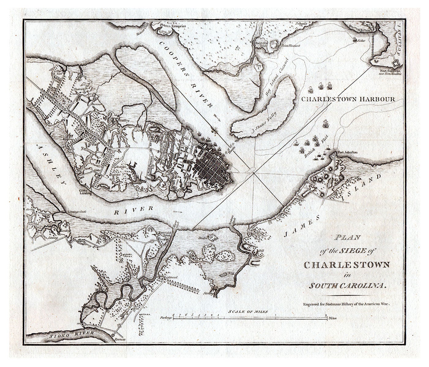
Plan of the Siege of Charlestown in South Carolina.
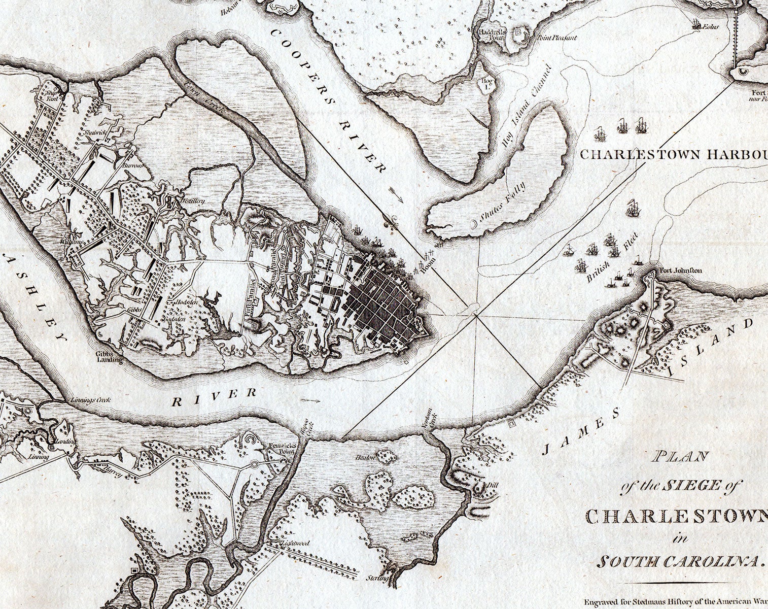
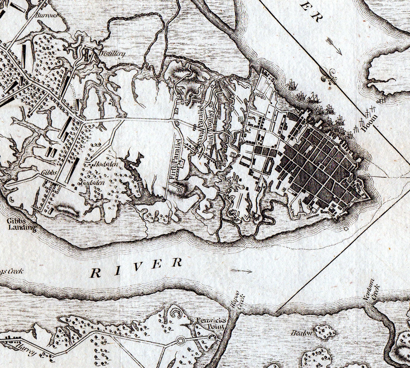
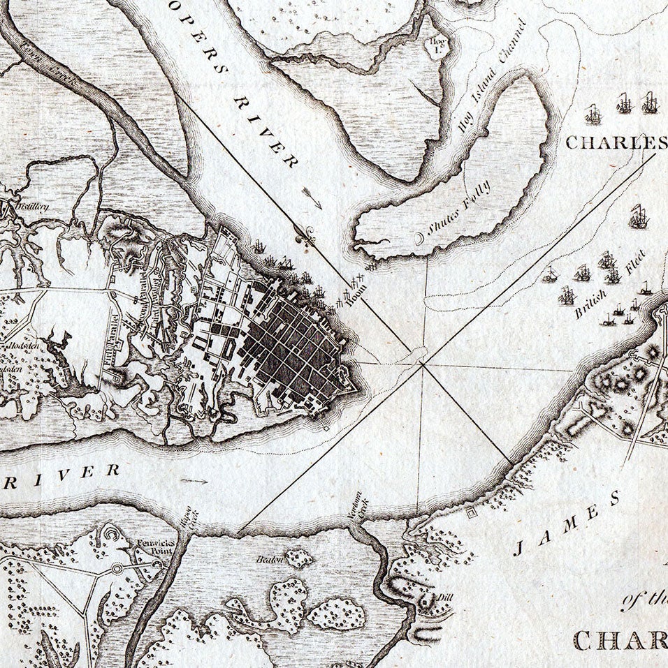
London, 1794. Engraving, 25.25 x 29.5 cm, plus margins. A handsome and highly informative plan of the Siege of Charlestown, one of the worst colonial defeats during the Revolution. First published by Faden in 1784, this is the later state of the map, published by Stedman in 1794. This plan of Charleston Harbor—located at the nexus of the Ashley and Coopers Rivers—illustrates in great detail the siege of Charleston, South Carolina, which occurred at the beginning of the British Southern Campaign. Taking place between 29 March and 12 May 1780, the siege was carried out by some 14,000 British troops under the command of Sir Henry Clinton and resulted in colonial Gen. Benjamin Lincoln’s surrender. The three parallels of the British siege are shown to the west of the city and a British fleet is depicted off the shore of Fort Johnston. Blocking Coopers River is a boom situated between Charleston and Shutes Folly. Also shown is a town plan of Charleston, as well as Fort Johnston, Fort Sullivan, Haddrells Point and Gibbs Landing. The map features geographical and topographical details, major routes, forts, vessels, waterways, and a scale of miles is given at the bottom. The map demonstrates how Clinton outmaneuvered Lincoln by crossing the Ashley River upstream from Charleston. Here Clinton’s men landed without conflict and built siege works; meanwhile, a group of British vessels entered the harbor and barred Charleston’s access to the ocean. Clinton extended the offer for Lincoln to surrender, but the Americans declined. In turn, the British began bombarding Charleston on April 10th. On the following day, a force under Banastre Tarleton suppressed an attempt led by Maj. Gen. Isaac Huger to break the British lines near the Cooper River. On May 12th, Lincoln finally surrendered to Clinton as his resources and ammunitions began to dwindle. First issued in 1784 by William Faden, a decade later Faden’s plates were obtained and reprinted by Charles Stedman for his History of the American War (1794). William Faden (1749–1836) was a notable English cartographer and publisher of maps and served as the royal geographer to King George III. During the Revolutionary War, Faden also designed such maps as Plan of the City and Environs of Quebec: With its Siege and Blockade By the Americans… (1776) and A Plan of the Operations of the Kings Army under the Command of General Sr. William Howe, K.B. in New York and East New Jersey (ca. 1777), among many others. Charles Stedman (1753–1812) was a British Army officer who fought in the Revolutionary War, following which he wrote a detailed history of the conflict. Stedman’s History remains a standard text on the subject. REFERENCES: Nebenzahl, Bibliography of Printed Battle Plans of the American Revolution, #87. CONDITION: Very good, little to no wear.
Item #5196
Sold