
Sign up to receive email notices of recent acquisitions.
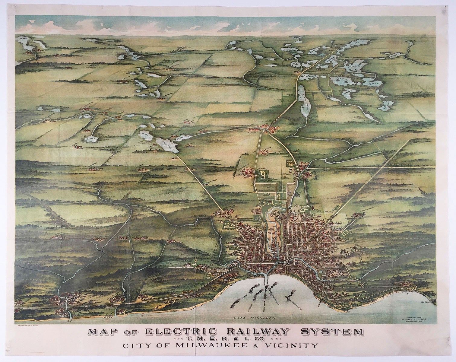
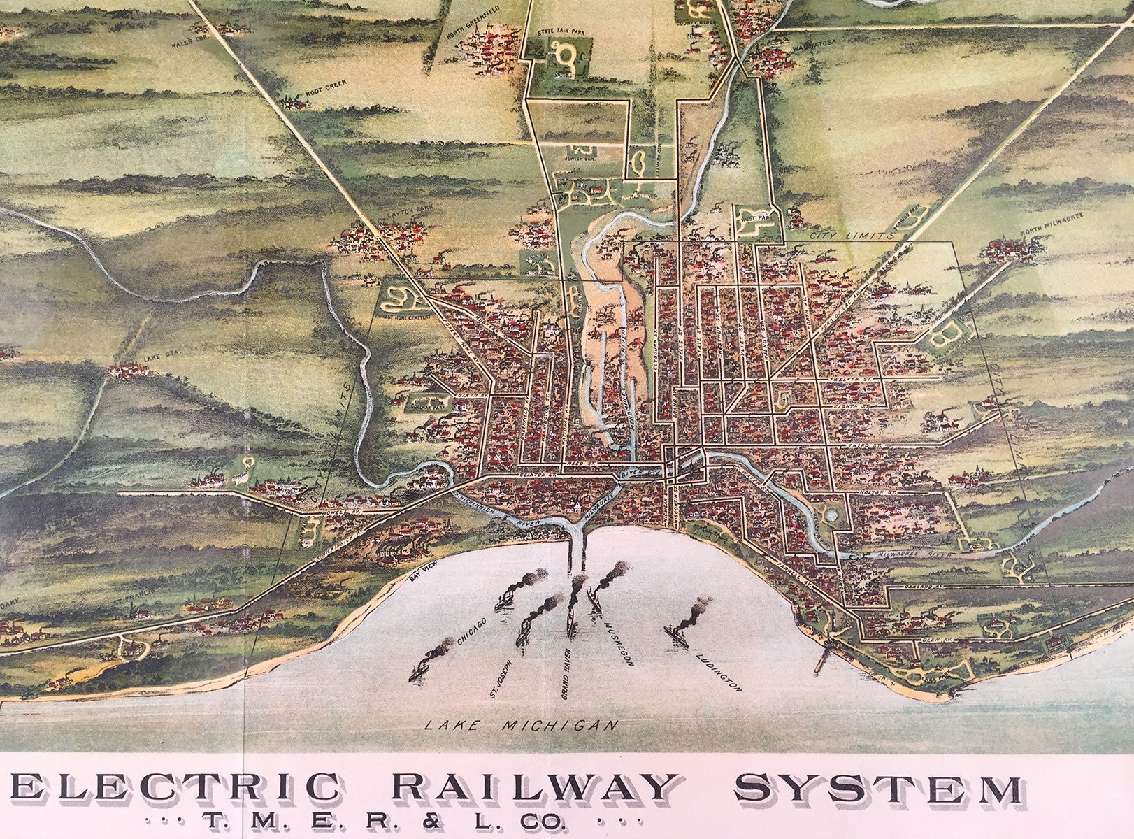
Map of Electric Railway System. T. M. E. R. L. Co. City of Milwaukee & Vicinity.
Milwaukee, Wisconsin: Northwestern Litho. Co., 1898. Chromolithograph, 18.25” x 26”, plus margins. A scarce bird’s eye view of Milwaukee depicting the full extent of the city’s electric railway system at the end of the 19th century. Showing the city from a vantage point over Lake Michigan looking west, this view embraces Milwaukee Bay, the whole of the city, and outlying areas, with numerous lakes shown to the west. The rail lines are shown in black along most of the city’s streets, the shoreline roads, and extending part way along various roads into the distance. Six steamships are shown heading out of the bay, further emphasizing the highly developed state of the transportation system serving the city. During its heyday, the Milwaukee Electric Railway & Light Co. was Wisconsin’s largest electric railway and electric utility system. Incorporated in January 1896, the company consolidated multiple preexisting horsecar, steam dummy and streetcar lines into one system. In time, the Milwaukee streetcar lines served most areas of the city and reached throughout southeastern Wisconsin. The company also had its own shops which could build and repair its streetcars and locomotives. The first electric streetcar in Milwaukee began operation on Wells Street on 3 April 1890, and the last streetcar active (in both Milwaukee and Wisconsin) operated on Wells St. on 2 March 1958. REFERENCES: Reps 4392; TMER&L at trainweb.org CONDITION: Good, old folds, touches of rubbing at some folds, light stains in margins.
Item #5410
Sold