
Sign up to receive email notices of recent acquisitions.
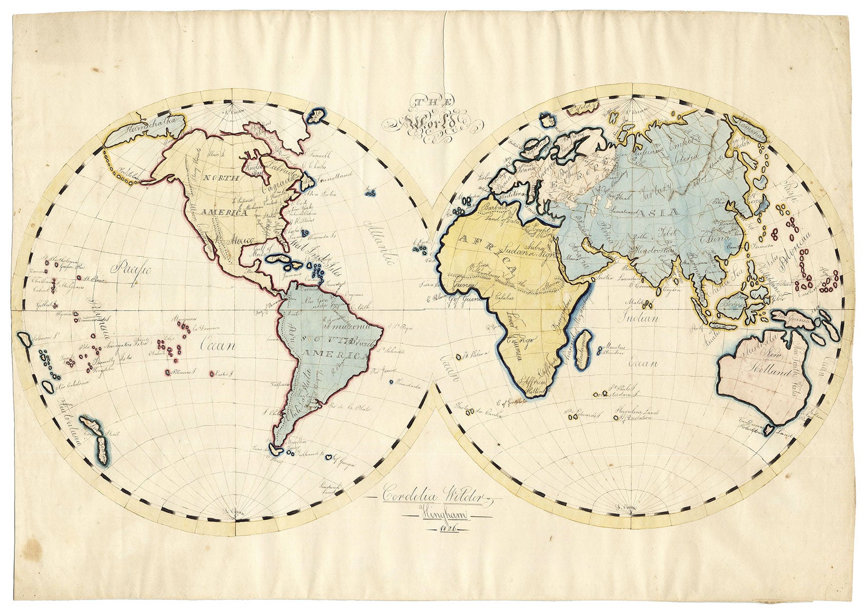
The World.
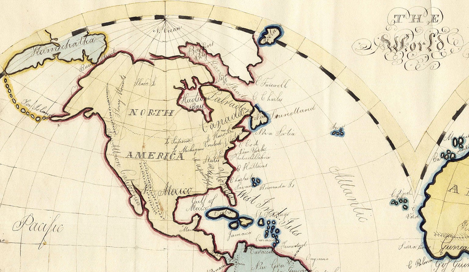
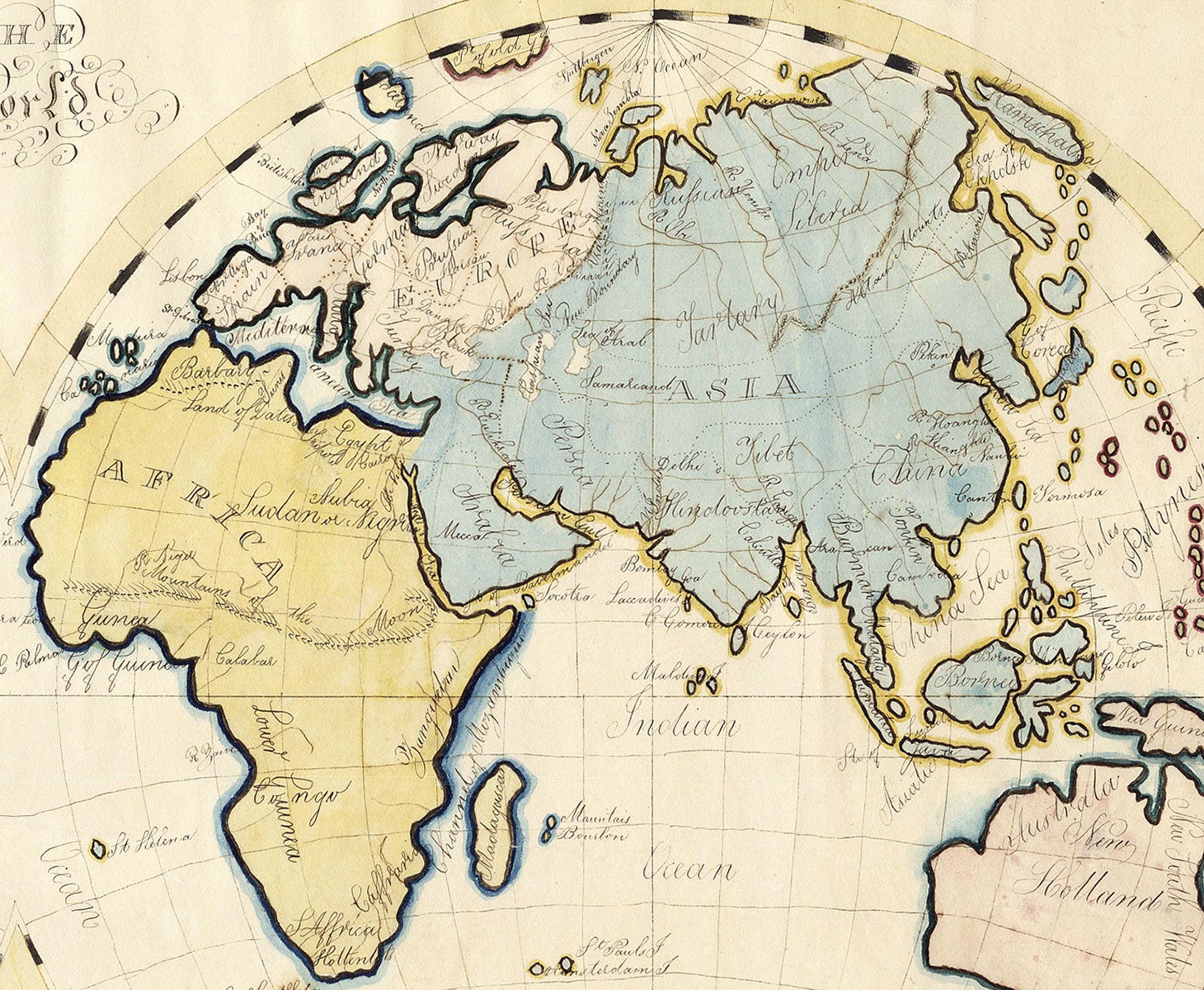
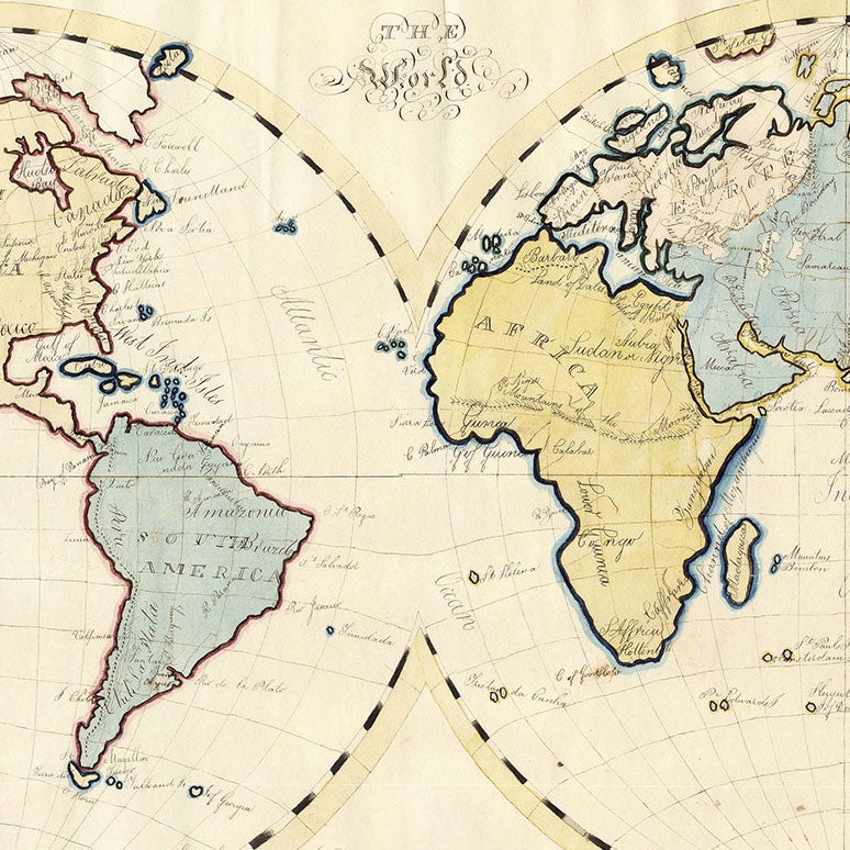
Hingham, [Mass.], 1826. Manuscript in ink and watercolor, 21” x 29.5” (sheet size). CONDITION: Vertical crease at top center, minor spotting and soiling, and a bit of waviness to paper (exaggerated by the scan). Trimmed close at sides, probably to fit an old frame. An attractive manuscript map by a Hingham, Massachusetts schoolgirl. The map is projected on a double hemisphere, with the continents in very appealing pastel wash and outline color and major topographical and riverine features delicately delineated. The map is dated 1826, but the geography reflects a late 18th century world view, including for example crude interpretations of Alaska Australia, and no sign of Antarctica. We have so far been unable to identify the prototype on which it is based. The map is signed “Cordelia Wilder, Hingham.” A woman of that name was born in Hingham, Massachusetts in 1812, which comports well with the 1826 date of the map. She married one Joseph Dana Adams in 1835, though by 1841 she widowed, and she seems to have spent the rest of her days in Hingham, dying there in 1894. Background From the 1790s through the 1830s map copying was an important element of American primary education, valued for imparting geographical knowledge and providing excellent practice in drawing and penmanship (Schulten, p. 186). Schulten argues, however, that the technique was also valued as a tool for developing character: “this task was often less about cartographic conceptualization than demonstrating the discipline and control required to replicate or emulate a map.” (ibid., p. 199) These maps were drawn or embroidered, to some extent by boys but primarily by girls, as the education of the former tended to place a greater emphasis on navigation and surveying than on geography. The source maps were usually from commercially-published atlases, as school geography texts did not begin to proliferate until the late 1810s. The practice began to decline in the 1830s, under the influence of educational theorists such as Pestalozzi, who argued that geographic education should be built on direct, local observation “rather than beginning with the most abstract concept of astronomical and world geography.” (ibid., p. 217) The surviving examples of the genre vary wildly: Subject matter includes states, regions, countries, continents and the world; sizes range from a notebook page to large productions on multiple joined sheets; decorative styles range from plain to highly adorned with calligraphic, botanical and/or patriotic ornamentation; and quality of execution ranges from extremely crude—as if dashed off at the last minute to fulfill an assignment—to highly refined. All are, however, interesting as examples of a certain pedagogical model and as windows into the minds of young Americans for many of whom little or no other historical trace remains. REFERENCES: For background see Susan Schulten, “Map Drawing, Graphic Literacy, and Pedagogy in the Early Republic,” History of Education Quarterly, vol. 57 no. 2 (May 2017), pp. 185-220. Offered in partnership with Boston Rare Maps.
Item #5596
Sold