
Sign up to receive email notices of recent acquisitions.
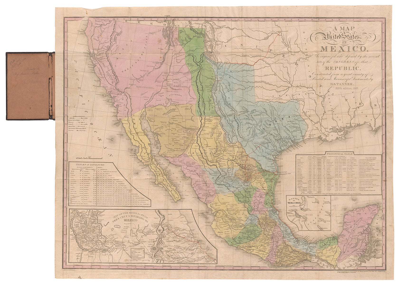
A Map of the United States of Mexico, As organized and defined by the several Acts of the Congress of that Republic, Constructed from a great variety of Printed and Manuscript Documents by H.S. Tanner.
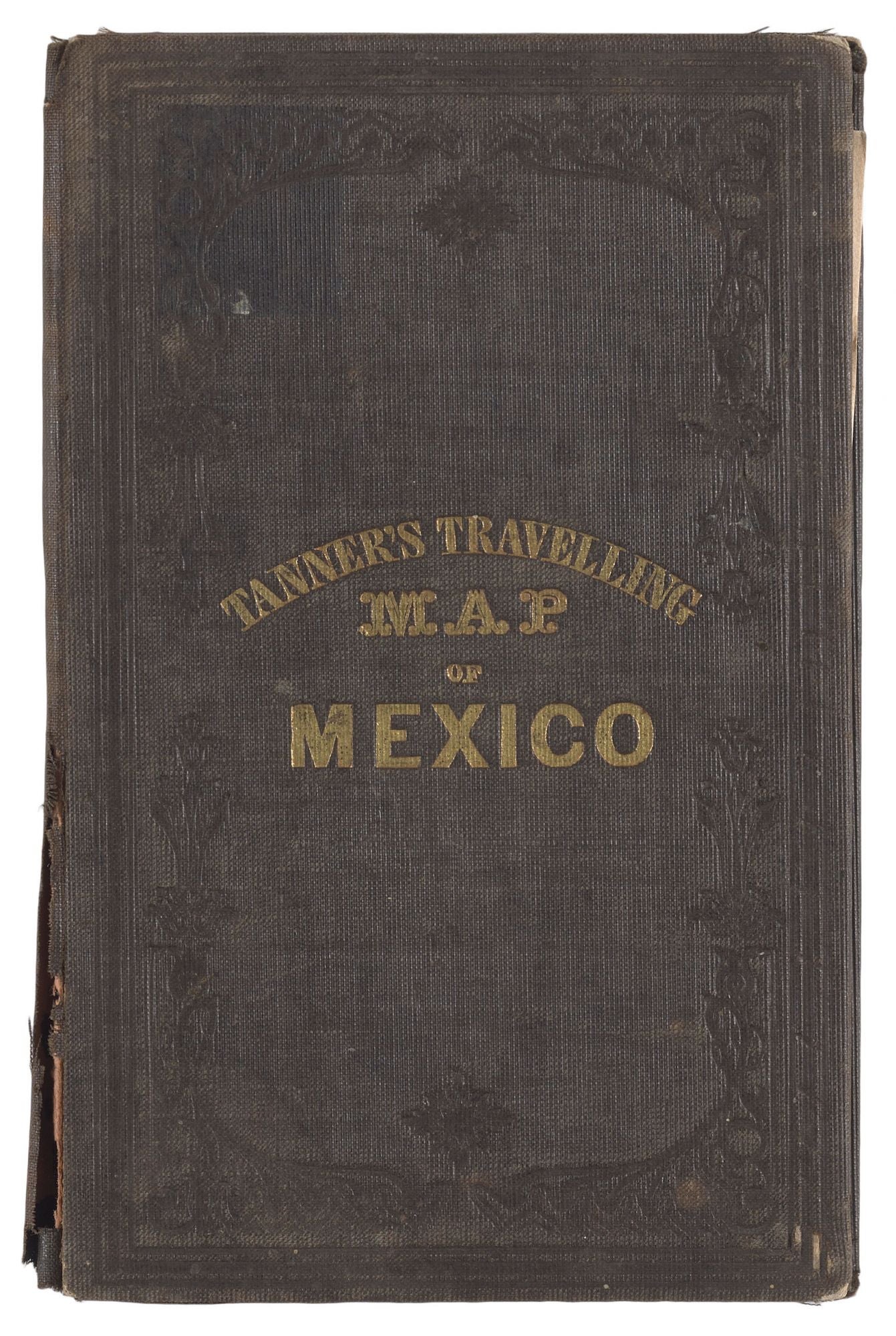
Philadelphia, 1847. Lithograph, 22.5" x 29" plus margins, full color, folding into original covers with title stamped in gold. The fifth edition of Tanner’s important map of Mexico and portions of the future southeastern United States, one of the most influential American maps of the first half of the nineteenth century and the best general map of the theater of the Mexican-American War, including details relevant to the War not found on any other edition of this map. This historically compelling map represents the Republic of Mexico, which lasted until the end of the Mexican War in 1848, consisting of today’s Mexico as well as the future U.S. states of California, Texas, Utah, Arizona, New Mexico, Nevada, and portions of Colorado and Oklahoma. Ristow notes that Tanner produced the first edition of this map in 1825 and states that he "issued 10 variants of one or another of five states" through 1847, as well as a final edition in 1850. This consequential series of maps traces both the growth of geographical knowledge of the southwest, as well as the alteration of political boundaries throughout the period covered. The early editions relied heavily on such European sources as Alexander von Humboldt and others. However, with successive editions, American sources played an increasingly significant role in the improvement of the map. This fifth edition builds on Tanner’s efforts in his two preceding maps to incorporate many new and authoritative American sources just as momentous changes were afoot in the territorial expansion of the nation. These sources include Stephen Austin’s 1830 map of Texas (Austin’s Grant in east central Texas is here demarcated and identified), William Emory’s Map of Texas and the Country Adjacent of 1844, and John Charles Fremont’s Map Of An Exploring Expedition To The Rocky Mountains of 1845. Also carried over from the previous maps is a large inset “Map of the Roads &c. from Vera Cruz and Alvarado to Mexico City,” presenting the most important theater of the War, where General Winfield Scott prosecuted his successful campaign to capture Mexico City from April 25, 1846, to February 2, 1848; and an inset map of the Harbor of Vera Cruz (the siege of Vera Cruz occurred in March of 1847; this inset first appears on the fourth edition of 1847). The fifth edition is the best general map of the Mexican War and supersedes Tanner’s previous Mexico maps, adding the dates of seven battles, from Palo Alto, May 8, 1846 to Vera Cruz, March 22 to 27, 1847, four of which occurred in the year of publication, as well as Gen Kearny's route from Ft. Leavenworth (appearing for the first time) to Santa Fe, and other battle routes (shown but not identified) extending from Texas south to La Puebla, Mexico, all highlighted in red. Rumsey calls this “the best edition in terms of showing the events of the Mexican War.” Henry Schenk Tanner (1786–1858) was one of the foremost American map engravers and publishers of the early nineteenth century. Primarily based in Philadelphia, where he worked for some four decades, Tanner produced some of his earliest works in partnership with his brother Benjamin Tanner, as well as noted mapmaker John Melish. In 1818 he persuaded fellow publishers and partners to fund the compilation of the New American Atlas, published in 1823. The Atlas was lauded during its day as “one of the most splendid works of the kind ever executed in this country,” and was republished through 1839. In the 1820s and early ‘30s, Tanner operated the leading U.S. map-publishing house, which boasted a substantial output and was associated with engraving and/or publishing many of the best maps of the period, including a wall-map of the United States of America (1830) and Stephen Fuller Austin’s important Map of Texas (1830). Around 1832, Tanner began work on the smaller format New Universal Atlas which went through several editions. Along with his seminal atlases, he also produced many travelers’ guides, state maps, wall maps and pocket maps. His abilities were recognized by his election to the Geographical Societies of London and Paris. The finest and most complete map of the theater of the Mexican War and one of the great maps of the American Southwest. REFERENCES: Wheat, Maps of the California Gold Region, #176. Wheat, Trans Mississippi West, vol. 3, #529; Rumsey #5158; Streeter Sale, vol. 6 #3824. Tooley 246. CONDITION: Very good, lightly worn at folds, a few faint dampstains, good color; covers worn at edges with splitting to cloth along lower half of the front edge of the spine.
Item #5752
Sold