
Sign up to receive email notices of recent acquisitions.
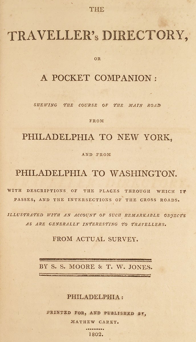
The Traveller's Directory, or a Pocket Companion: shewing the course of the main road from Philadelphia to New York, and from Philadelphia to Washington. With descriptions of the places through which it passes, and the intersections of the cross roads. Illustrated with an account of such remarkable objects as are generally interesting to travellers. From actual survey.
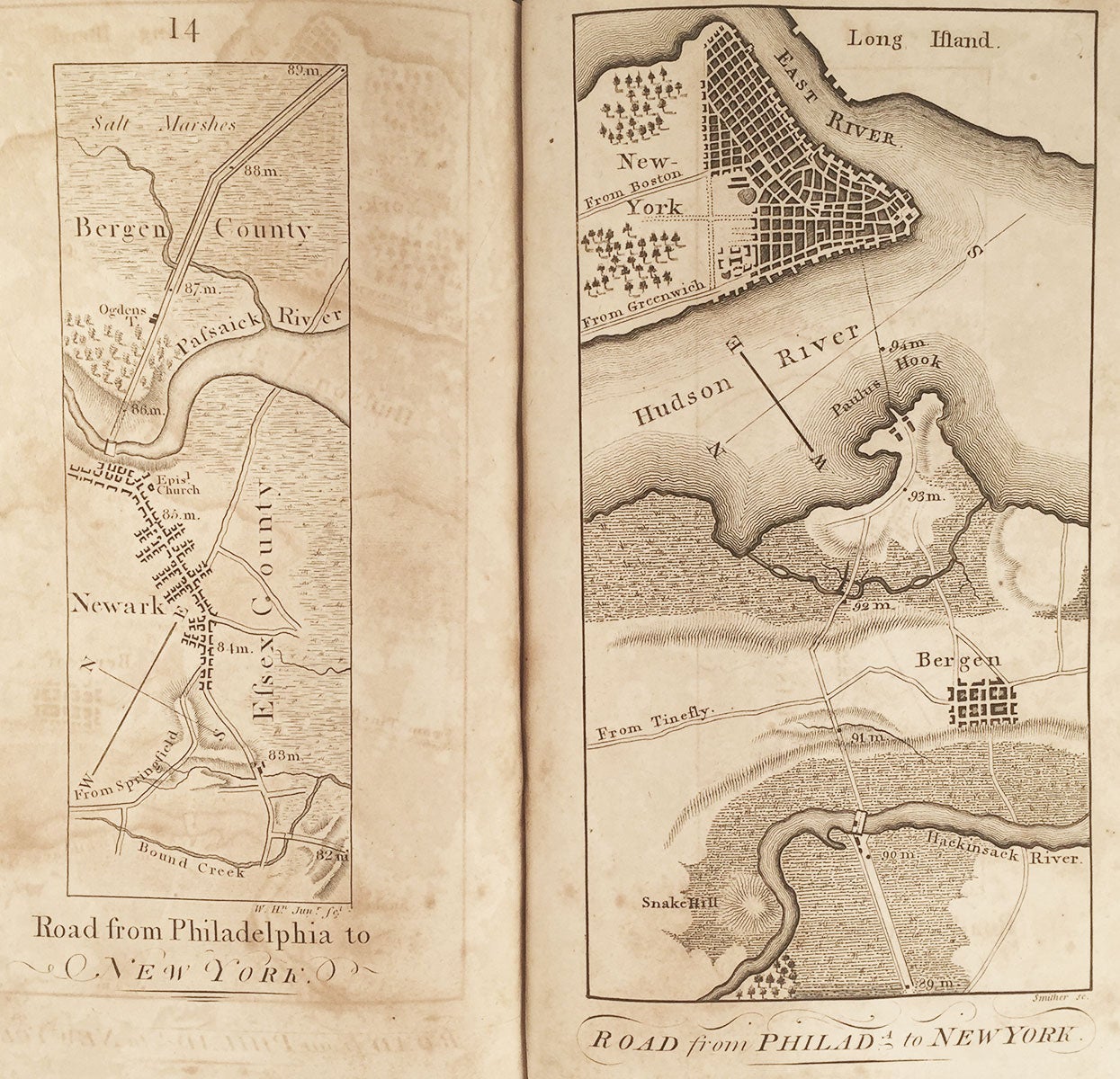
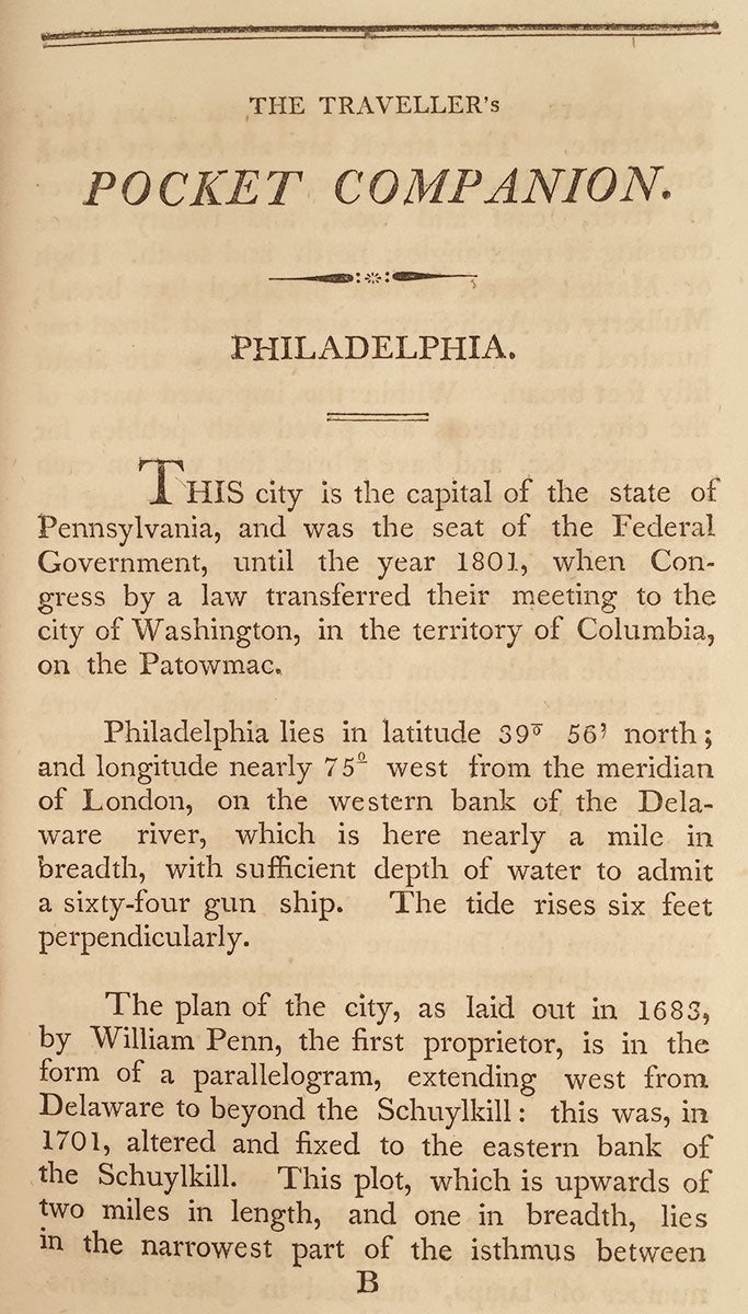
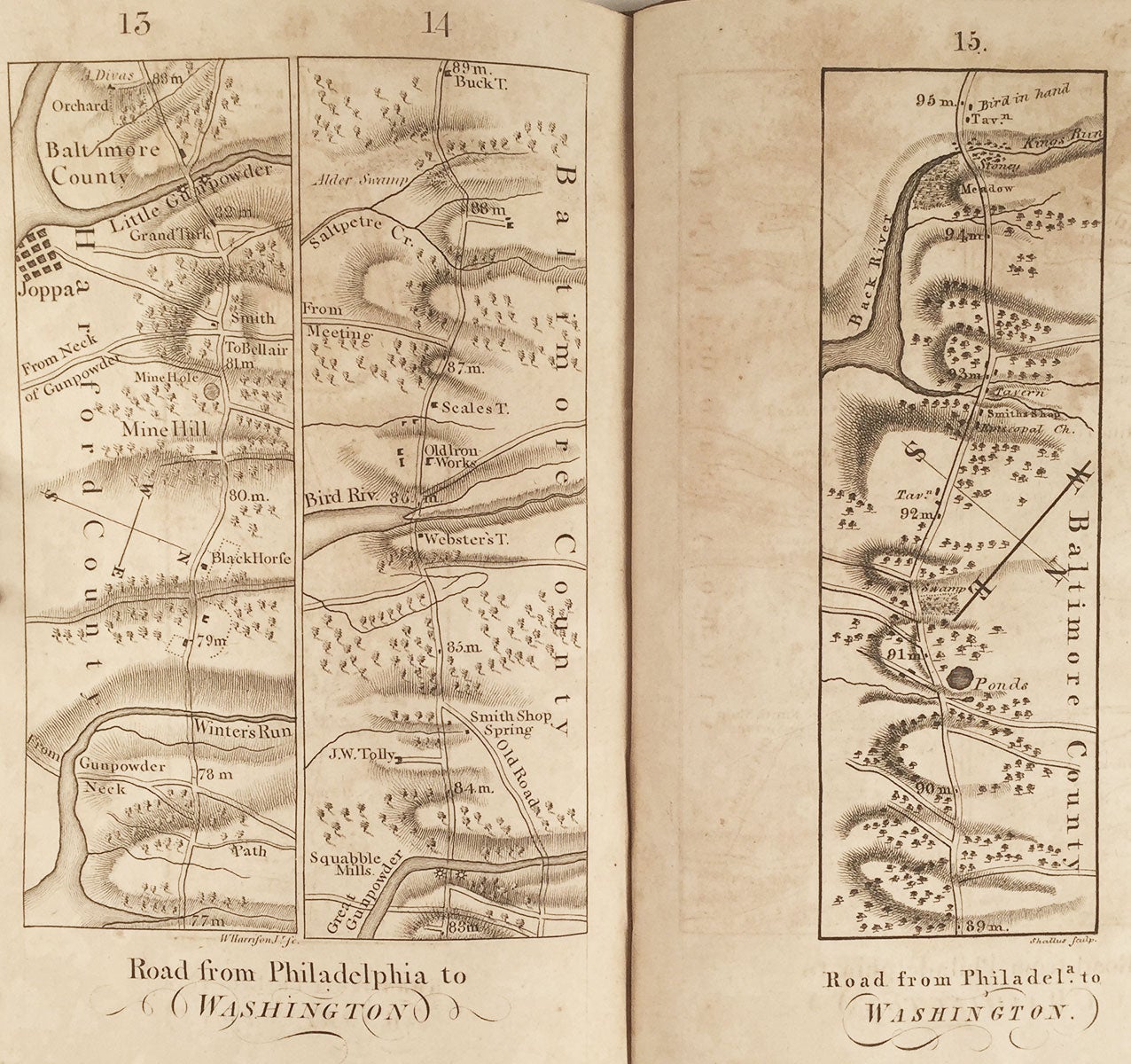
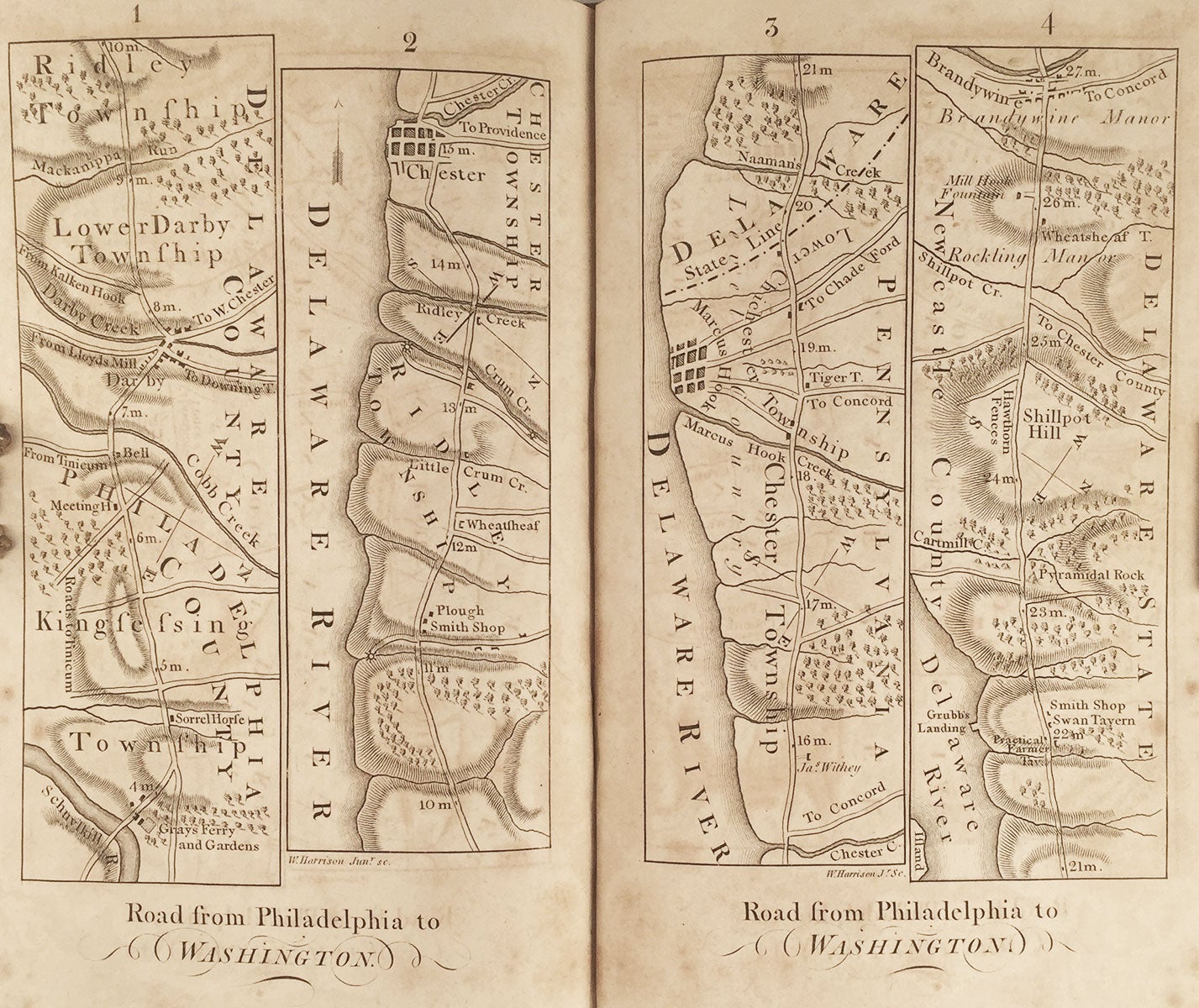
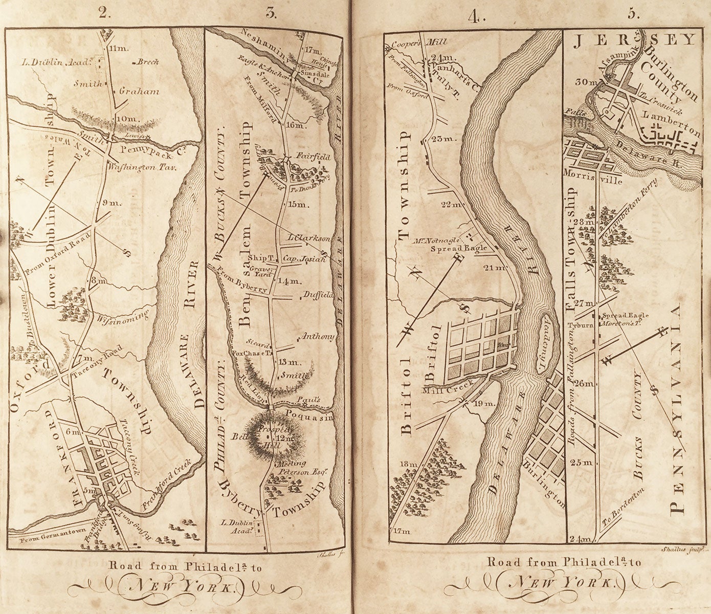
Philadelphia: Printed for, and published by, Mathew Carey, 1802. 8vo, original tree calf covers, sympathetically renewed spine with original title label laid down, single gilt rules to spine; [4], 52 pp., 38 engraved maps on 22 leaves. Lacking preface leaf. CONDITION: Occasional foxing throughout, small excision to p. 19/20, lacking preface leaf, which seems never to have been present; otherwise good. The scarce first edition of this early book of road maps, the second such work published in America, after Christopher Colles’s Survey of the Roads of the United States (1789), and the first to depict in detail the roads connecting New York, Philadelphia and Washington. The text begins with a geographical, historical, and architectural account of Philadelphia, including descriptions of such notable institutions and organizations as the Philosophical Society, the Philadelphia Library, the Abolition Society (“to superintend the morals, conduct, and ordinary situation of free blacks,” etc.), the Bank of Pennsylvania, the University, and Peale’s Museum (containing “the most valuable and extensive collection of the subjects of natural history, to be met with in this country”). Various towns and villages along the roads to Washington are described, and the text concludes with a description of Washington, with notes on the Capitol, the President's house, and Georgetown. Carey hired Joshua John Moore and Thomas W. Jones to conduct the surveys and draft the maps. As evidenced by letters Moore and Jones wrote to Carey, their task was quite challenging. Writing on 29 June 1801, they noted: “We should have written to you before this, had not fatigue of our daily journies rendered repose indispensable after the finishing of our notes and traverses. After twelve days driving our way through an immense multitude of questioners, observers, laughers, & critics, who generally thronged around us at every place, to our great discomposure at first…If astonishment would ensure success to a work, we may entertain strong hopes indeed of ours; but it has nearly exhausted our health, as every violent effort naturally must.” The maps resulting from these strenuous efforts feature not only roads and distances, but geological features (relief is shown by hachure), streams, graveyards, taverns (many of them with evocative names, such as American Arms Tavern, Wheatsheaf Tavern, etc.), churches, dwellings, meeting hoses, brickyards, woodlands, and so on. Various occasional details lending interest to the maps include “hawthorn fences” by the road, a “pyramidal rock,” “Chinese House” (on the Delaware River), “mine hole,” etc. The volume concludes with a map of Washington. The plates were produced by four engravers: William Harrison, Jr., Francis Shallus, John Draper, and James Smither, Jr. A second edition was published in 1804 with revised and expanded text but no alterations to the maps. Dublin-born American publisher Mathew Carey (1760–1839) ran the largest American publishing house of the 19th century, which he founded in 1785. Initially publishing serials and journals, Carey’s first cartographic publication arrived in 1794 with A General Atlas for the Present War (1794), which was based on maps from William Guthrie’s Atlas to Guthrie’s System of Geography. In 1795, Carey published The General Atlas for Carey’s Edition of Guthrie’s Geography Improved, which included sixteen maps of U.S. States. Later that year these sixteen maps—plus an additional five others—saw publication as American Atlas. For this work, Samuel Lewis made many important contributions as geographer, draftsman, mapmaker and penman. Engravers included William Barker, Joseph T. Scott, James Thackery, John Vallance, Samuel Hill, Amos Doolittle and Benjamin Tanner. In 1796 Carey published his General Atlas, which featured maps of the rest of the globe. REFERENCES: Shaw & Shoemaker 2686; Howes M778; Streeter Sale 3969; Felcone, New Jersey Books, 886.
Item #5900
Price: $6,500.00