

Sign up to receive email notices of recent acquisitions.
Victoria British Columbia Canada. The Head Quarters for Miners Outfits.
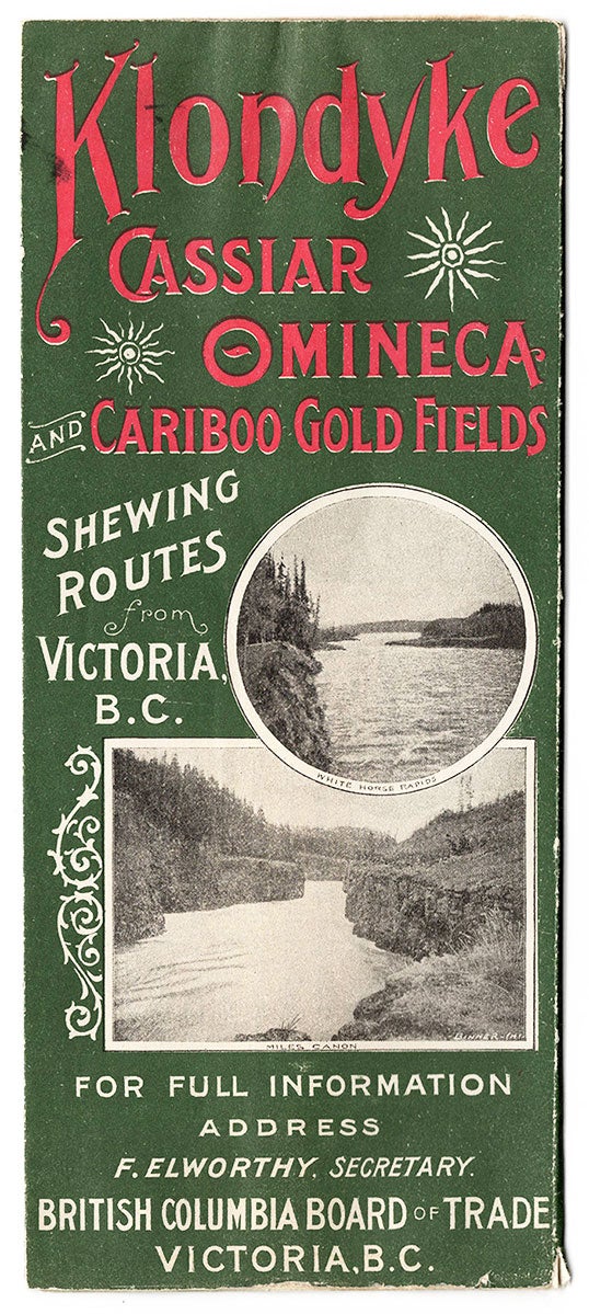
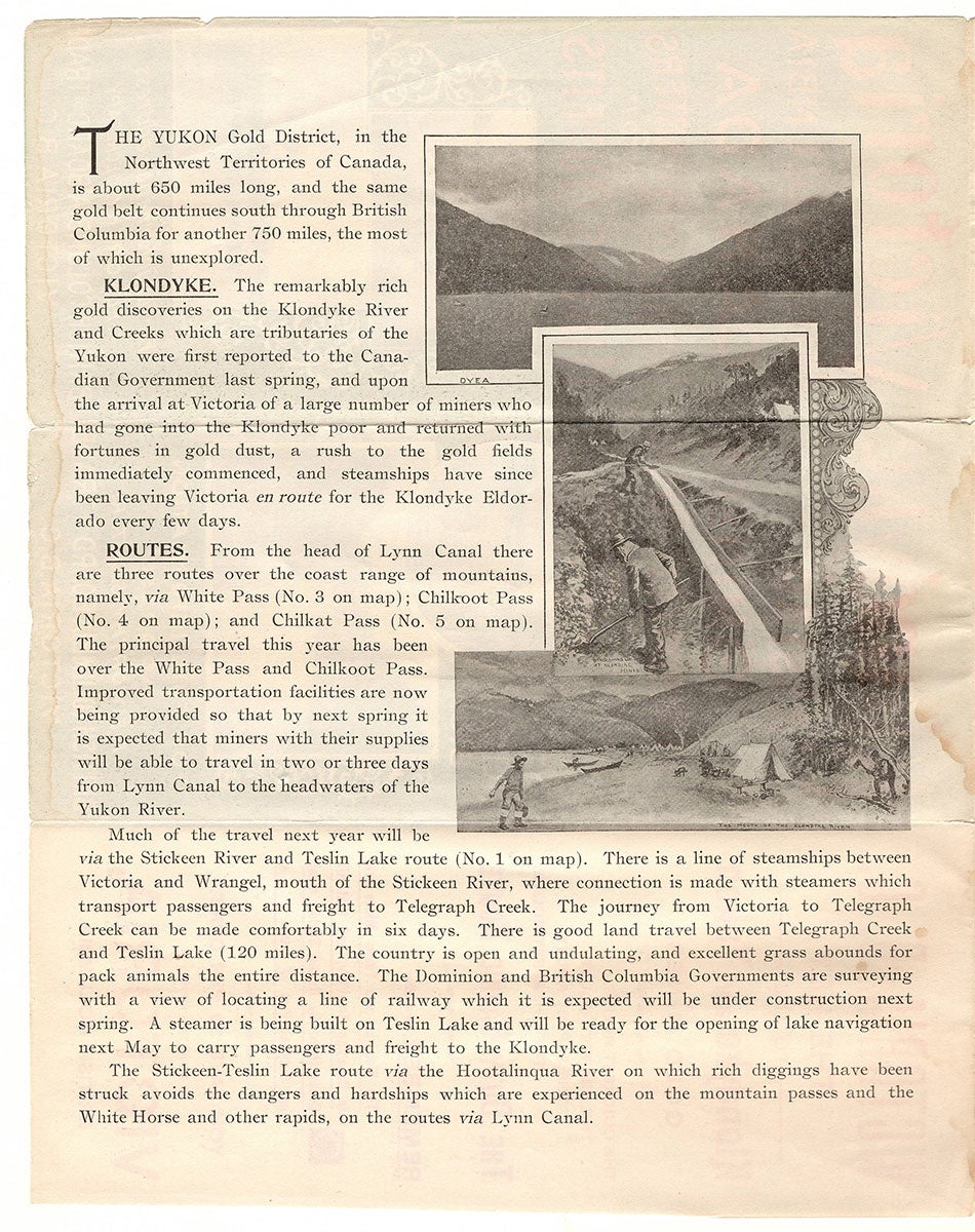
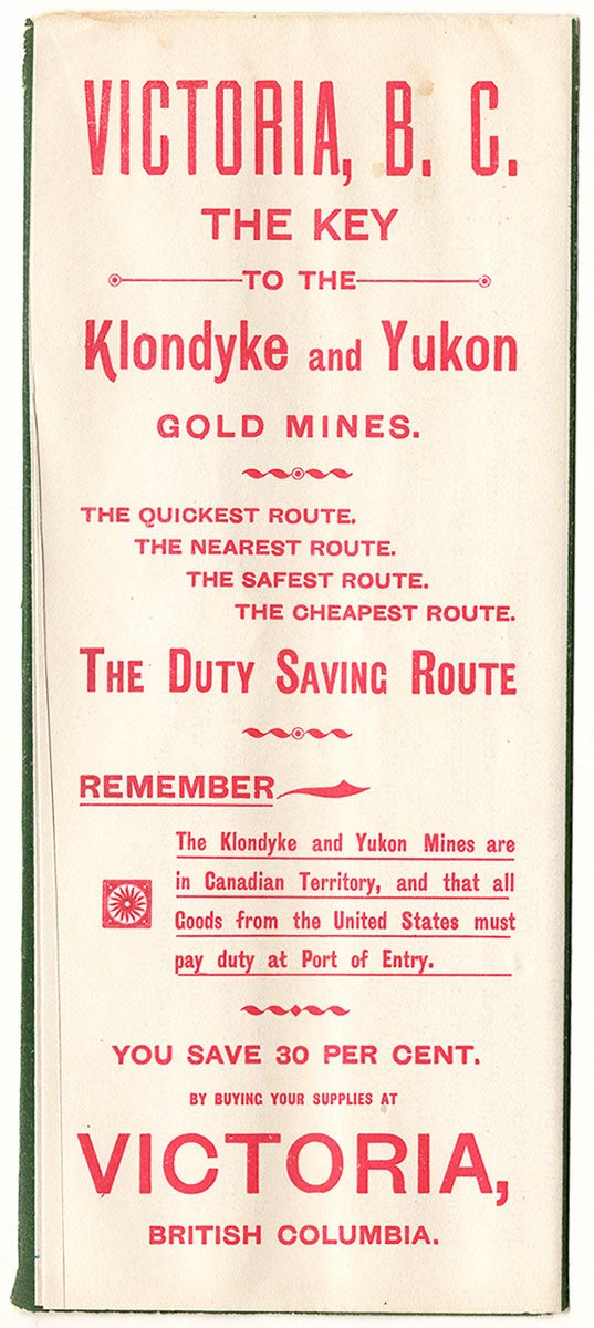
Victoria, B.C.: British Columbia Board of Trade, 1897. Folding brochure (9” x 4”) with color map (10” x 7.5”). Small purple stamp of “Simon Leiser & Co., Klondyke Outfitters of Victoria, B.C.” in map margin. A scarce Klondike gold rush brochure with map promoting steamship lines originating in Victoria, described here as the duty-saving, quickest, nearest, safest, and cheapest point of departure. Steamships are noted as departing almost daily from Victoria—dubbed “the key” to the Goldmines—for Wrangel, Lynn Canal, and St. Michael. Appearing on the covers are photo illustrations of water transportation scenes of miners venturing to the Klondike and various waterways en route. The back cover promotes in particular the Cassiar, Omineca, and Cariboo Gold Fields. Prospective travelers are advised to be sure to “obtain your ticket direct to Victoria; the fare is the same as to all other Coast Cities. Victoria’s outfitting advantages are unequalled; prices are lower, duties are saved and customs annoyances avoided.” The map—spanning from Victoria in the bottom-right to the Klondike Region in the upper-left—shows the routes (passes and trails) from Victoria, and identifies the Klondike Goldmines as well as other mines in this region. An illustrated “Gold Belt” spans the entirety of gold mining territory, while a table gives approximate distances to the Klondyke Gold Fields, and a Key Map shows the route from Victoria to Klondyke via St. Michaels. Covered in depth here are Canadian Duties; Outfits and Prices; Transportation; Routes; the Klondyke itself, beginning: “The Yukon Gold District, in the Northwest Territories of Canada, is about 650 miles long, and the same gold belt continues south through British Columbia for another 750 miles, the most of which is unexplored.” Inset photo illustrations show individuals in the Klondike and en route to the Goldfields. It is noted that the Klondike and Yukon Mines were in Canadian Territory, and thus all goods from the U.S. were required to pay duty at Port of Entry. However, one could save thirty percent by buying one’s supplies at Victoria. The text concludes with the following cautionary note: “Many of the steamers for the Klondyke from other Pacific ports have during the past two months met with disasters as they were unseaworthy. Passengers avoid all risks by taking the Victoria steamers.” Interested parties are advised to contact F. Elworthy of the British Columbia Board of Trade in Victoria for more information. OCLC records only four copies. CONDITION: Good, light staining at center vertical fold, 1.5” separation at bottom center fold; light wear at map margins.
Item #5983
Sold