
Sign up to receive email notices of recent acquisitions.
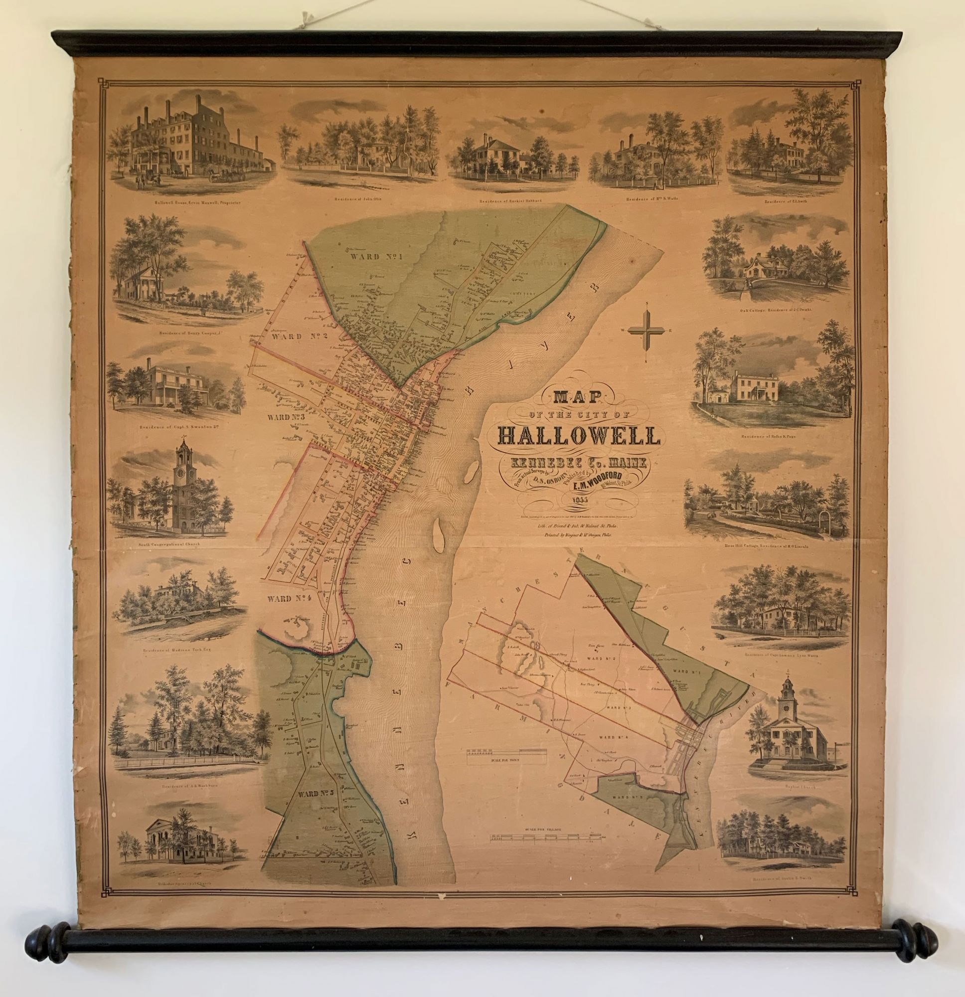
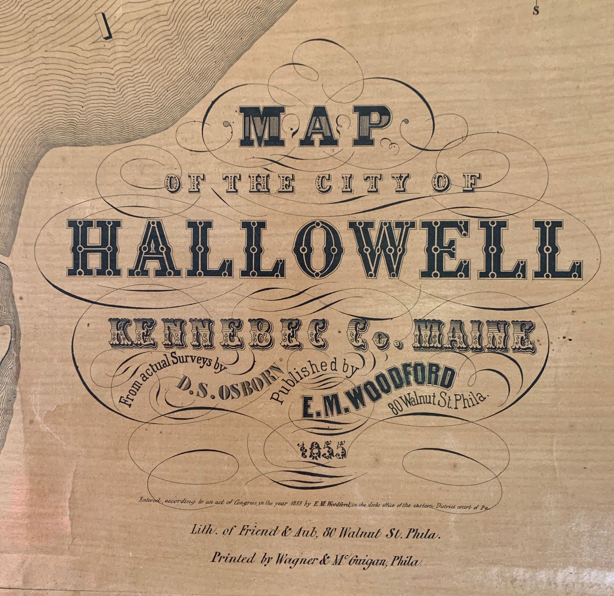
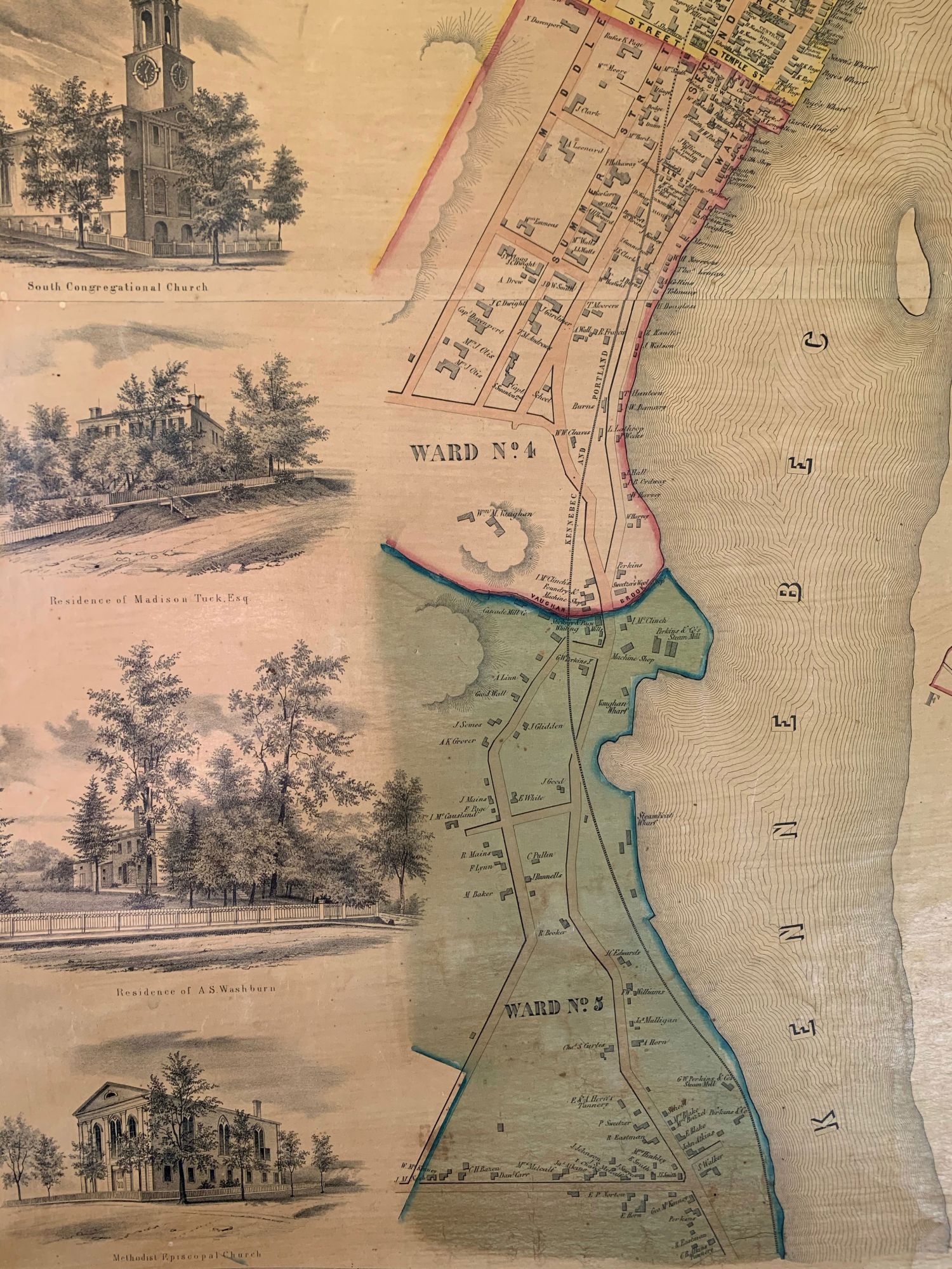
Map of the City of Hallowell Kennebec Co. Maine.
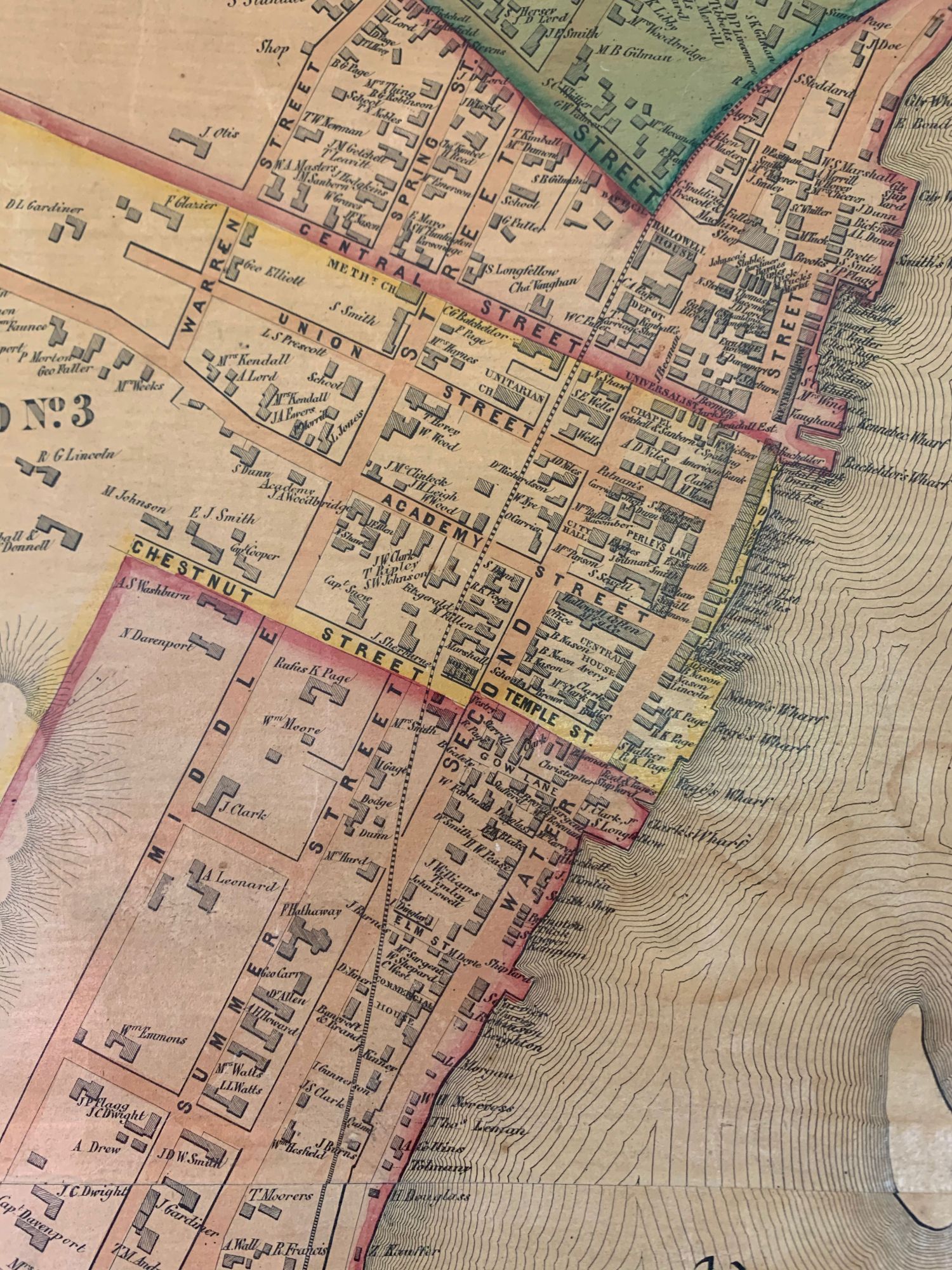
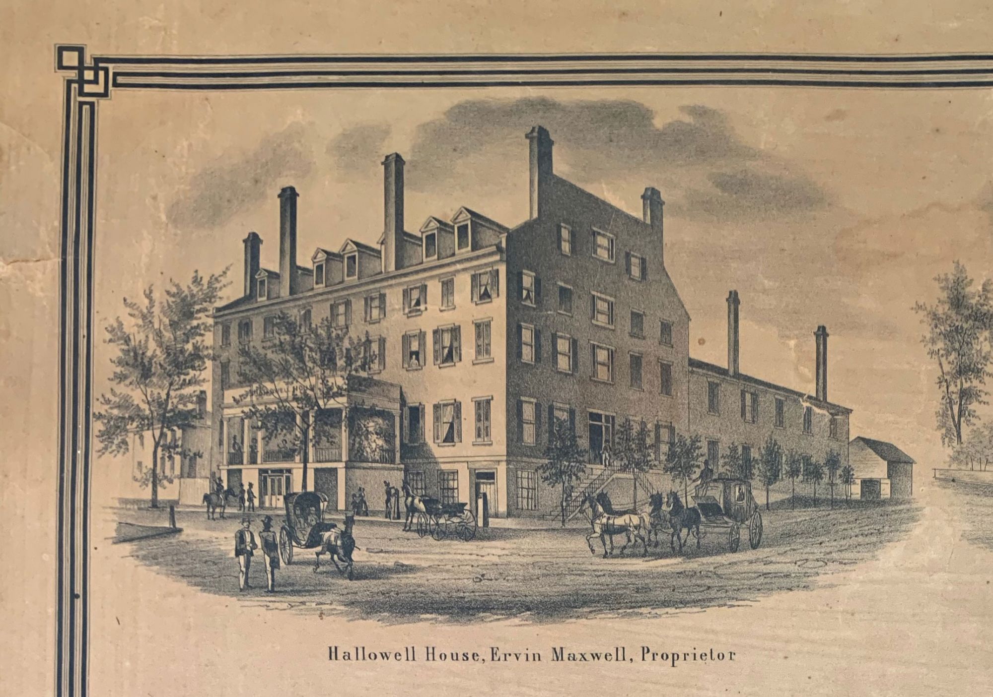
Philadelphia: E. M. Woodford, 80 Walnut St., 1855. Lith. of Friend & Aub, 80 Walnut St. Phila. Printed by Wagner & McGuigan, Phila. Hand-colored lithograph on two joined sheets, mounted on original linen, attached to original wooden rods, remnants of green silk selvage. A beautifully preserved example of this scarce map of the city of Hallowell, Maine, situated on the Kennebec River, near Augusta, the state capital. The map consists of an overview of the portion of the city nearest the river; an inset map depicting the entire city, which comprises five numbered wards; and seventeen vignettes, including thirteen residences, three churches, and a hotel. The Kennebec & Portland Railroad runs through the entire waterfront district. Buildings and property owners are identified throughout the map. Occupying a large tract of land in Ward 4 is the home of William Manning Vaughan, a member of a distinguished local family (Vaughan was the grandson of Benjamin Vaughan (1751–1835), a friend of Benjamin Franklin and radical member of the British parliament, who settled in Hallowell in 1799 on lands inherited from his mother, Sarah Hallowell). Surveyor and sometime publisher E.M. Woodford undertook surveys for at least eleven maps of Massachusetts towns, nine maps of Connecticut towns, and two of New Hampshire towns, all published between 1851 and 1855, most by Richard Clark. Woodford also published at least thirteen maps, including nine of Maine towns made by D.S. Osborne, including the map offered here. Little has come to light regarding surveyor D. S. Osborne,. He is known to have conducted surveys for at least eleven maps of Maine towns, as well as two maps of Massachusetts towns published by Richard Clark. Most of his activity seems to have been concentrated in New England over a two-year period. Ten of his twelve maps were published in 1855, and two—maps of Gardiner and Camden, Maine—appeared in 1856. Not in OCLC. Maincat records copies, at the Maine State Library and Maine Historical Society. REFERENCES: Scott, Valerie, ed. Tooley’s Dictionary of Mapmakers, Q–Z vol., p. 408. CONDITION: Very good, most of selvage perished, a few minor nicks and small light dampstains.
Item #6382
Sold