
Sign up to receive email notices of recent acquisitions.
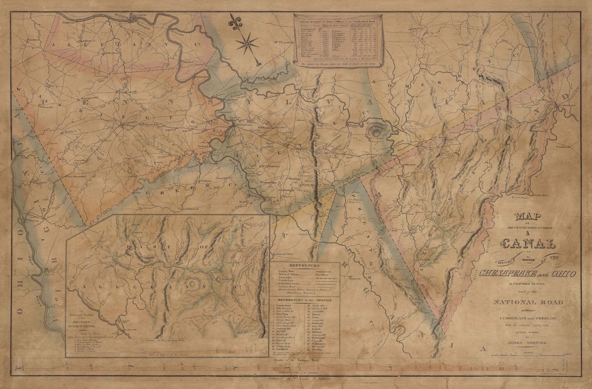
Map of the Country Through Which a Canal to Connect the Waters of the Chesapeake and Ohio is Proposed to Pass and of the National Road Between Cumberland and Wheeling with the Adjacent Country from Actual Survey by James Shriver.
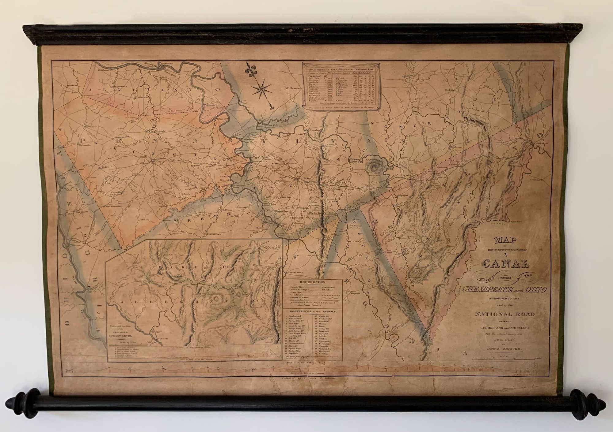
Baltimore: Fielding Lucas, [1824]. Hand-colored engraving, 18.25” x 28.25” plus margins, mounted on new linen and affixed to original wooden rods. CONDITION: Good, some toning and light stains, a few small paper losses mainly in margins, occasional cracks, stable. A rarely seen map, especially in this wall map format, published in conjunction with Shriver’s An Account of Surveys and Examinations…Relative to the Projected Chesapeake and Ohio, and Ohio and Lake Erie Canals (1824). The map shows sections of Maryland, Pennsylvania and Virginia, the country through which the contemplated canal would have passed and through which the National Road passes. Richly detailed, the map identifies residences, stores, hotels, forts, glass works, iron works, springs, numerous roads and waterways, and so on. An inset map of a portion of Allegheny County entitled “An enlarged section of the proposed summit level” appears in the lower left and shows the region surveyed by Shriver as described in his Account of the Surveys, “where the chief obstacle to forming a continuous route for canal navigation between the Atlantic and the Western states is supposed to exist” (Shriver). Below the inset map are profiles showing “ A section of the dividing ridge” and the National Road, the latter showing heights above the level of the tide in the Potomac at various locales along the road. Appearing at the center top is a table entitled “Tabular History of the Towns & Villages on the Cumberland Road,” listing the towns, when they were founded, numbers of inhabitants, houses, stores, inns, and the number of “houses erected since the location of the road.” First championed by Thomas Jefferson to support westward expansion, the National Road, extending from Cumberland, Maryland to Wheeling, Virginia (later West Virginia) and built between 1811 and 1837, was the first major improved highway in the U.S. built by the federal government. Also known as the Cumberland Road, it was not only an important thoroughfare for emigration and commerce, but also a source of inspiration for stories and songs, its taverns and way stations hosting many travelers. The Cumberland and Ohio Canal was an impressive feat of engineering, paralleling the Potomac from Washington to Cumberland, Maryland, but its proposed extension through western Maryland to the Ohio River, as surveyed and considered here by Shriver, was never undertaken due to exorbitant cost projections. Fielding Lucas (1781–1854) was a publisher and mapmaker originally from Fredericksburg, Virginia. Lucas worked in various publishing houses in Philadelphia before moving to Baltimore in 1804 where he became a bookseller. In 1810 he established a publishing business at 138 Market Street, with a specialty in maps. Among the cartographic works to his credit are A New & Elegant General Atlas Containing Maps of Each of the United States (1812); A General Atlas Containing Distinct Maps of all the Known Countries in the World (1823); Robert Mills’s Atlas of South Carolina (1825); and Chart of the Chesapeake and Delaware Bays (1832). Worldcat records six copies, none of which appear to be in wall map form. No copies recorded in trade at oldmaps.com or Rare Book Hub. A rare and handsome map relating to internal improvements in early nineteenth century America. REFERENCES: Phillips, List of Maps of America, p. 229; Ridgeley, D. Catalogue of the Library of the State of Maryland (Annapolis, 1833), p. 18; Shriver, James. An Account of Surveys and Examinations…Relative to the Projected Chesapeake and Ohio, and Ohio and Lake Erie Canals (1824); The Cumberland Road at nationalgeographic.org.
Item #6438
Sold