
Sign up to receive email notices of recent acquisitions.
Routes to Ktaadn.
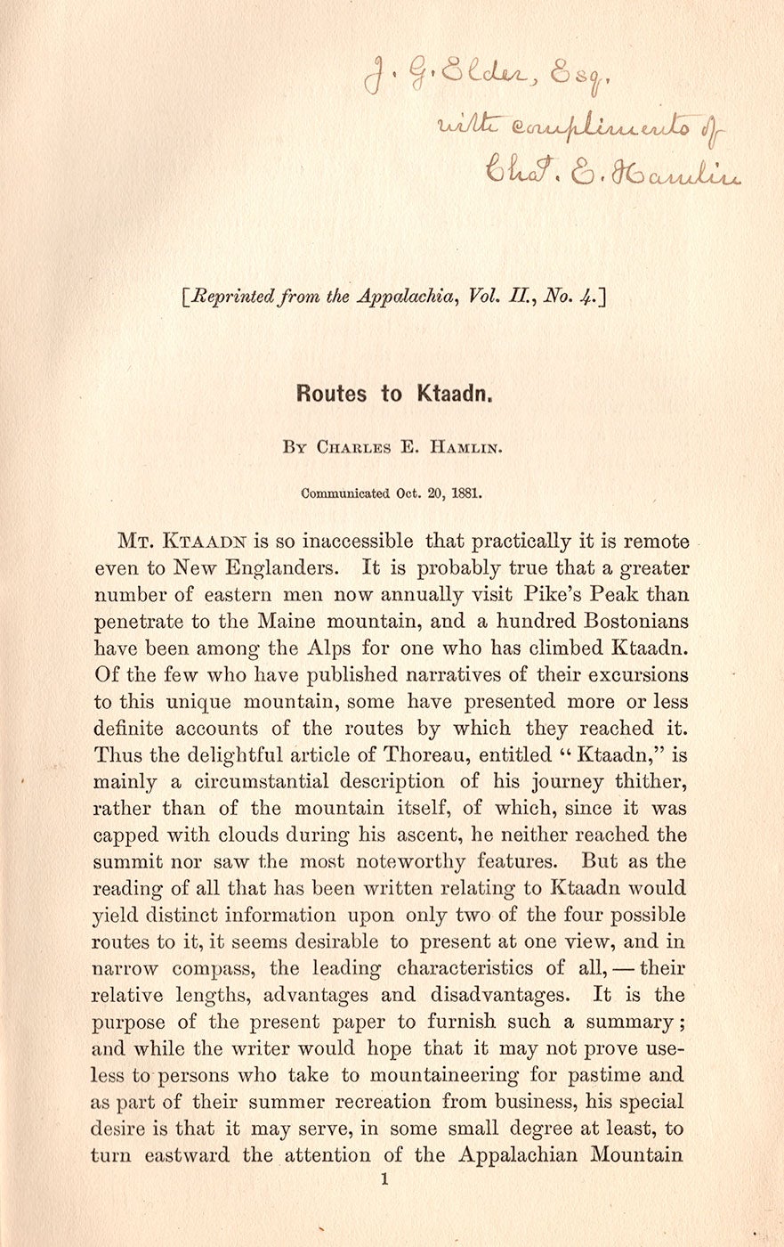
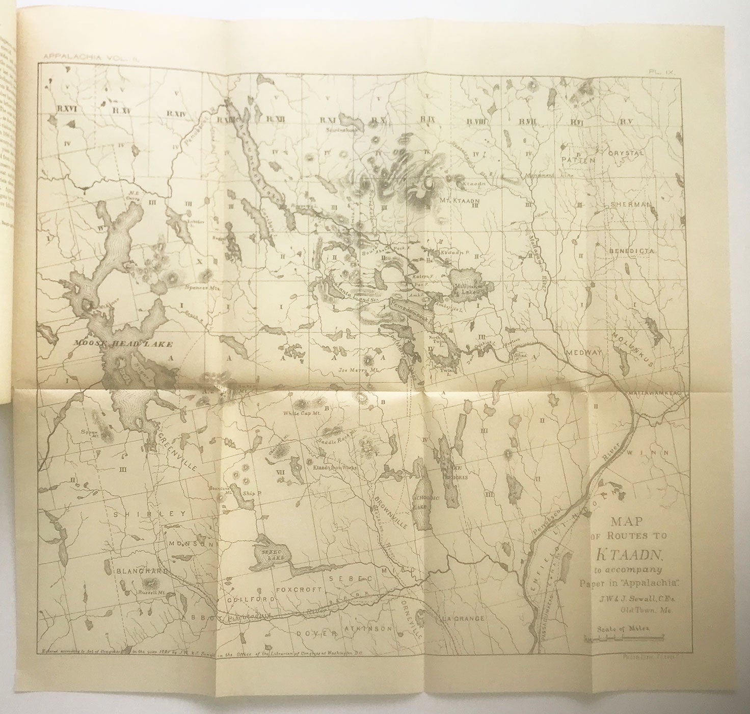
[Boston]: December 1881. 8vo (9.25” x 6”), printed wrappers. 26 pp., folding map, 13.75” x 15.5”, plus margins. Inscribed at head of page 1, “J. G. Elder, Esq. with compliments of Chas. E. Hamlin.” CONDITION: Very good, light toning and a few tiny stains to wrappers and page 1. Map very good, one 1 cm tear at central horizontal fold. A guidebook detailing four routes to Maine’s Mount Katahdin, inscribed by the author, and accompanied by one of the first published maps of the mountain. This pamphlet, an offprint from the Appalachian Mountain Club’s biannual journal Appalachia (vol. II, no. 4), identifies and describes four routes to Maine’s highest mountain, which, at the time, as Charles Hamlin writes, was still “so inaccessible that practically it is remote even to New Englanders.” The routes he outlines are via Mattawamkeag and the Penobscot; via Brownville and the Joe Merry Lakes; via Moosehead Lake and the Penobscot River; and via Sherman and the Wassataquoik Stream. As Hamlin outlines: It is probably true that a greater number of eastern men now annually visit Pike’s Peak than penetrate to the Maine mountain, and a hundred Bostonians have been among the Alps for one who has climbed Ktaadn. Of the few who have published narratives of their excursions to this unique mountain, some have presented more or less definite accounts of the routes by which they reached it. Thus the delightful article of Thoreau, entitled ‘Ktaadn,’ is mainly a circumstantial description of his journey thither, rather than of the mountain itself… But as the reading of all that has been written relating to Ktaadn would yield distinct information upon only two of the four possible routes to it, it seems desirable to present at one view, and in narrow compass, the leading characteristics of all, —their relative lengths, advantages and disadvantages. The detailed map, entitled “Map of Routes to Ktaadn to accompany paper in ‘Appalachia,’” was prepared by the J. W. & J. Sewall Company in Old Town (and printed by the Forbes Co.) and spans from Moosehead Lake in the west to Mattawamkeag in the east, and from Dover in the south to Mt. Katahdin in the north. The map shows two routes up the mountain: the Abol trail approaching the mountain from the south-west, and the other route approaching Katahdin from the east. Railroad lines, bodies of water, an iron works are indicated; relief is shown by hachure. The J. W. and J. Sewall Company was a surveying, civil engineering, and forestry company established in Old Town, Maine in 1880 by brothers James Wingate and Joseph Sewall. James Wingate (1852–1905) graduated from Bowdoin College in 1877 and after briefly teaching surveying at MIT, he went into business. Today the company is based in Bangor, Maine, and is the oldest continuously operating forestry consulting firm in North America. Charles Eugene Hamlin (1861–1921) was a professor of geology at Harvard University who visited and studied Katahdin on multiple occasions. The mountain’s Hamlin Peak and Hamlin Ridge are named for him. Hamlin was one of the original members of the Boston-based Appalachian Mountain Club (the oldest outdoor group in the U.S., established 1876), and his article “Routes to Ktaadn,” published in 1881 in the club’s journal, Appalachia, was accompanied by one of the first maps of the mountain. Hamlin came from a distinguished political family: his father was Civil War general Charles Hamlin, and his grandfather was Lincoln’s first vice president, Hannibal Hamlin. Charles later wrote a biography of his grandfather, The Life and Times of Hannibal Hamlin (1899). OCLC records only five copies, three of them held by non-Maine institutions. REFERENCES: Hussey, Arthur M. Bibliography of Maine Geology, 1672-1972 #00725; Sarnacki, Aislinn. “Katahdin’s Hamlin Ridge is a lesser-known hiking gem,” Bangor Daily News (1 Oct. 2020); “Charles Eugene Hamlin” at Find a Grave online; “About Sewall” at Sewall Infrastructure online.
Item #7522
Sold