
Sign up to receive email notices of recent acquisitions.
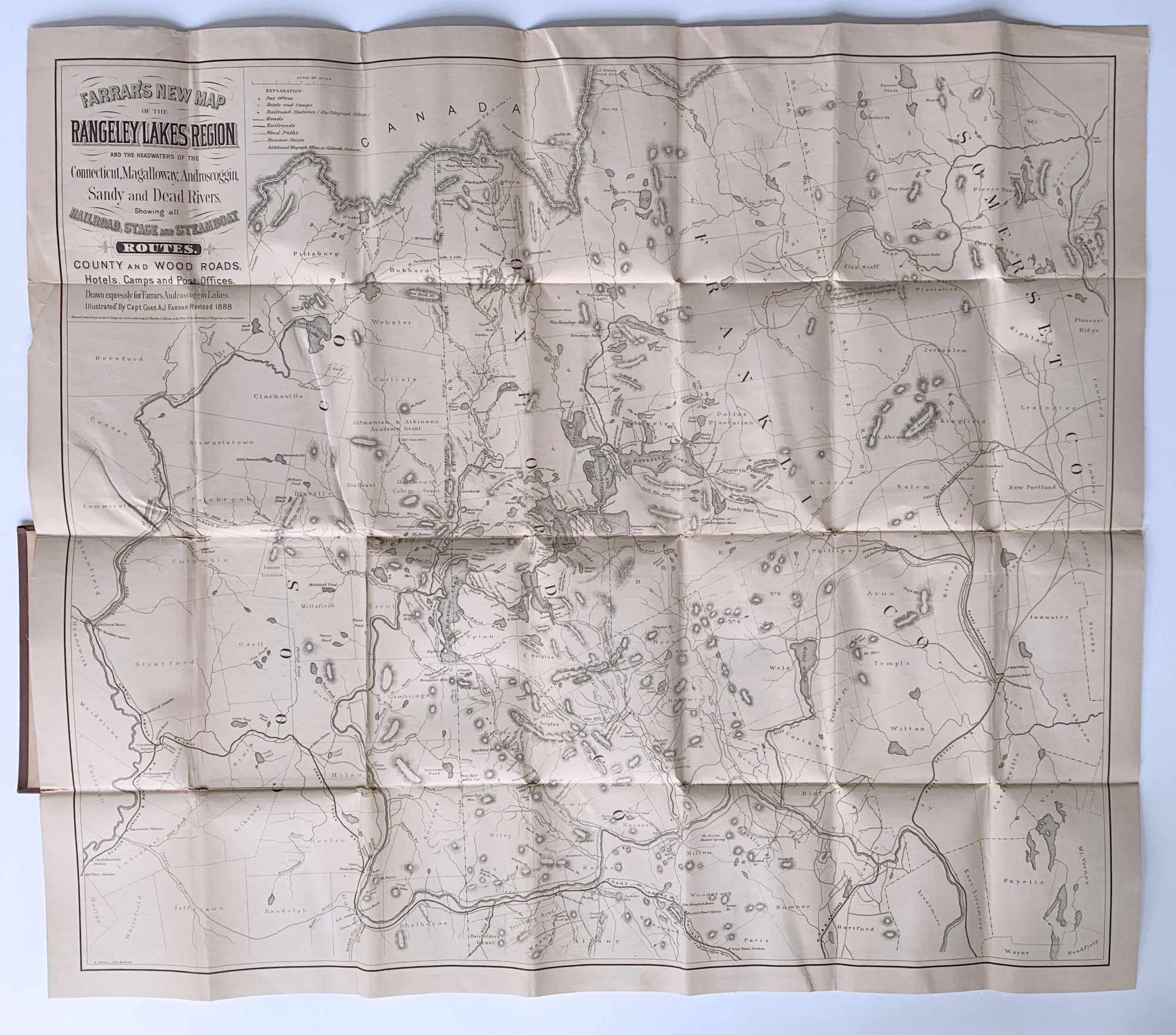
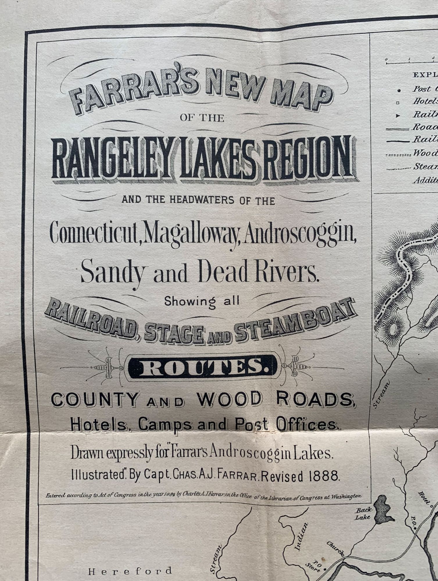
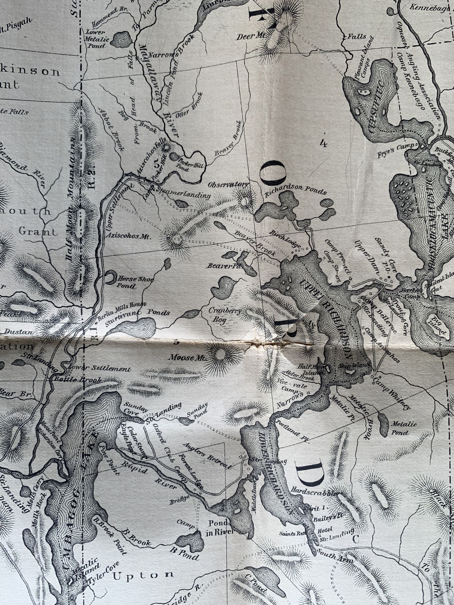
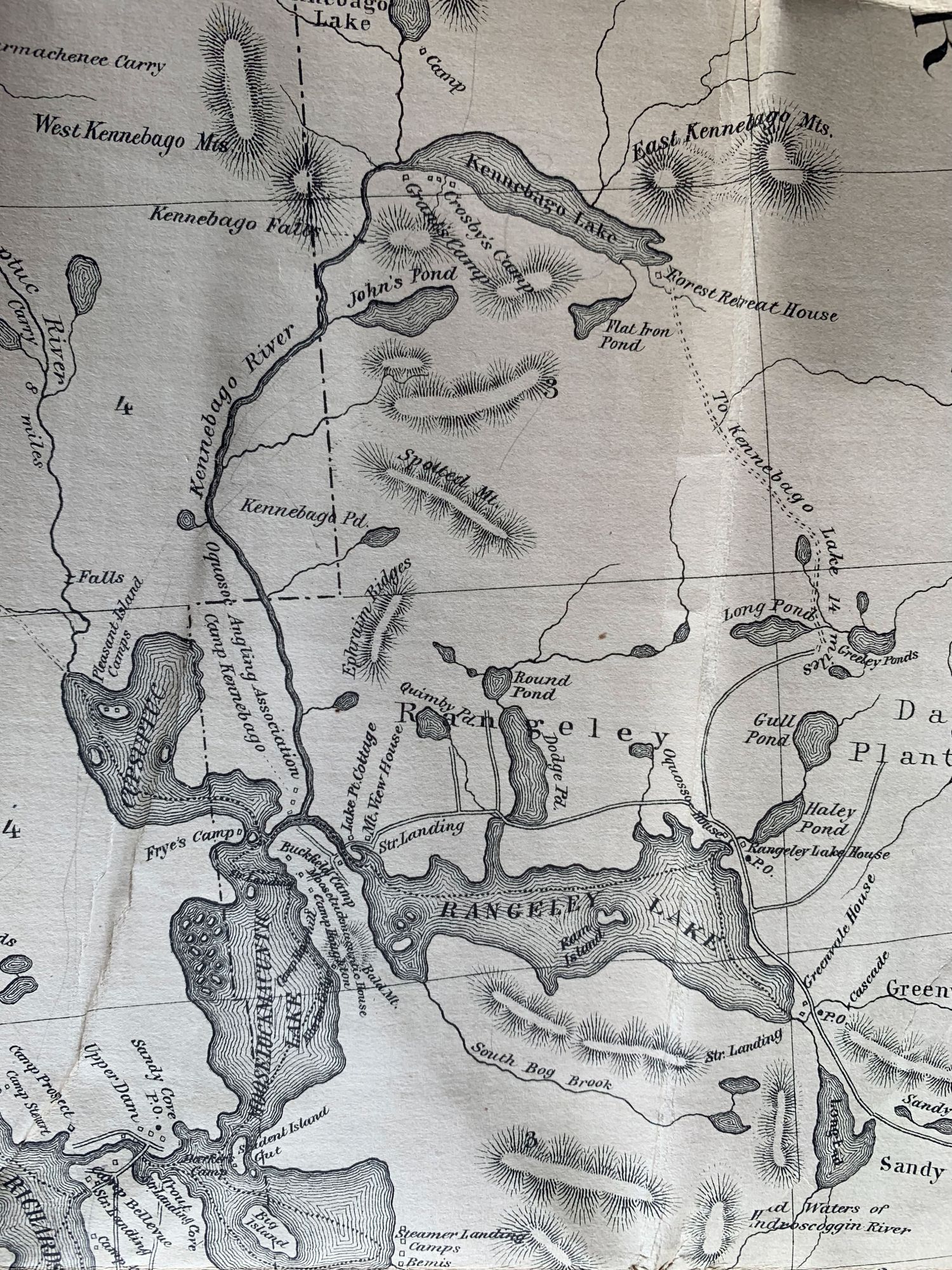
Farrar’s New Map of the Rangeley Lakes Region and the Headwaters of the Connecticut, Magalloway, Androscoggin, Sandy and Dead Rivers. Showing All Railroad, Stage and Steamboat Routes. County and Wood Roads, Hotels, Camps and Post Offices. Drawn Expressly for Farrar’s Androscoggin Lakes.
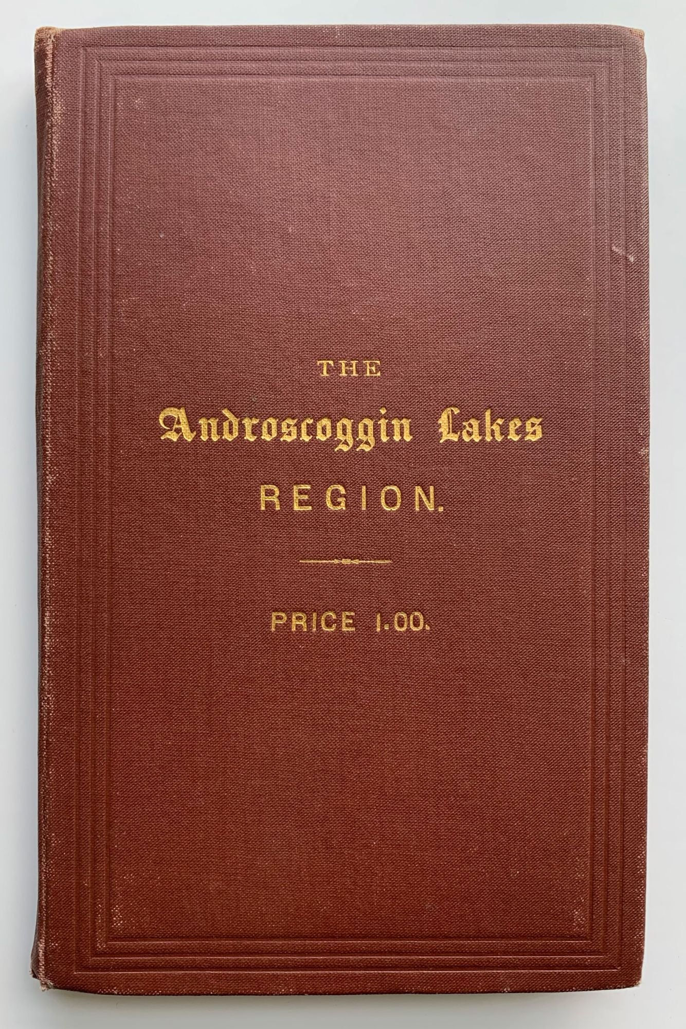
Boston, 1888. Pocket map, 22” x 25.5” plus margins, mounted on original linen and folding into original 16mo (6.5” x 4”) brown cloth covers, gilt title and price on front cover. CONDITION: Good, separation along fold to right of section of map mounted to covers, but completely stabilized by linen backing; additional minor separation at folds. A “Revised edition” of Farrar’s map to accompany his Rangeley Lakes guide, here issued separately. This is a much more detailed and expansive map than the map by M.M. Tidd that appeared in the first edition of Farrar’s guide to Rangeley (1876). It extends from Emden, Anson and Starks in the east to the Connecticut River in the west, and from a section of the Grand Trunk Railway in the south to the headwaters of the Dead River in the north. Depicited and identified here are numerous lakes, ponds, streams, and mountains; the Oquosoc Angling Association’s Camp Kennebago along the Kennebago River; other camps, hotels, lodges, towns, townships, etc. A key appears to the right of the title in the upper left corner. Relief is shown by hachure. Farrar published various guide-books with maps as well as separately issued pocket maps of the Rangeley Lakes region, beginning in 1876. The pocket maps are much scarcer than the guide-books. The Thompson sale included five different issues of the Farrar guide-book, but just one pocket map (1892), which is described as “extremely scarce.” None of the pocket maps are recorded in Williamson. The most prolific 19th century writer on the Maine woods, Capt. Farrar began writing his guides as a promotion for his Richardson Lake properties and commercial transportation company in 1876. In addition to his Androscoggin Lakes, Rangeley, and Moosehead Lake guide-books, he also wrote a series of camping narratives, including Camp Life in the Wilderness, From Lake to Lake, and Through the Wilds, as well as four north woods adventure stories: Eastward Ho!, Wild Woods Life, Down the West Branch, and Up the North Branch. A scarce and very appealing map of the Rangeley Lakes region.
Item #7789
Sold