
Sign up to receive email notices of recent acquisitions.
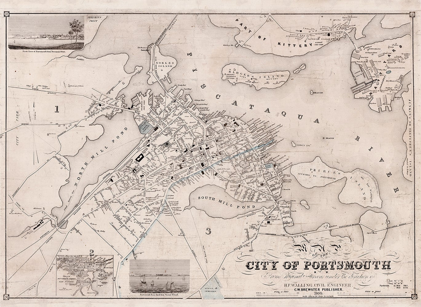
Map of the City of Portsmouth N. H.
C. W. Brewster Publisher, 1850. Lithographic map with touches of hand coloring, 23.5” x 33.25” plus margins. Henry Walling’s fine map of Portsmouth, New Hampshire, showing the city and the immediate vicinity. Depicted here are Portsmouth itself, a portion of the Piscataqua River, a number of islands, including Nobles Island, Badger’s Island and Pierce’s Island, as well as part of Kittery, Maine, opposite Portsmouth, including the Navy Yard. The waterfront character of the city lends the map a very particular flavor and interest. There are numerous wharves at the water’s edge, along with timber docks, iron foundries, shipyards, and a mariner’s house. The largest of the shipyards by far is the Navy Yard, and many features are identified, including the dry dock basin and railway, the oakum store, timber sheds, ship houses, fire engine houses, a smithery, the commandant’s quarters, and so on. Many of the houses on the map are identified by owner, and numerous public and commercial buildings are identified as well, including schools, churches, mills, the Athenaeum, Brick Market, Boston & Portland Railroad Depot, etc. Also included are two inset views, Portsmouth Navy Yard From Central Wharf and River View of Portsmouth From Freeman’s Point, as well as an inset chart entitled Sketch of Portsmouth Harbor From the Best Authorities. One of the most prolific American mapmakers of the mid-nineteenth century, Henry Walling produced a host of excellent town, county, and state wall maps. According to Cobb, the Walling map is preceded by only one other large format map of the city, J. G. Hales’ Map of the Compact Part of the Town of Portsmouth (1813). REFERENCES: Cobb 193. OCLC records only three copies, and Cobb four. Not in Rumsey, Phillips or Antique Map Price Record. CONDITION: Good, reinforced with Japanese tissue to repair various breaks and tears, small loss to border at top, and other small losses slightly affecting printed area at upper right, some foxing at the top of the map.
Item #3066
Sold