
Sign up to receive email notices of recent acquisitions.
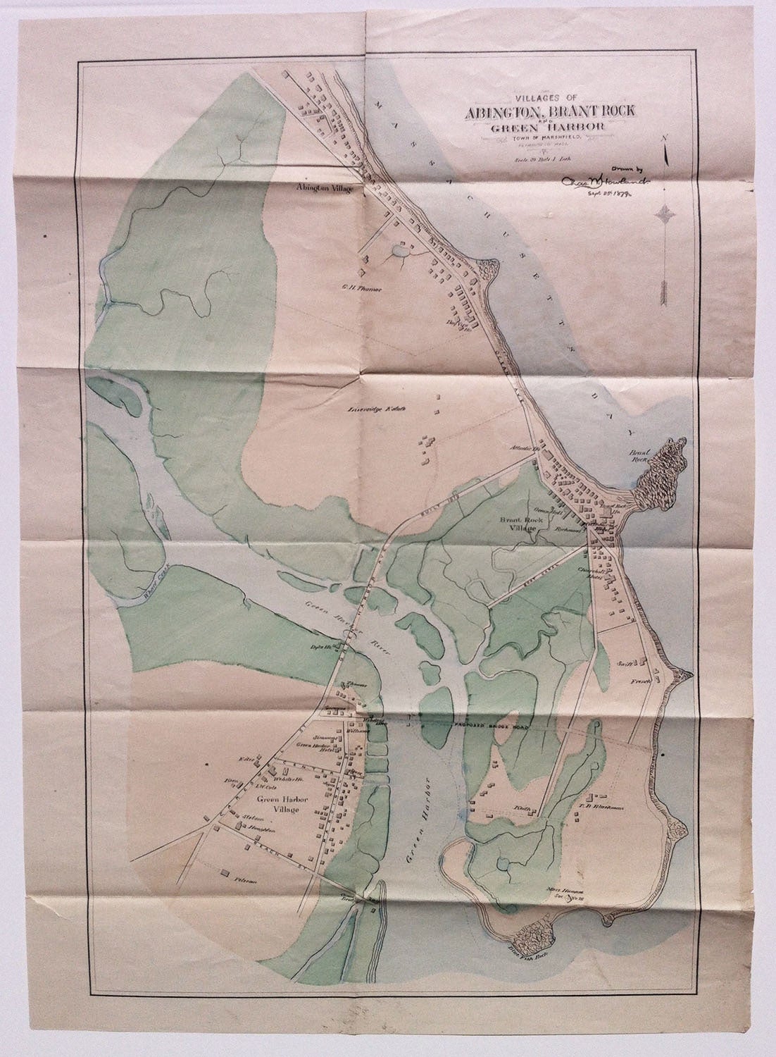
Villages of Abington, Brant Rock and Green Harbor, Town of Marshfield, Plymouth Co. Mass.
Marshfield, Mass., Sept. 25th, 1879. Manuscript map in black ink with watercolor wash, 19.125” x 12.5” plus margins. A skillfully drawn manuscript map, which appears to have been compiled for an official purpose, but does not appear to have been published. This map focuses on the waterfront villages of Marshfield, Massachusetts, a town perhaps best known as the home of Daniel Webster, whose house in Green Harbor Village is identified. While the exact purpose of the map is unstated, it would seem to relate to improvements and proposed improvements to the system of roads. Green Harbor Avenue, which extends across Green Harbor River connecting the village with Ocean Avenue and the Massachusetts Bay waterfront, bears a note indicating that it was built in 1879—the year this map was drawn. Perhaps more notably, the map shows a proposed bridge road extending from the oceanfront below Brant Rock Village, across the peninsula and Green Harbor to Webster’s Dock, in Green Harbor Village. This proposal, which came to naught, seems to have been the raison d’être for the map, which was likely used by those who had it drafted in their attempt to build support for the scheme. Other features of the map include the numerous public and private buildings in each village—as well as some in more peripheral zones—many of which are identified. Among these are the aforementioned Daniel Webster house, as well as numerous hotels, and life-saving station No. 26 of the Massachusetts Humane Society, located near Blue Fish Rock. The extensive salt marshes for which Marshfield is named are carefully drawn and highlighted in green wash. OCLC records just one map by Charles W. Howland, his Map of the Town of Abington Plymouth County, Mass., Boston, J. Mayer & Co., 1873 (as well as an 1874 issue), a town located to the west of the region depicted in the present map, and not to be confused with the Village of Abington. An apparently unique map reflecting Marshfield’s state of development in the late nineteenth century. CONDITION: Very good, old fold marks, a bit of light damp-staining and soiling.
Item #3067
Price: $1,500.00
Add to Wish List