
Sign up to receive email notices of recent acquisitions.
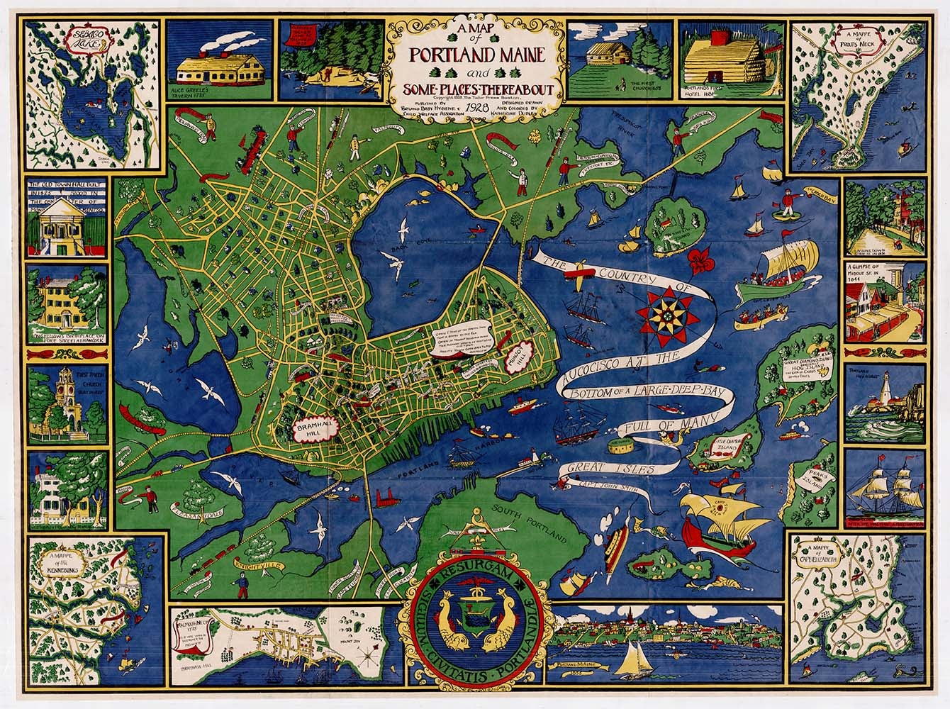
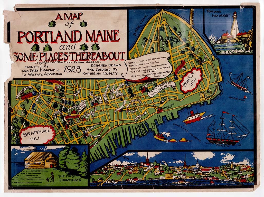
A Map of Portland Maine and Some Places Thereabout.
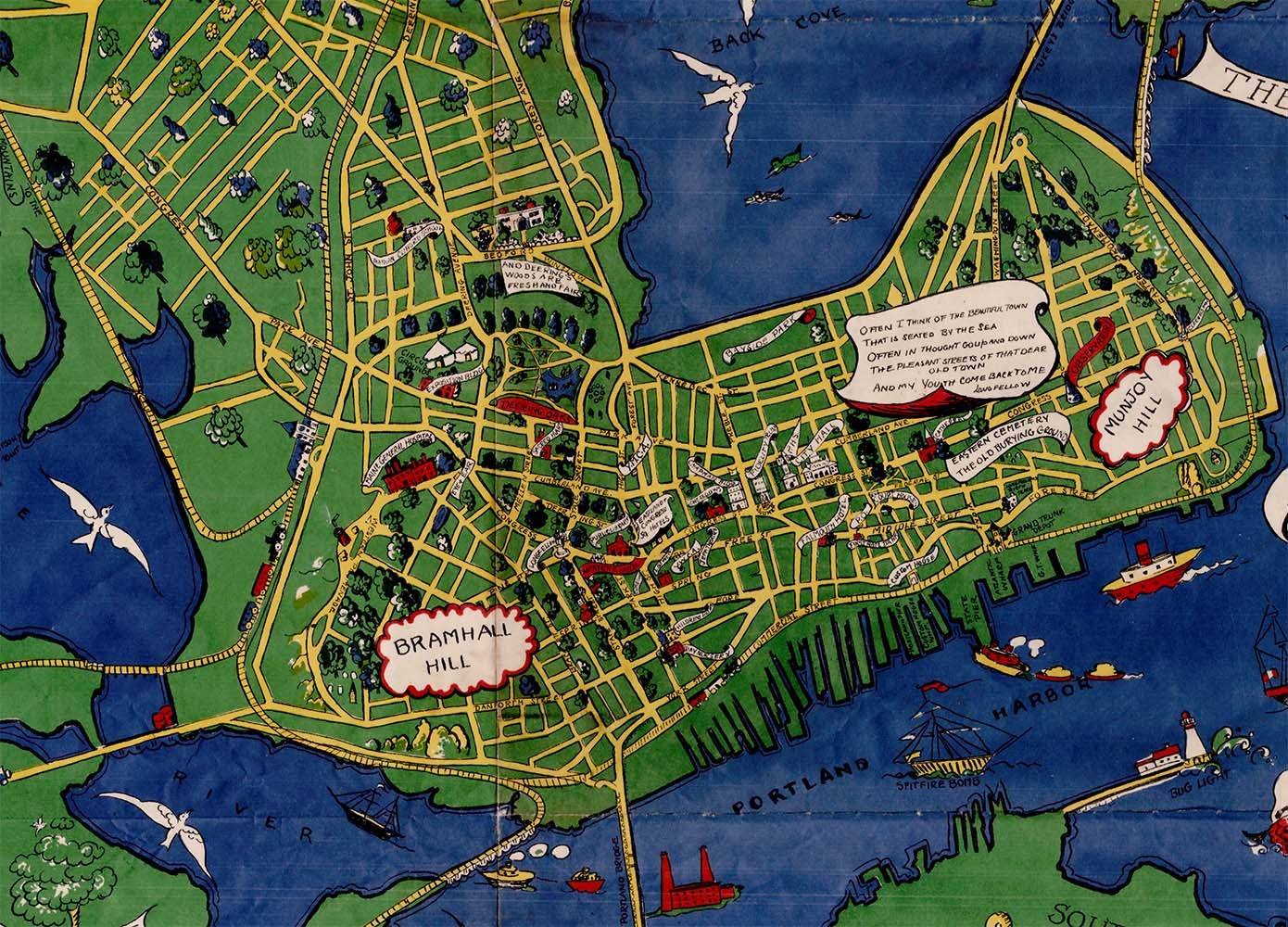
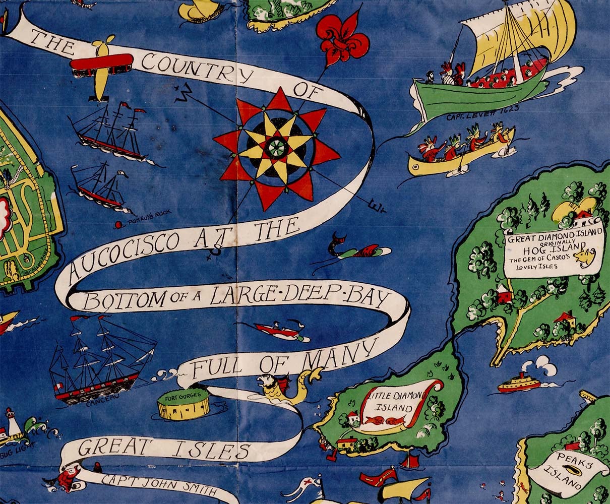
Portland: Published by Portland Baby Hygiene and Welfare Association; The Tudor Press, Boston, 1928. Color printed map, 29” x 39”; in original pictorial envelope. A lively pictorial map of Portland, Maine “designed, drawn and colored by Katherine Dudley” evidently to raise funds for the cause of baby welfare. A banner flying over Casco Bay reads “The Country of Aucocisco at the Bottom of a Large Deep Bay Full of Many Great Isles Capt John Smith” (Aucisco was Smith’s name for the native people who dwelled on the shores of the bay). Numerous vessels, both modern and historical, ply the waters around the city, including that of Smith, who explored the region in 1614, and a canoe paddled by several native men wearing historically inaccurate headdresses. A host of prominent buildings are identified, and looming large over the city is a quotation from native son Henry Wadsworth Longfellow, beginning “Often I think of the beautiful town / That is seated by the sea...” Various historical vignettes surround the main map, as well as inset maps of Falmouth Neck in 1775 “as it was when destroyed by Mowett,” Prout’s Neck, Sebago Lake, Cape Elizabeth and the Kennebunks.
CONDITION: Good, some chipping and tears to envelope.
Item #3348
Sold