
Sign up to receive email notices of recent acquisitions.
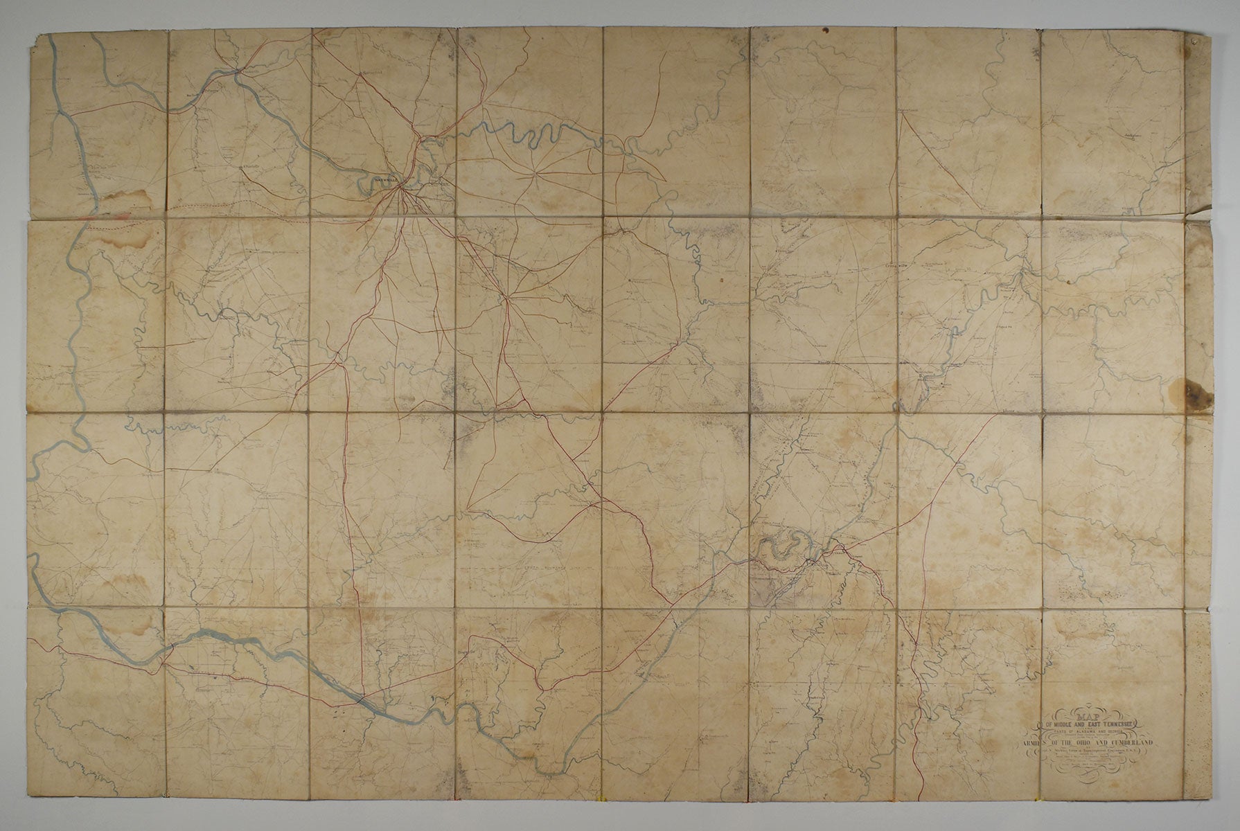
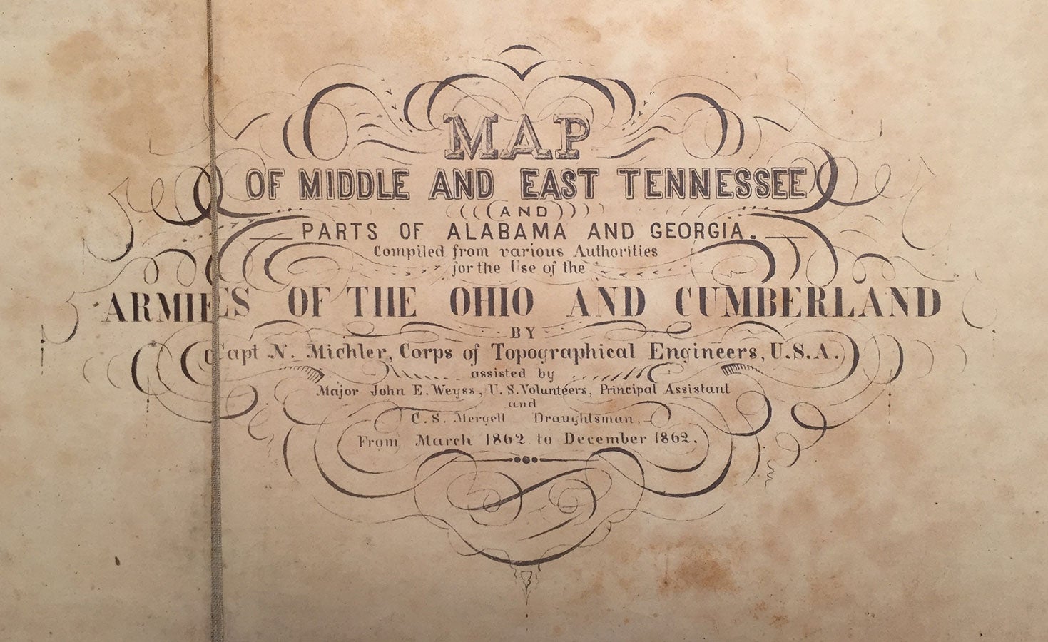
Map of Middle and East Tennessee and Parts of Alabama and Georgia, Compiled From Various Authorities for the Use of the Armies of the Ohio and Cumberland.
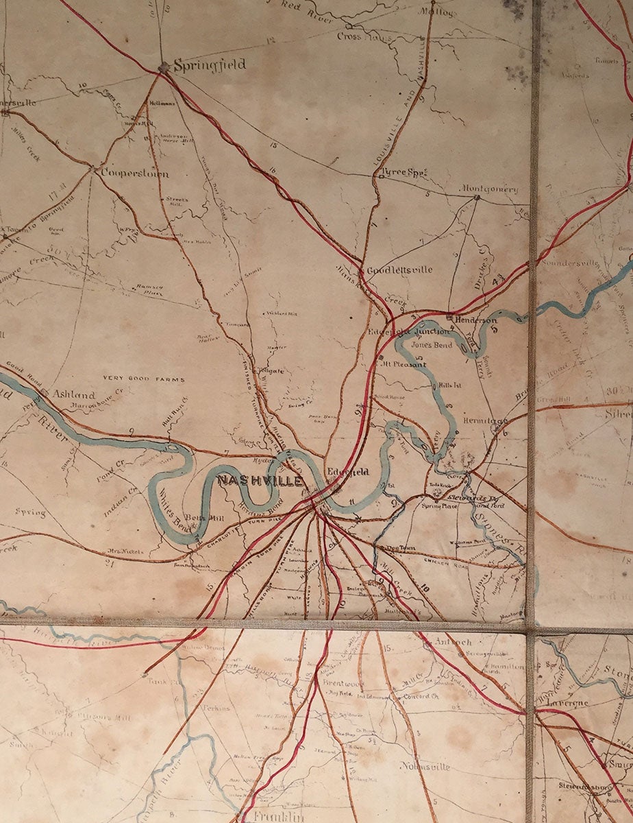
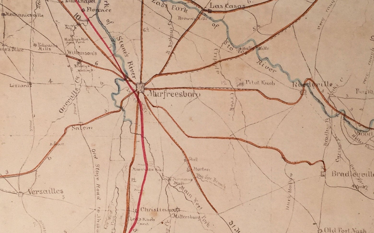
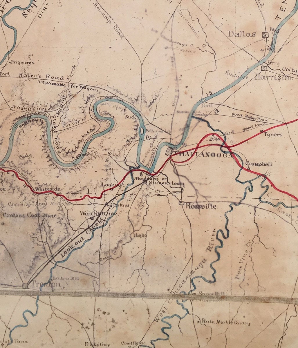
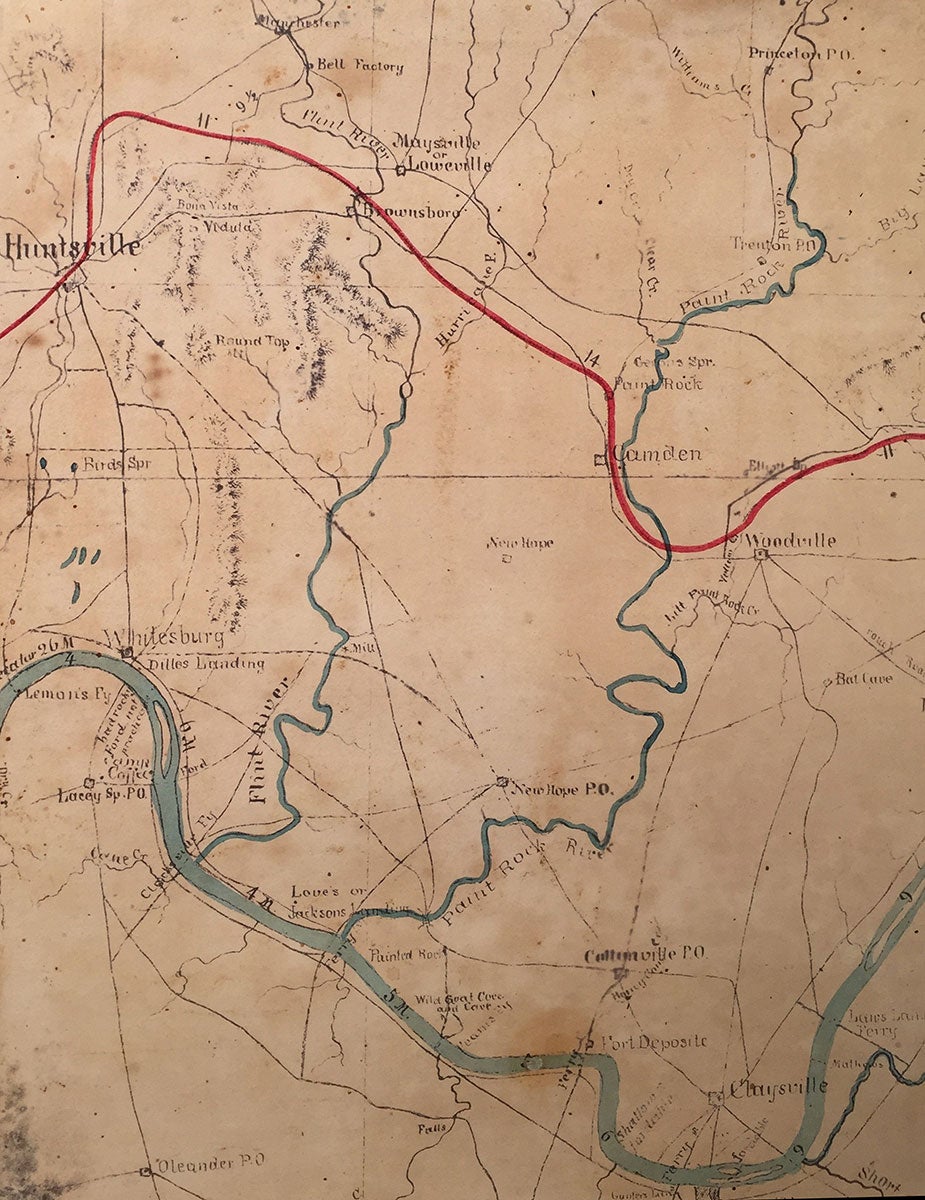
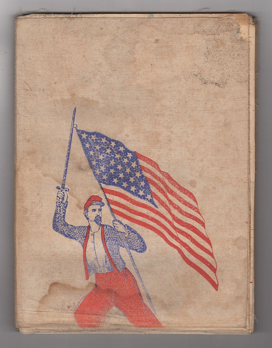
Tennessee, 1862. Hand-colored sun-print-positive photocopy, 69.25” x 45”, dissected and mounted on linen; verso of one panel stamped in red and blue ink with image of Zouave bearing a U. S. flag and legend “Red, White and Blue,” verso of another panel stamped in blue with image of scroll reading “Stand by the Flag”; an ink annotation reading, "Done April 2d 1863" appears on another panel. A remarkable Civil War map, printed in the field using the innovative sun-print process, for the use of forces stationed in Tennessee under General William S. Rosecrans—one of the few high-ranking officers in either army to give top priority to maps and mapmaking. This map shows all the major roads and rail lines in addition to many other features of middle and east Tennessee, parts of northern Alabama, and a portion of north-west Georgia at the bottom-right, extending from Clarksville, Tennessee in the north to Moulton, Alabama in the south, and from Clinton, Tennessee in the East to Savannah, Tennessee in the west. Railroads are colored red and turnpikes orange; rivers and other bodies of water are colored blue; dotted lines delimit state boundaries; and relief is shown by hachures—seen mainly in the areas of Chattanooga and Huntsville. The Cumberland and Tennessee Rivers, two prominent features, rise in the east and snake their respective ways across much of the map. The quality of roads is a feature of particular interest. They are variously labeled “good,” “rocky,” “pretty good mountain road,” “passable,” “not passable for wagons,” “impassable for wagons,” and so on. Miles to certain locations are often noted; for instance, in the center of Bellefonte, Alabama: “55 M. to Huntsville by road." Ironworks, creeks, stores, factories, taverns, steam mills, churches, ferries, school houses, and farms, as well as a number of "stands" (perhaps outlets for agricultural commerce) are also identified on the map. The majority of the railroads and turnpikes in the upper-half of the map converge on Nashville and various turnpikes intersect in Murfreesboro. Numerous railroads are shown, among them the North Western R.R. stemming from Nashville, partially represented by a dotted red line labeled “not finished,” leading to the Tennessee River via Waverley. In November of 1861, Maj. Gen. William S. Rosecrans assumed command of the Army of the Ohio, consisting of 67,000 troops, soon renaming it the Army of the Cumberland. With headquarters in Nashville, Rosecrans' task was to dislodge the Confederates from Middle and East Tennessee; in particular, the Nashville-to-Chattanooga corridor. Confederate Commander Braxton Bragg’s Army of Tennessee had recently stationed in Murfreesboro. As David A. Powell writes, "[t]hus began one of the great adversarial relationships of the war, second only to that between the Union Army of the Potomac and Robert E. Lee's Army of Northern Virginia.” In presiding over the Army of the Cumberland, Rosecrans inherited a weak supply link, due to Confederate raids on the Louisville & Nashville Railroad. Another problem he faced was a shortage of engineers, initially having just three at his disposal: John B. Anderson, James St. Clair Morton, and Nathaniel Michler, the latter the sole topographical engineer for the Army of the Cumberland, responsible for mapping middle Tennessee and central Kentucky. In light of this dearth, Rosecrans—determined to have the most detailed maps possible—assigned regular Army officers to gather information about roads, bridges, streams, fields, etc. All of these recordings were then transferred to Michler who created and reproduced maps of the surrounding areas—although he was not especially keen on Rosecrans' idea of utilizing regular Army officers. Much of the map presented here—compiled between March and December of 1862—was based on reconnaissance missions undertaken by officers who had little-to-no training in map-making. General Rosecrans would launch his new Army's first offensive against Bragg's Rebel forces in Murfreesboro, which culminated in the bloody Battle of Stones River, from December 31, 1862 to January 2, 1863. Both armies would lose about a quarter of their troops. Ultimately, however, Bragg chose to retreat, letting Rosecrans take Murfreesboro—effectively a victory for Rosecrans, and a much needed one for the Union. In the immediate wake of the Union's calamitous defeat in Fredericksburg, Virginia—where they lost some 13,000 men—Rosecrans' newly gained hold over parts of the Nashville-to-Chattanooga corridor was met with great excitement and was a sign of hope for the Union early on in the war. Evidently published in December of 1862 and containing the best available information, Michler’s map was likely used by Rosecrans and his generals at Murfreesboro, although this particular copy, which bears a manuscript note on the verso reading “Done April 2d 1863” (either a publication date or the date it was mounted on linen?), may not have been in use at the time of the Battle of Stones River. Certainly the map was available for the subsequent Tullahoma and Chickamauga Campaigns. Among the foremost mapmakers of the Civil War, Nathaniel Michler (1827–1881) ranks with such notable Union topographical engineers as Bvt. Colonel William E. Merrill and Capt. William E. Merrick. A native of Pennsylvania, Michler graduated from West Point in 1848, then served as a lieutenant of topographical engineers, making surveys in Texas and New Mexico, and plotting a course for a proposed canal through Panama. Joining the Army of the Ohio as a Captain, Michler would work with John Weyys on the present map, as well as topographical sketches of Corinth, Mississippi (1862) and Decherd, Tennessee (1862), among others. Reassigned to the Army of the Potomac, Michler produced numerous other maps throughout the War, as well as highly accurate post-war maps of Petersburg and elsewhere. He concluded his Civil War service as a brevet brigadier general. According to Tooley, Michler "devised new photographic techniques to allow field maps to be quickly updated, copied and distributed." In addition to hand-copying and lithography, Union army mapmakers used two photographic methods to reproduce their manuscript maps, both of which have been described as “sun-prints.” Manuscript maps could be updated and re-photographed as new information was acquired. The present map is described by the Library of Congress as a “hand-colored sun-print-positive photocopy,” as are a number of other Michler maps. Speed, exactness of reproduction, and the relative ease of issuing updates, were the principal advantages of the sun-print, while a lack of focus at the edges and the tendency to fade were drawbacks. OCLC records only 4 copies, at the Library of Congress, Abraham Lincoln Presidential Library, University of Michigan (Bentley Historical Library), and the Tennessee State Library. An important Union Army field map published just prior to the great contests for control of Tennessee, notable for its method of production and its immediate usefulness in the field. CONDITION: Good, damp-stained along several dissections, some moderate browning and damp stains throughout, a few minor losses; in sum, no condition issues out of the ordinary for a map used in the field. REFERENCES: Stevenson, Richard W., Civil War Maps, 393.5; McElfresh, Earl B. Maps and Mapmakers of the Civil War, pp. 70, 92, 247; Scott, Valerie, ed. Tooley’s Dictionary of Mapmakers, K–P, p. 250 (Riverside, CT, 2003); Army, Thomas F. Engineering Victory: How Technology Won the Civil War (Baltimore, 2016).
Item #4277
Sold