

Sign up to receive email notices of recent acquisitions.
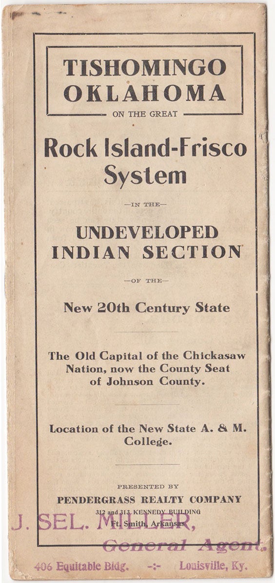
Tishomingo, Oklahoma on the Great Rock Island-Frisco System in the Undeveloped Indian Section of the New 20th Century State. The Old Capital of the Chickasaw Nation, now the County Seat of Johnson County. Location of the New State A. & M. College.
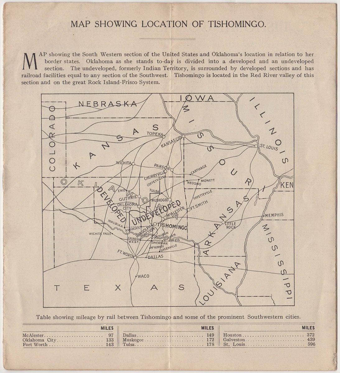
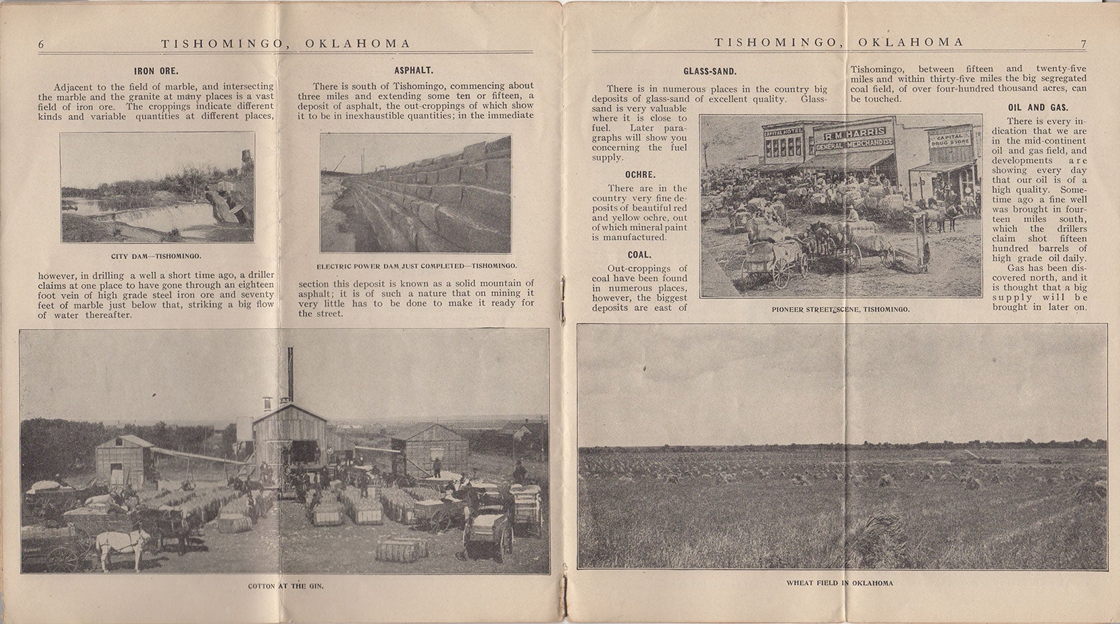
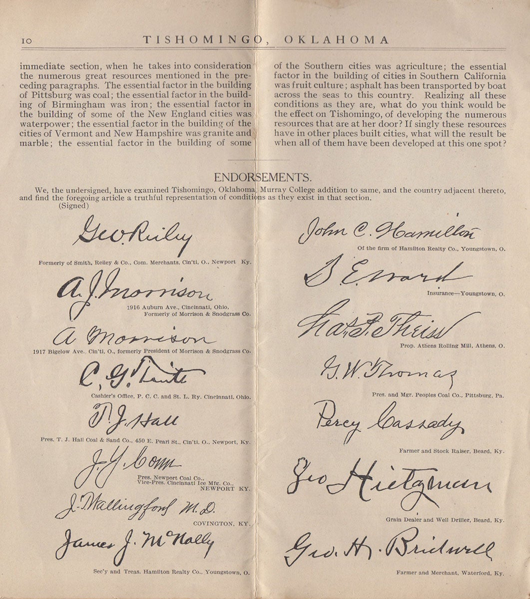
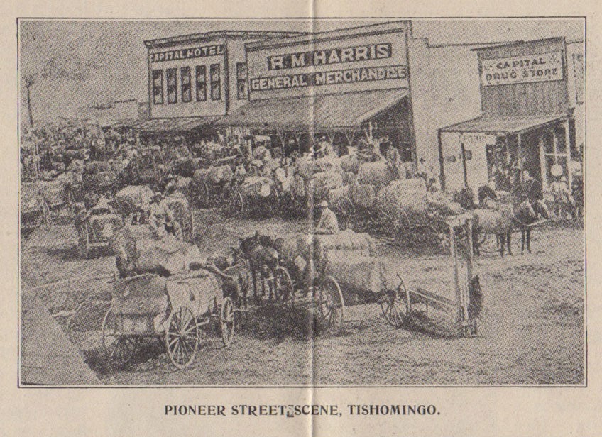
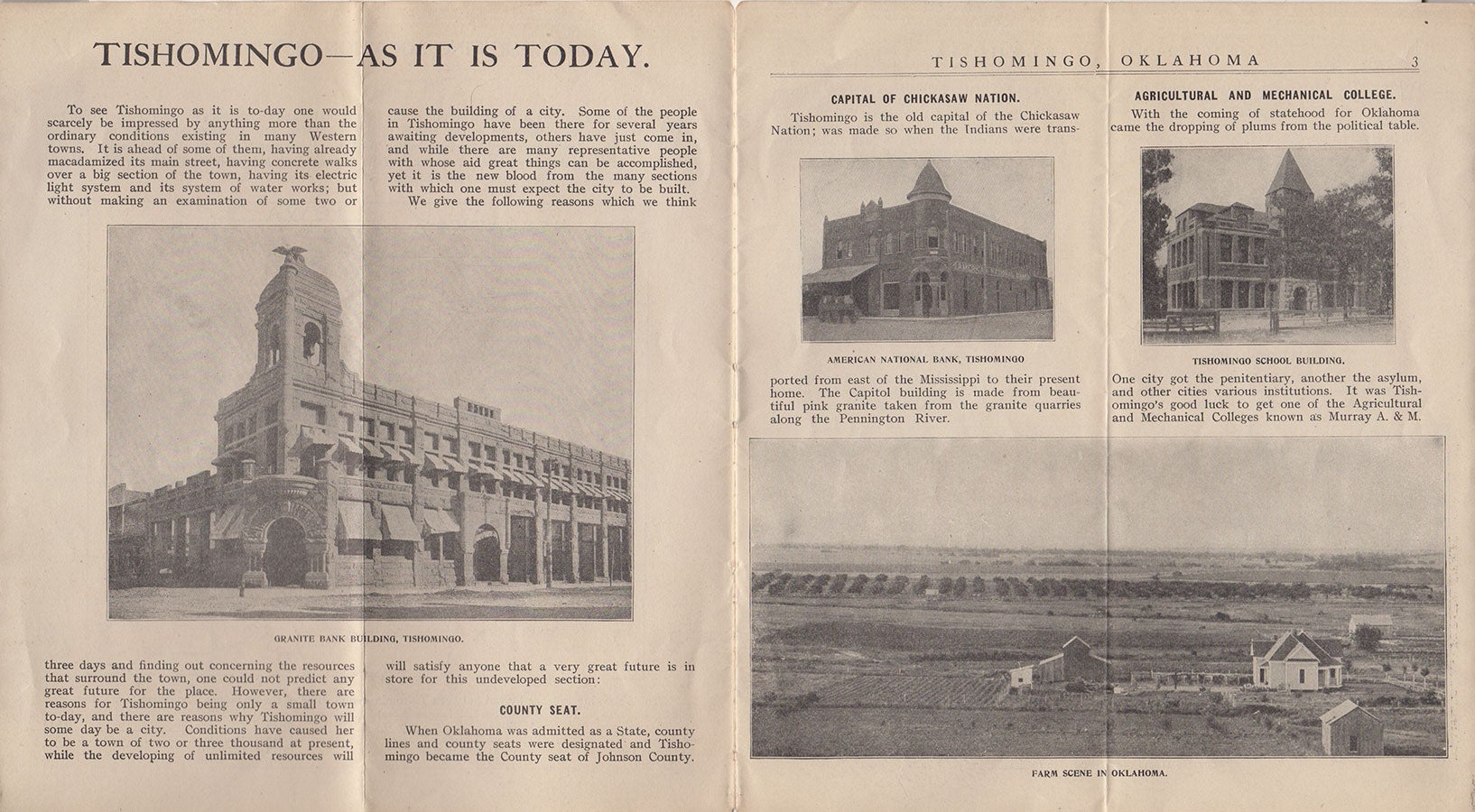
Ft. Smith, Arkansas: Pendergrass Realty Company, [ca 1909]. Brochure, 8” x 9”, folded to 4” x 9” with b&w front and back panels. 11 pp., numerous b&w illus., 1 map. Purple stamp at foot of front panel reading “J. Sel. Miller, General Agent, 406 Equitable Bldg., Louisville, Ky.” Ink stamp at foot of back panel reading: “B. Hoechner.”. A brochure promoting the Tishomingo region in the decade following the last of the Oklahoma land rushes. The old capital of the Chickasaw Nation and the county seat of Johnson County, Oklahoma, Tishomingo was primed for great things after statehood thanks to its Rock Island-Frisco railway connections, natural resources, and the Indian section opening up for development. The Chickasaw nation chose this region for its pure water and fertile land, naming the city Tishomingo after their old chief. When Oklahoma became a state in 1907, Tishomingo became the county seat and began its modernization. “With the coming of statehood for Oklahoma came the dropping of plums from the political table. One city got the penitentiary, another the asylum, and other cities various institutions. It was Tishomingo’s good luck to get one of the Agricultural and Mechanical Colleges known as Murray A. and M.” Described here are such advantages as the abundant mineral resources, moderate climate, and water power Apologies are made for the undeveloped Indian section as the government had placed restrictions on selling the land the Indians owned. “However July a year ago, Congress removed the restrictions from a big portion of the Indian lands and the time for development is just now right in the Indian section.” An Oklahoma Review article looks forward to the future of great railway systems carrying the surplus of the Chickasaw Nation’s fields; great quantities of granite supplying the world; and power from the “latent force of the laughing Pennington [river] lighting the region.” Endorsements for the legitimacy of the brochure’s claims are included with the printed signatures of farmers, merchants, a well-driller, realtors, grocers, coal company presidents and the like. A 6” x 5” b&w map shows the southwest section of the United States with Oklahoma and its bordering states. The Developed and Undeveloped sections of Oklahoma are highlighted. Scarce. No copies recorded in OCLC. CONDITION: Good, worn and soiled on outer panels, some chipping, 1” separation on bottom fold of panels, 1/8” insect damage bottom left corner of back panel.
Item #4313
Sold