

Sign up to receive email notices of recent acquisitions.
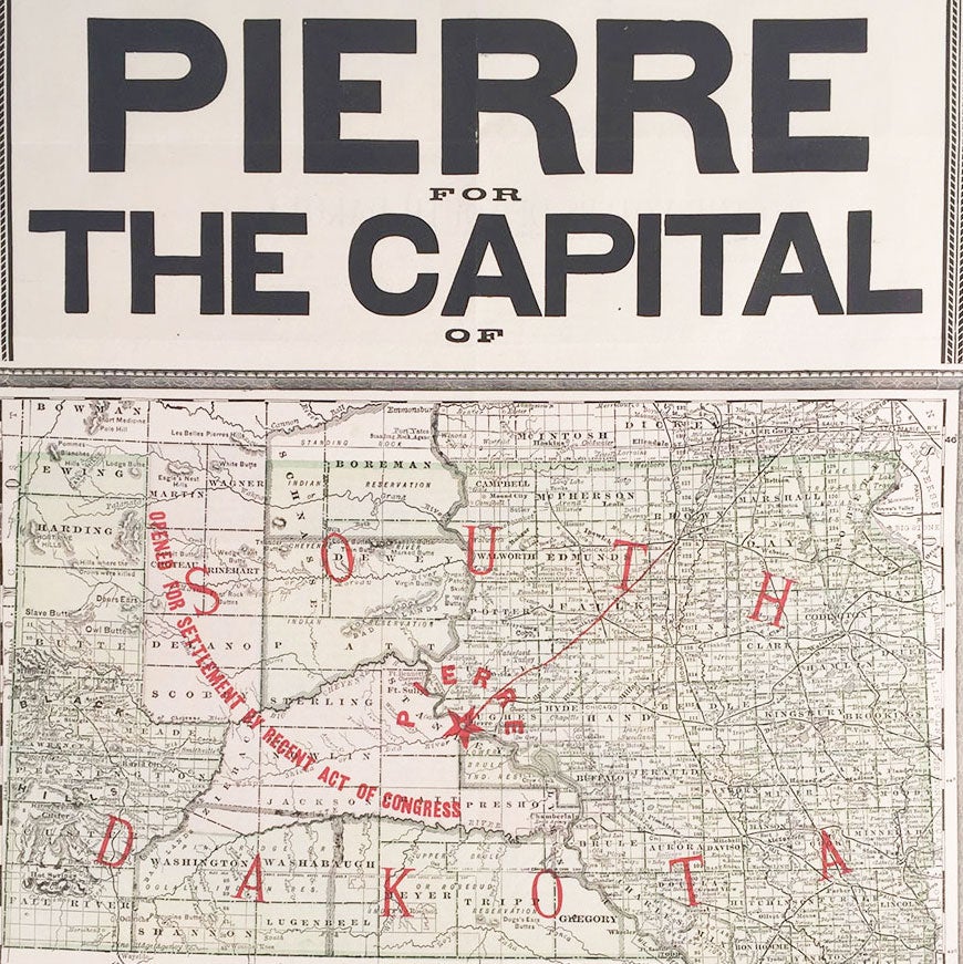
Pierre for the Capital of South Dakota.
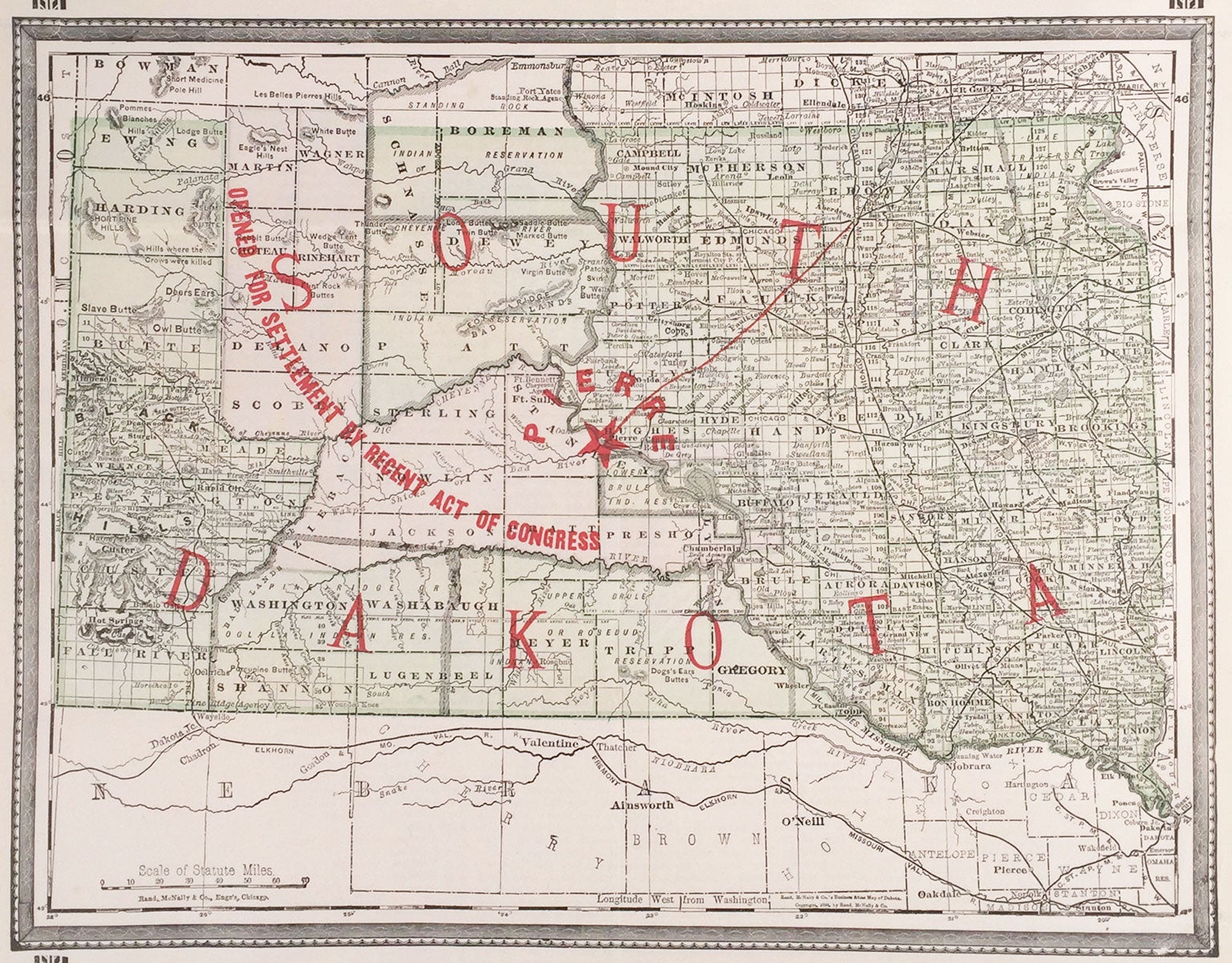
Chicago: Rand, McNally & Co., Pettibone, Wells & Co., 1889. Broadsheet (54 x 35 cm) with map printed in red, black, and green, 32.5 x 25 cm; four columns of text on verso. A persuasive broadsheet map advocating for Pierre as the capital of South Dakota, published in the year that South Dakota became a state. Also reflected here and used as a selling point is the imminent opening of Sioux Reservation lands to white settlement stemming from the Sioux Agreement of 1889. Founded in 1880 during the Great Dakota Boom of 1878 to 1887, Pierre began as a ferry landing on the banks of the Missouri River near the Dakota Central Railroad terminal. When this map was published a political battle was being waged between those advocating for Pierre as the state capital and those favoring other cities, such as Mitchell (which was closer to the center of population), Huron, and others. Being closer to the geographical center of the state and located on the Missouri River, Pierre won by a large margin in a state-wide vote. South Dakota became a state a month later. This map shows the would-be state of South Dakota, which is colored green, as well as slivers of Nebraska and North Dakota. Pierre is located at the dead center of the territory and identified with a large red star. Uncolored regions to the west and northwest of Pierre are identified as “opened for settlement by recent act of congress.” Appearing in the lower left corner are the Black Hills and Deadwood. Also identified are various Native American reservations, including Rosebud Reservation, Standing Rock Reservation, the Lower Brulé Indian Reservation, etc., as well as “Indian agencies,” railroads, roads, towns and so on. A note in the vicinity of the Short Pine Hills in the northwest reads “Hills where Crows were killed.” Text appearing below the map highlights the town’s advantages:
Pierre has River Navigation, a $70,000 system of Water Works, two miles of Street Railway, large Brick Packing House, $50,000 Court House, the Presbyterian University of Dakota, the Government Indian Industrial School, numerous large and substantial Brick Blocks and Wholesale Establishments, Sand, Brick, and Building Stone in abundance, and is the Geographical Center of South Dakota.
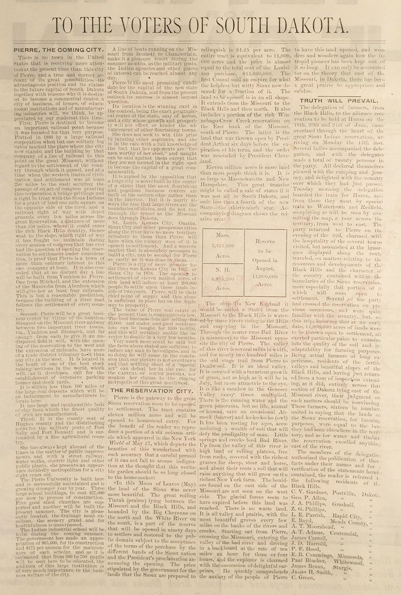
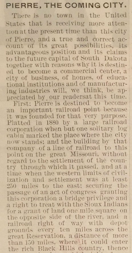
The text on the verso sets forth at length the various advantages underpinning Pierre’s candidacy as the future capital, including its future as an “important railroad point” and “a great business center.” Fully half of the text relates to the imminent opening of Sioux reservation lands to homesteaders, with Pierre touted as the gateway. Much of this section quotes a newspaper article simultaneously praising the land and asserting that the Sioux are overcharging for it:
The price stipulated by the government for the lands that the Sioux are prepared to sell is $1.25 per acre. The entire tract is equivalent to 11,000,000 acres and the price is almost equal to the total cost of the Louisiana Purchase, $15,000,000. The first Consul sold an empire for what the helpless but witty Sioux now demand for a fraction of it.
The final section reports on a trip taken by a delegation of sixteen farmers from the Black Hills to examine the quality of the Sioux reservation land soil and its adaptability for farming purposes. The farmers were “united in saying that the lands of the Sioux reservation, for farming purposes, were equal to the best they had seen elsewhere in the territory.” The Sioux land is described in highly evocative terms.
WorldCat records just two copies, as well as another two copies of an issue in German.
CONDITION: Very good, old folds, three small pieces of tape in upper margin of verso.
Item #5187
Sold