
Sign up to receive email notices of recent acquisitions.
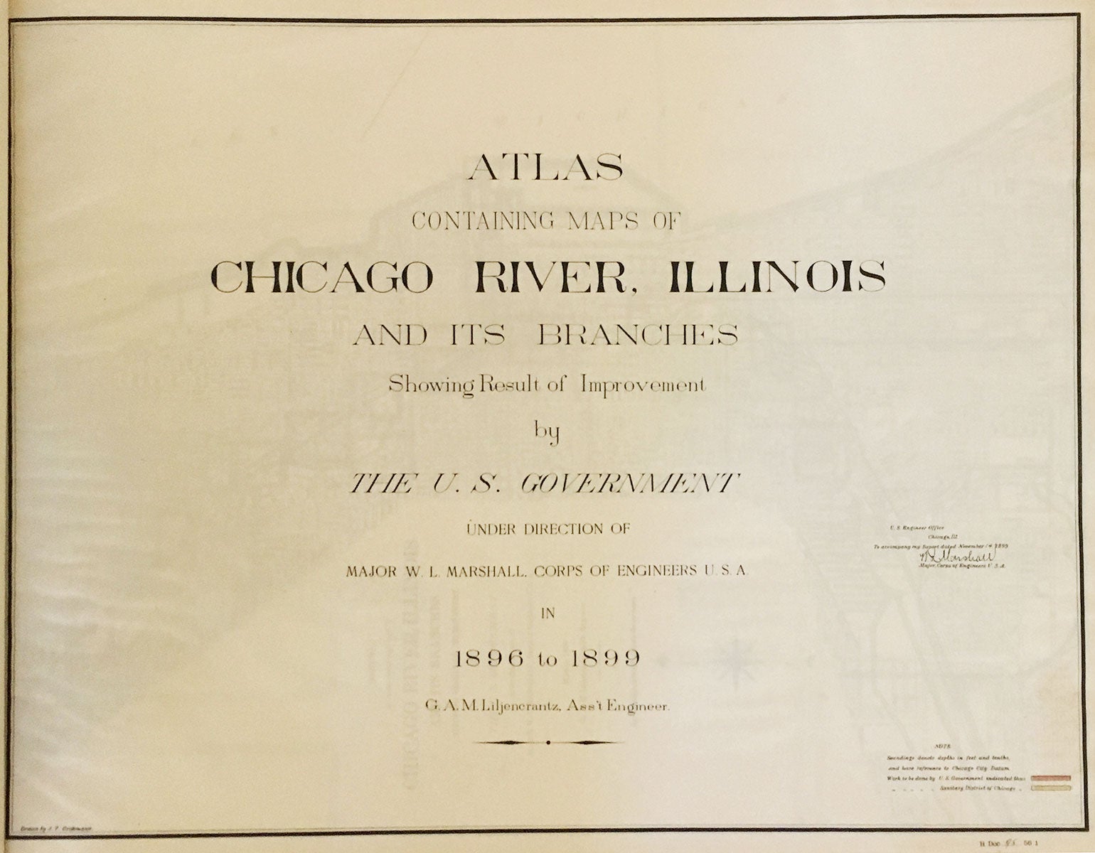
Atlas Containing Maps of Chicago River, Illinois and its Branches Showing Result of Improvement by The U.S. Government Under Direction of Major W. L. Marshall, Corps of Engineers U.S.A in 1896 to 1899. G. A. M. Liljencrantz, Ass’t Engineer.
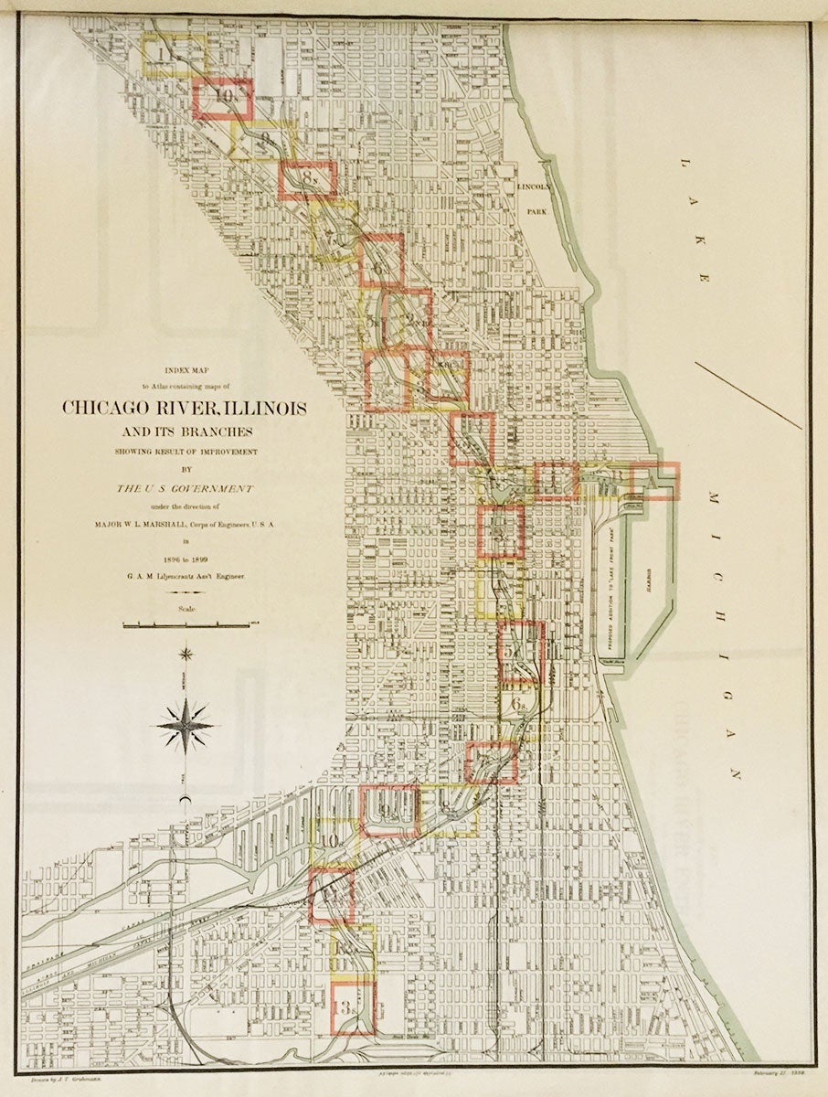
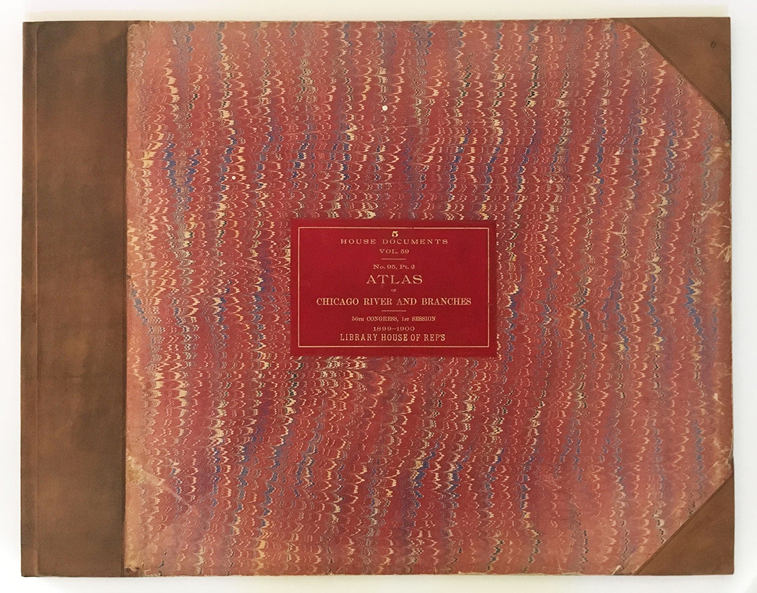
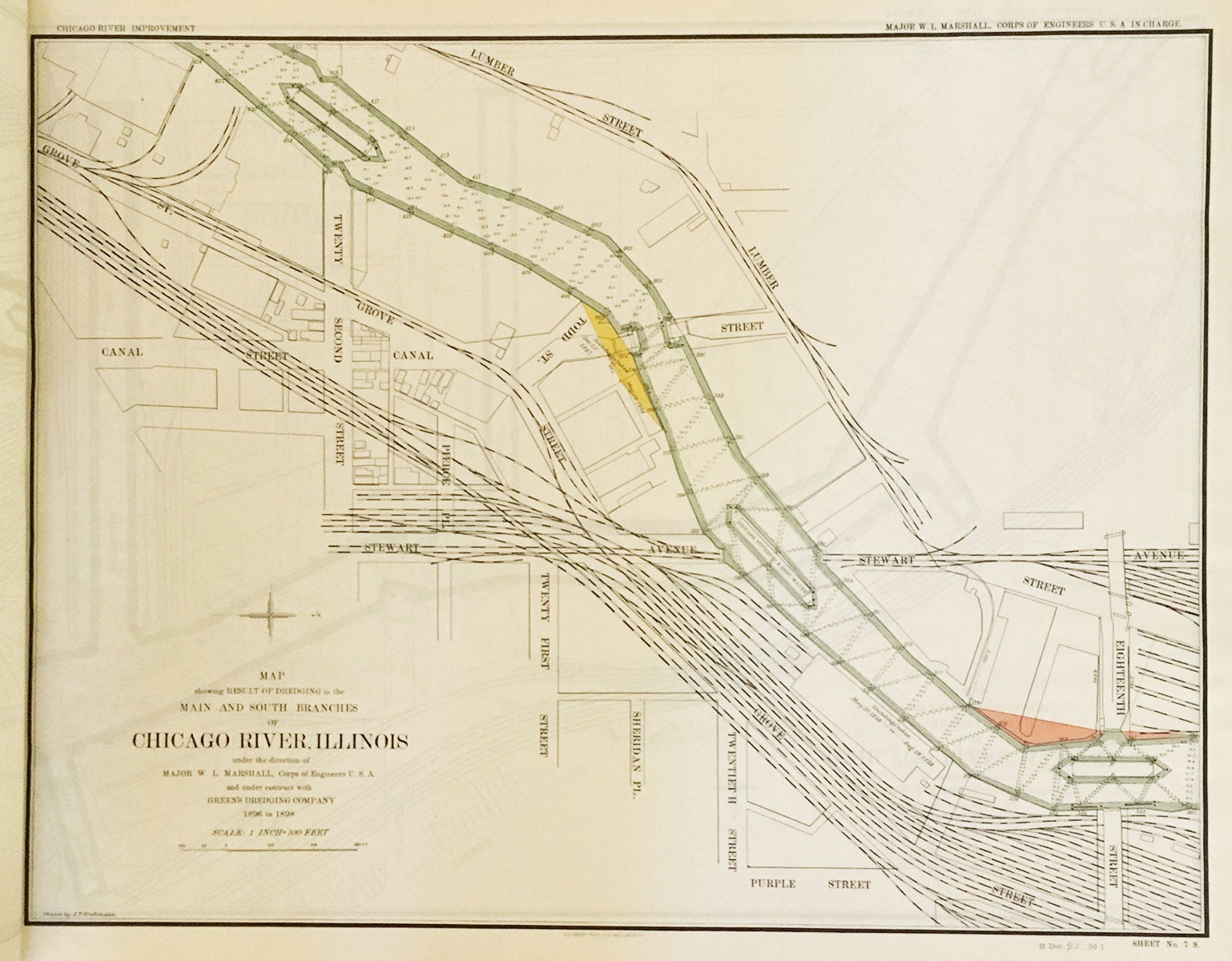
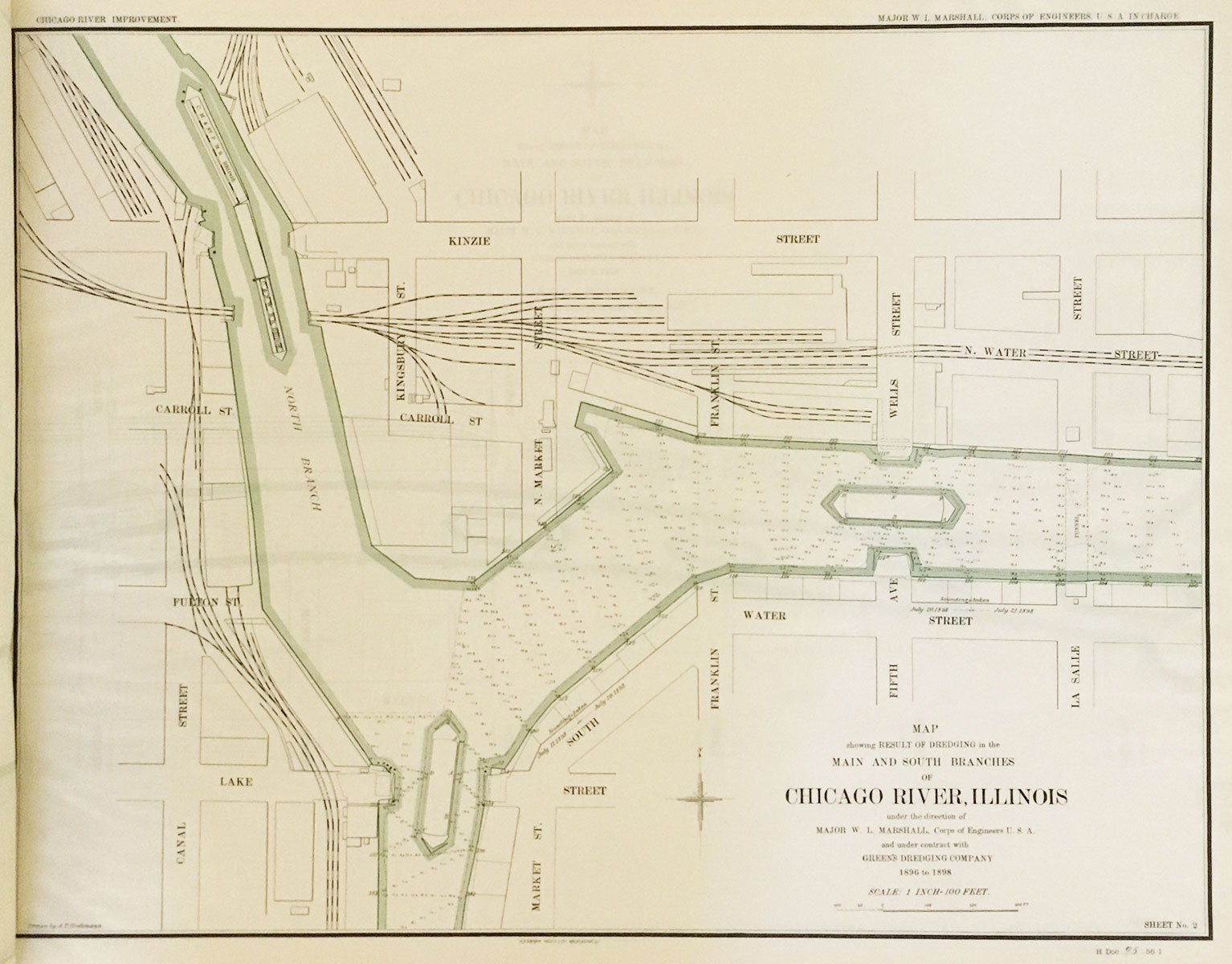
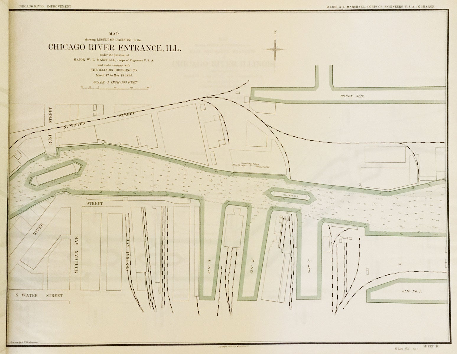
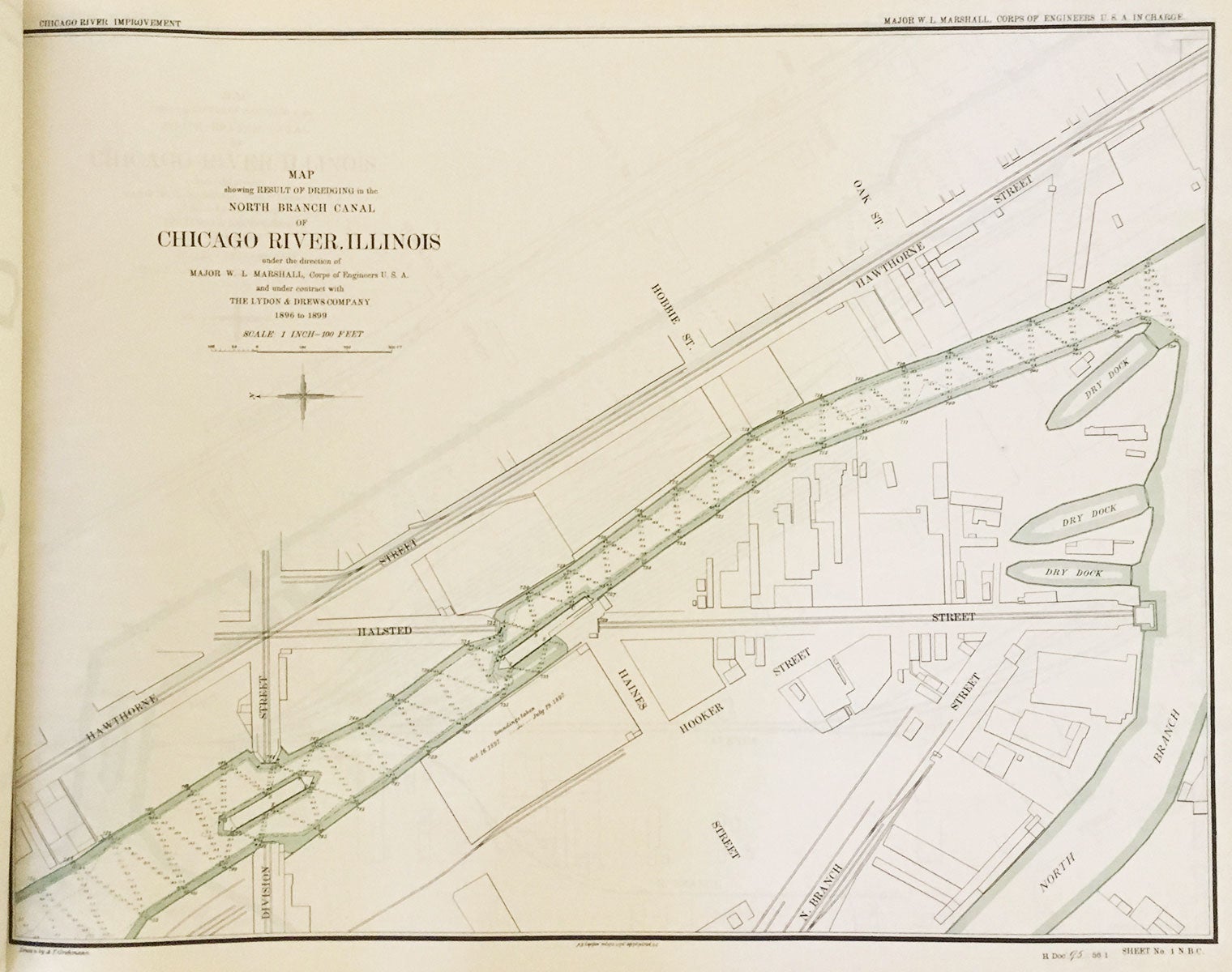
Washington D.C.: A.B. Graham photo. lith., 1899. Large oblong folio (22.75” x 28.5”), recent half calf with original marbled covers, gilt red morocco title label at front-cover. 29 hand-colored photo-lithographic maps (20” x 27”). An atlas documenting improvements to the Chicago River, conducted between 1896 and 1899, toward the construction of a new sanitation and commercial shipping system, a project capping a decade of growth that saw the World’s Columbian Exposition (1893) and an increase of 600,000 in the city’s population.. This atlas begins with an index map providing an overview of the city with fifteen sections of the river highlighted in red and twelve in yellow. Red indicates work done by the U.S. Government, while yellow denotes work by the Chicago Sanitary District. The overview map depicts a portion of Lake Michigan, the North and South branches of the Chicago River, harbors, parks, a drainage canal, railroads, stock yard slips, and so forth. The following twenty-eight maps document the results of the dredging operations. The river is highlighted in green (along with its various docks and slips) on all maps and numerous figures for soundings appear in each section of river depicted. The work was conducted by such firms as Lydon & Drews Co., Illinois Dredging Co., and others under the direction of Major W. L. Marshall of the Army Corps of Engineers. Running throughout the city, the Chicago River consists of a system of waterways whose combined length is some 156 miles. The city’s geographic importance derives in part from its namesake river and the related Chicago Sanitary and Ship Canal linking the Great Lakes to the Mississippi River Basin, and ultimately the Gulf of Mexico. In 1889, the Illinois General Assembly created the Chicago Sanitary District (credited for some of the work documented herein) in order to replace the Illinois and Michigan Canal with the Chicago Sanitary and Ship Canal. This new, much larger waterway helped meet the city's increased sewage and commercial navigation needs. Finished by 1900, the project reversed the flow of the main stem and South Branch of the river—and the waste they carried—by using a series of canal locks and also increasing the flow from Lake Michigan into the river—causing the river to empty into the new canal instead and thereby protecting the water quality of Lake Michigan, the city’s reservoir. In 1999, the system was named a “Civil Engineering Monument of the Millennium” by the American Society of Civil Engineers. An important atlas relating to one of the most significant internal improvements in the history of Chicago. REFERENCES: Phillips and LeGear. A List of Geographical Atlases in the Library of Congress, 12720; Chicago in the 1890s at https://www.lib.uchicago.edu/e/collections/maps/chi1890/; Dept. of Natural Resources, State of Illinois. Chicago River/ Lakeshore Area Assessment (October 2000); American Society of Civil Engineers. “Chicago Wastewater System” at web.archive.org CONDITION: Very good, light wear to covers, one small white paint speck at front-cover; maps very good, title-page toned.
Item #6228
Sold