
Sign up to receive email notices of recent acquisitions.
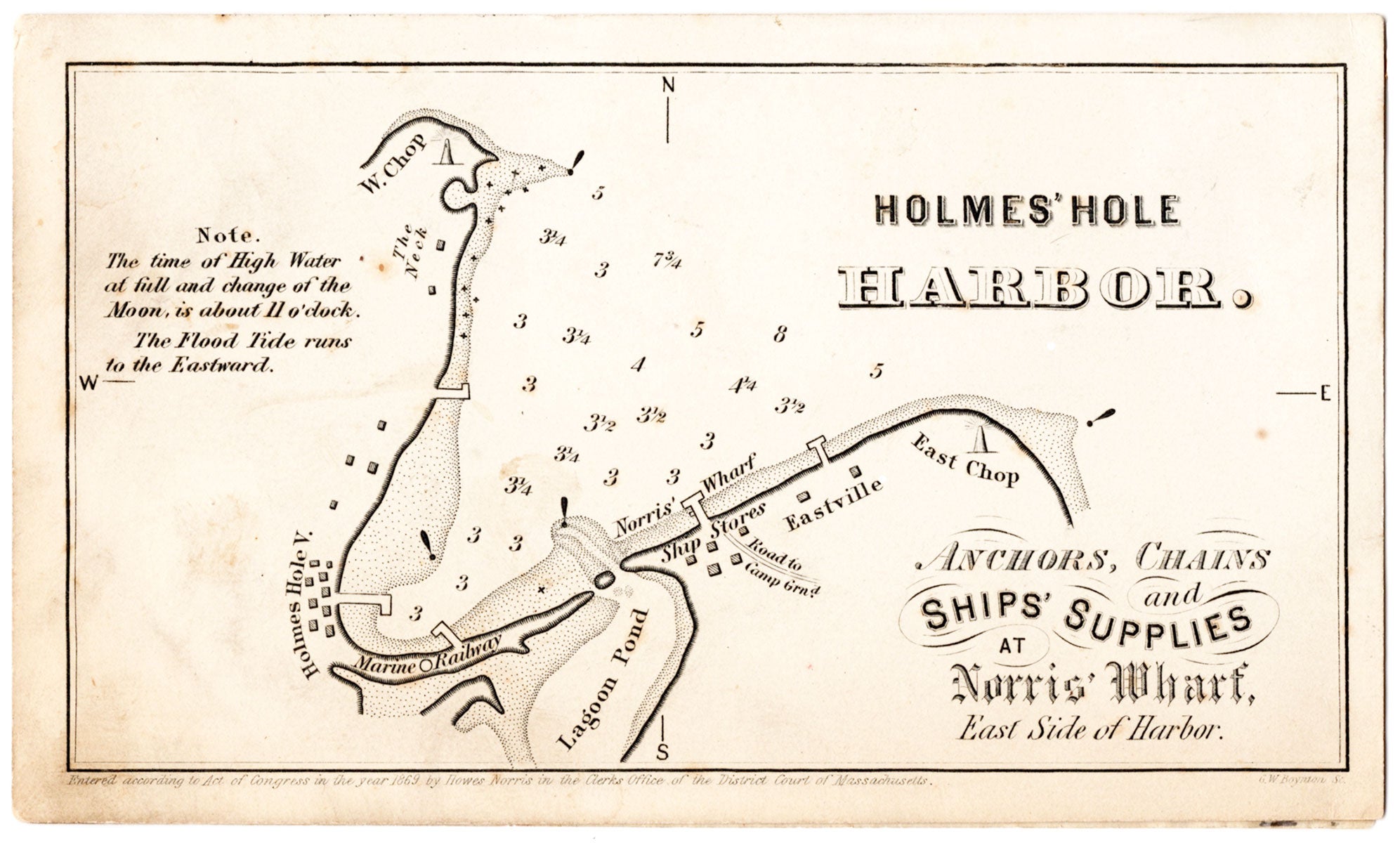
Holmes’ Hole Harbor: Anchors, Chains and Ships’ Supplies at Norris’ Wharf, East Side of Harbor.
Holmes Hole, Martha’s Vineyard, Massachusetts, 1869. Trade card (3.25” x 5.5”), chart and text on cardstock, duplicated on attached transparent paper. CONDITION: Good, lightly soiled, glue residue to verso and corresponding stains and small hole to transparency.
A rare trade card for a Martha’s Vineyard chandler, featuring a small chart of Holmes’ Hole Harbor (today’s Vineyard Haven). The chart extends from East Chop to West Chop, shows their respective lighthouses, and locates Eastville, Norris’ Wharf Ship Stores, the road to the campground, Lagoon Pond, the Marine Railway, Holmes Hole V[illage], and The Neck. Soundings appear in the harbor and two notes on the left read “The Time of High Water at full and change of the Moon, is about 11 O’clock. The Flood Tide runs to the Eastward.” Holmes’ Hole, so named until 1871, was a shipbuilding center and primary harbor for the New York to Boston shipping trade.
Item #7250
Price: $275.00
Add to Wish List