
Sign up to receive email notices of recent acquisitions.
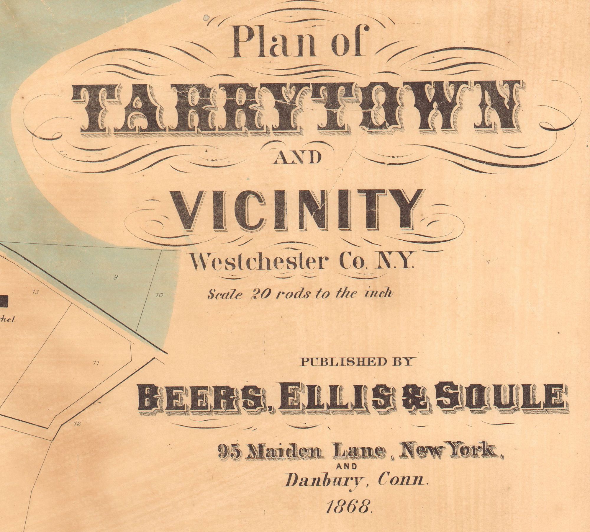
Plan of Tarrytown and Vicinity, Westchester Co. N.Y.
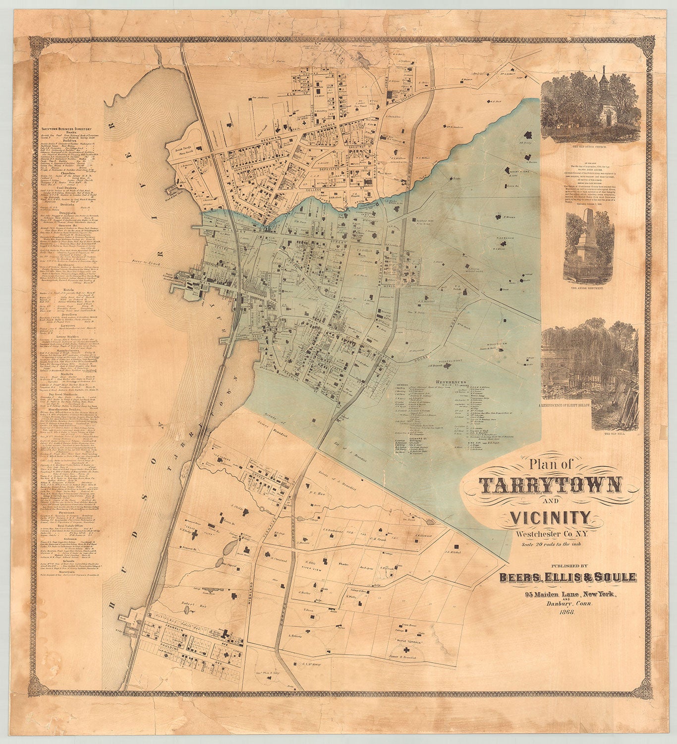
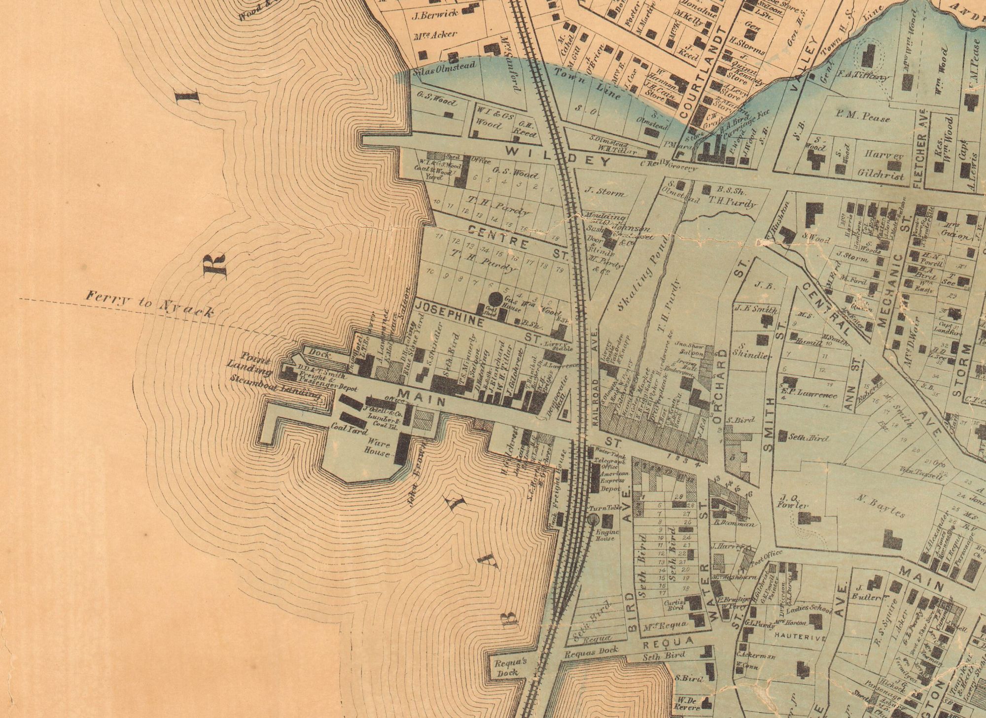
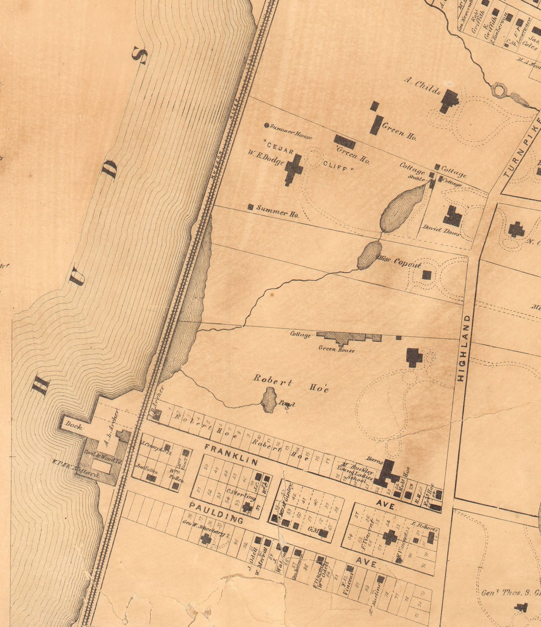
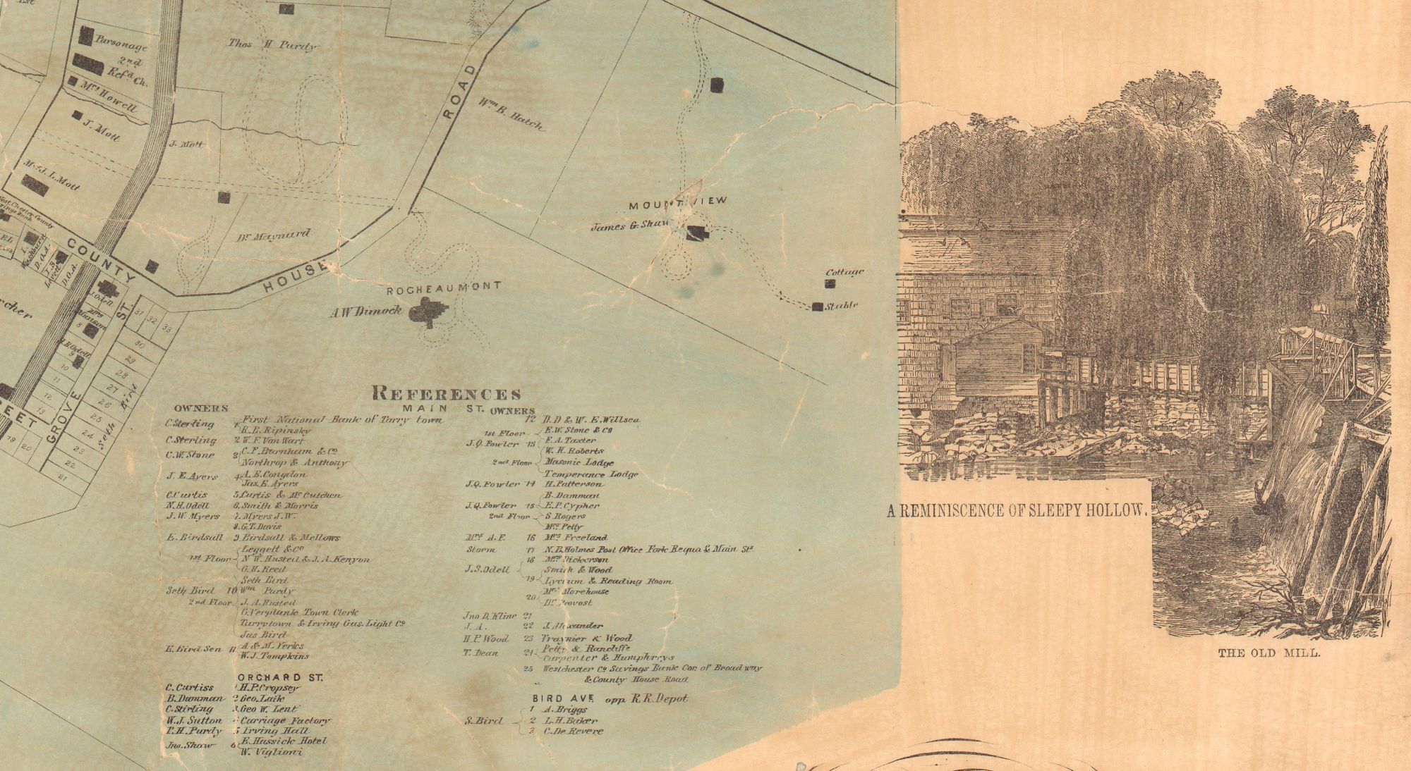
New York: Beers, Ellis & Soule, 1868. Hand colored lithograph, 29.25” x 27.5” plus margins. Mounted on new linen. A rare and quite detailed, large-scale map of Tarrytown, New York, showing both the more densely developed village, as well as outlying areas. Commercial, public, and domestic buildings are identified (their very footprints, in fact, are shown), as well as a number of large estates. Among the latter are the family seat of Robert Hoe (of printing press manufacturing and book collecting fame), the James Benedict property, Rocheaumont, Pleasance, Mount Andre, and others. The tracks of the New York and Hudson River Railroad, which transformed the town following its arrival there in 1849, are shown along the Hudson waterfront. Vignettes of The Old Dutch Church, the Andre Monument, and the Old Mill (also entitled A Reminiscence of Sleepy Hollow) appear to the right of the map. On the left is a business directory, listing banks, builders, grocers, manufacturers, physicians, saloons, etc. Beers, Ellis & Soule published a similar but smaller map in their Atlas of New York and Vicinity, which also appeared in 1868. Rare. OCLC, records just one copy, at the New York State Library. Not in Phillips, Rumsey, or Antique Map Price Record. CONDITION: Paper cracked, especially along the upper three inches, but stabilized on new linen throughout, minor losses with minimal effect on printed area, residual damp-stains.
Item #2883
Price: $1,750.00
Add to Wish List