
Sign up to receive email notices of recent acquisitions.
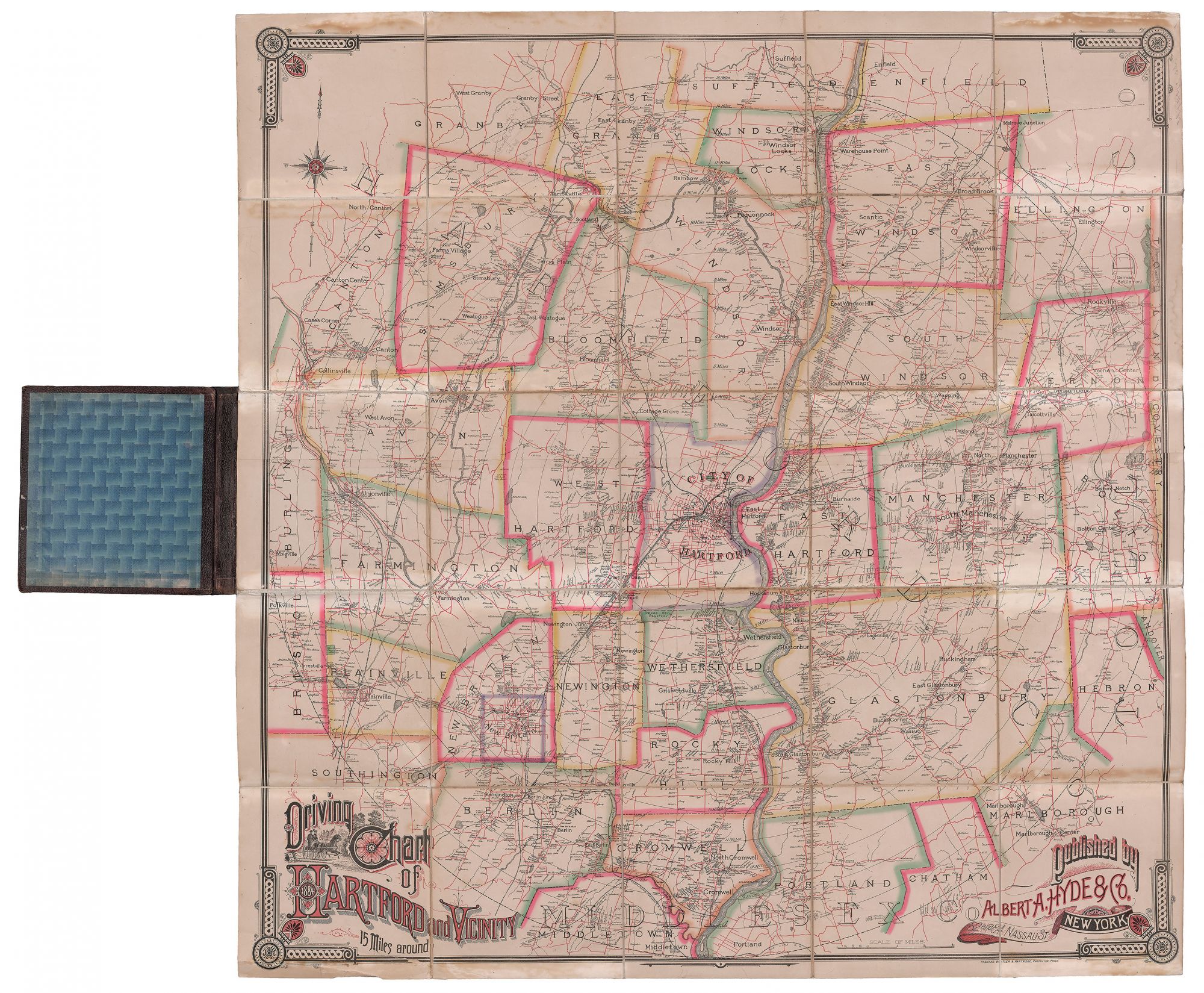
Driving Road Chart of the City of Hartford and Vicinity (Fifteen Miles Around.)
New York: Albert A. Hyde & Co., 82 and 84 Nassau St.; Philadelphia: Packard, Butler & Partridge, photo-lith., 1884. Hand-colored photolithograph, 40” x 39.25”, plus margins, dissected and mounted on linen and folding into 8vo case (9” x 8.75”), burgundy cloth over boards, gilt title on front cover. A large and handsome carriage-road map representing the extensive network of roads in the city of Hartford, Connecticut and the surrounding area, published during the peak of the carriage era. This highly detailed map shows cities, towns, roads, mills, factories, dwellings and their owner’s names, railroads, rivers, lakes, etc. It extends from Suffield in the north to Middletown in the south, and the edges of Tolland and Coventry in the east to Bristol and Burlington in the west. From Hartford City Hall at center, concentric circles radiate out to fifteen miles, in one-mile increments. Relief is shown by spot heights. Roads are printed in red and towns are variusly colored in outline. The border and cartouche are in the Eastlake style, the latter incorporating a vignette of a couple on a horse-drawn carriage on a city road. The recreational carriage era in America lasted from circa 1850 to 1910—with carriage touring seeing a spike after the Civil War. An activity largely confined to the affluent, carriage driving enjoyed the height of its popularity during the 1880s, and the area around Hartford offered many opportunities for pleasing country drives. In 1883, David A. Partridge joined the Philadelphia print and map company Packard & Butler (est. 1879), which primarily produced Christian-themed prints and color advertisements. Renamed Packard, Butler and Partridge, the company lasted until 1893. OCLC records eight copies. REFERENCES: Introduction: Transportation in America and the Carriage Age at parkcityhistory.org CONDITION: Good, some browning to margins and along the edges of some sections, but generally bright and clean; covers somewhat worn.
Item #5516
Price: $1,500.00
Add to Wish List