
Sign up to receive email notices of recent acquisitions.
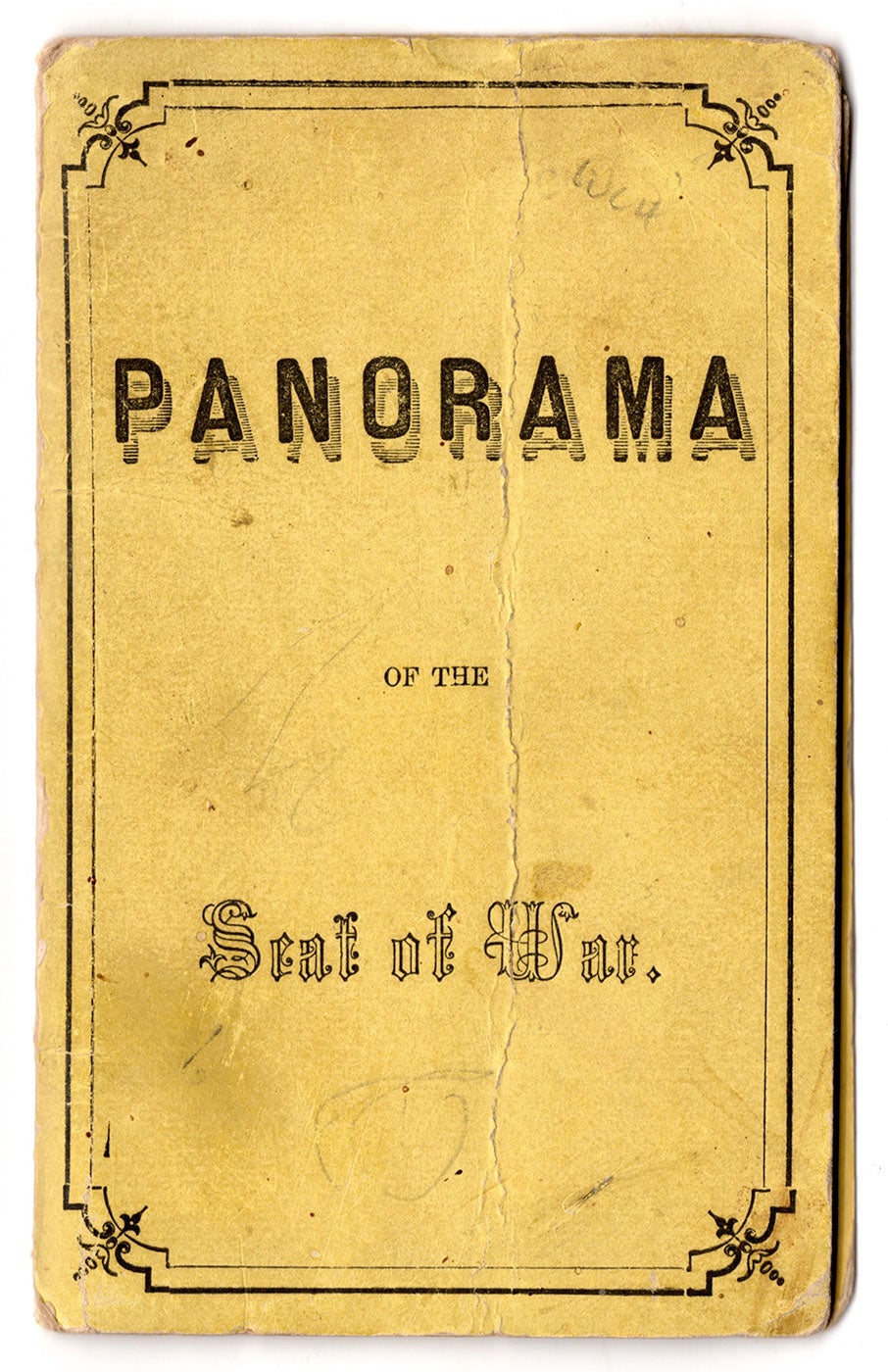
Panorama of the Seat of War.
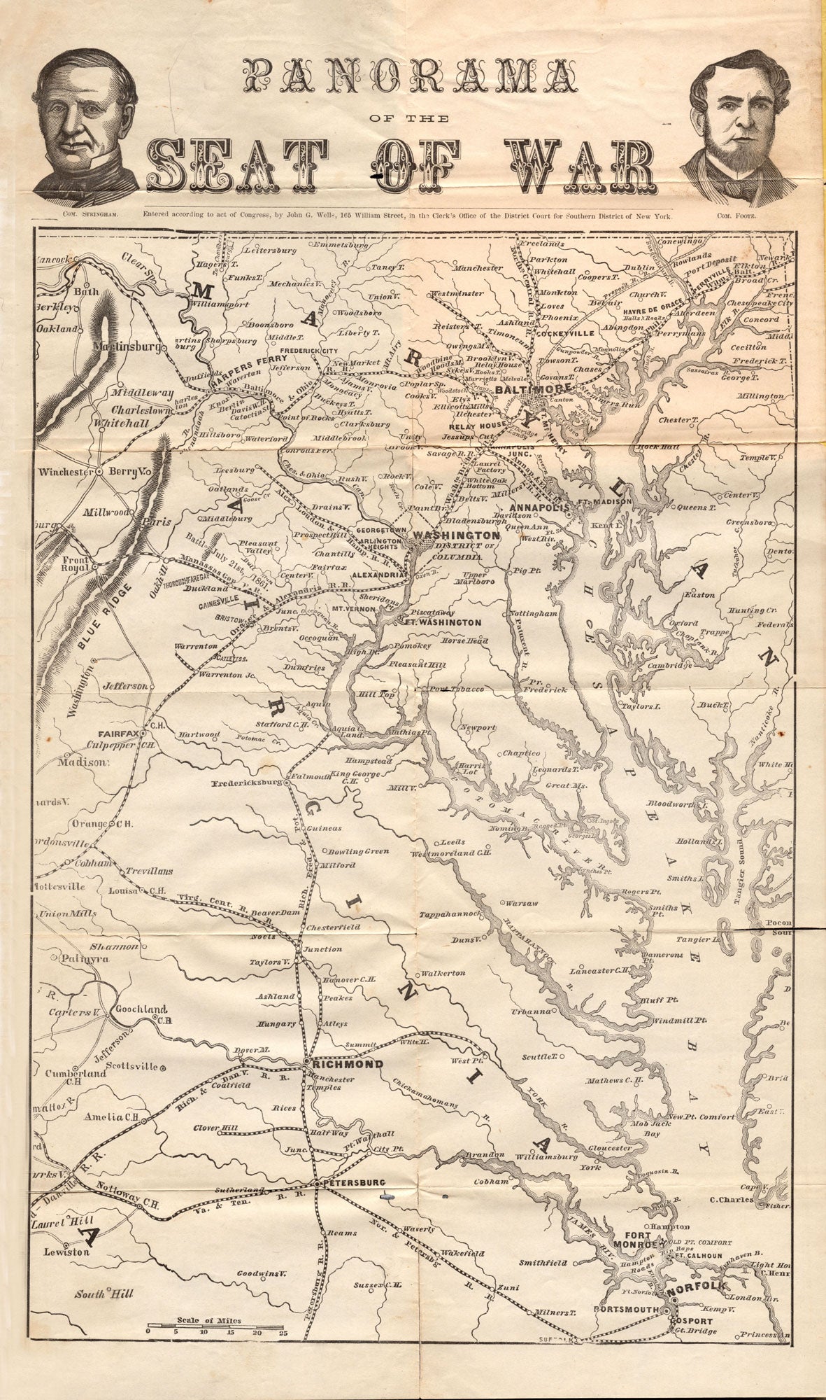
New York, [ca. 1861]. Folding map, 15” x 9”, plus margins, in printed yellow cardstock wrappers, 5.25” x 3.25”. CONDITION: Light staining and vertical crease down the middle of the front and back wrappers; map good, a few stains, a few separations along folds, some repaired on verso with document repair tape. A scarce and appealing pocket map published early in the Civil War showing the locus of conflict and featuring portraits of two Union Navy commanders who played pivotal roles in the first year of the war. Extending from Norfolk, Virginia in the south to Baltimore in the north, and the Blue Ridge mountain range in the west to Chesapeake Bay in the east, this map includes portions of Virginia, Maryland, Georgia, and Washington D.C. Multiple railroads—such as the Orange & Alexandria R.R. and the Virginia & Tennessee R.R.—are seen passing through the region. The top margin includes bust portraits of Union Commodores Silas H. Stringham (1798–1876) and Andrew Hull Foote (1806–1863). The inclusion of Stringham and Foote’s portraits suggests this map was published in the first year of the war. In August 1861, Foote was charged with the naval defense of the upper Mississippi River. Commanding the largely improvised Western Gunboat Flotilla (predecessor of the Mississippi Squadron), he was very effective in command. His first major operation came in Feb. 1862 with his attack on Forts Henry and Donelson in tandem with Gen. Ulysses S. Grant. Both Forts fell and Foote received much of the credit. In June 1862, Foote moved to Washington, promoted from commodore to rear admiral. He died in June 1863. Stringham fought in the War of 1812 and the Mexican-American War, and at the outbreak of the Civil War was appointed by President Lincoln as commander of the Atlantic Blockading Squadron. With Gen. Benjamin Butler, Stringham led a joint amphibious assault on Forts Clark and Hatteras in North Carolina. While the attack constituted the Union’s first naval victory of the war, Stringham was criticized for withdrawing too soon and in turn he resigned his command in December 1861. He continued to serve as commandant of the Boston Navy Yard and later as port admiral in New York. Other maps published by Wells (1821–1880) include Wells' new map of the Crimea, Sea of Azoff, Europe (1855); Pocket Hand-Book of Iowa; past, present, and prospective… illustrated with a new railroad and township map (1857); Wells' new sectional map of Kansas from the latest government surveys (1857); Wells' new sectional map of Minnesota: from the latest government surveys (1857); and Wells' new rail road and township map of Missouri and eastern Kansas: from the latest government surveys (1857). WorldCat records only two copies, at the Newberry Library and AAS. The copy held at the Newberry Library features anti-Confederate cartoons on the verso credited to engraver “Waters-Son.” REFERENCES: Tooley's Dictionary of Mapmakers, Q–Z vol. (Riverside, Connecticut, 2001), p. 371; Andrew Hull Foote (The Gunboat Commodore) at ehistory.osu.edu; Flag Officer Silas H. Stringham at loc.gov
Item #7615
Sold