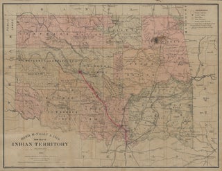
Rand, McNally & Co.s....
A comprehensive map of Indian Territory on the cusp of large-scale white settlement and further Native American dispossession, with manuscript additions reflecting railroad expansion. Depicted here are the lands allotted by the US government to thirty-plus relocated Native American nations, including the “Five Civilized Tribes” (Cherokee, Creek, Choctaw, Chickasaw, and.....

![Item #8751 Saline and Gage Counties, Nebraska. 50,000 Acres of Land For Sale…[recto] Map of...](https://jamesarsenault.cdn.bibliopolis.com/pictures/8751_1.jpg?width=320&height=427&fit=bounds&auto=webp&v=1728944892)


![Item #9455 Map of the Territory of Utah[;] Great Salt Lake Valley[;] Plat of Salt Lake City Utah....](https://jamesarsenault.cdn.bibliopolis.com/pictures/9455_1.jpg?width=320&height=427&fit=bounds&auto=webp&v=1746963520)